
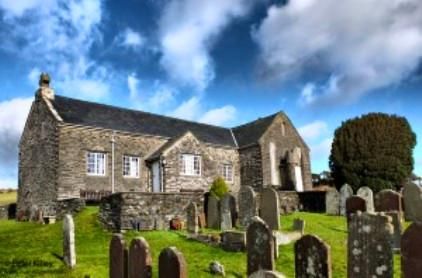
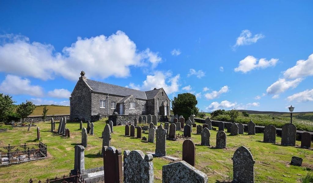
| Memorials | : | 0 |
| Location | : | Isle of Man |
| Coordinate | : | 54.2097491, -4.5159383 |
frequently asked questions (FAQ):
-
Where is St. Luke's Churchyard?
St. Luke's Churchyard is located at Brandywell Rd Middle ,Isle of Man.
-
St. Luke's Churchyard cemetery's updated grave count on graveviews.com?
0 memorials
-
Where are the coordinates of the St. Luke's Churchyard?
Latitude: 54.2097491
Longitude: -4.5159383
Nearby Cemetories:
1. Cloughey Presbyterian Church Cemetery
Northern Ireland
Coordinate: 54.4287261, -5.4803625
2. Priory of St. Mary and St. Bega
St Bees, Copeland Borough, England
Coordinate: 54.4941300, -3.5931700
3. St Bridget’s Churchyard
Beckermet, Copeland Borough, England
Coordinate: 54.4404100, -3.5205000
4. Old Court Chapel
Northern Ireland
Coordinate: 54.3703590, -5.5563350
5. St. John's Churchyard
Beckermet, Copeland Borough, England
Coordinate: 54.4463280, -3.5145220
6. Whitehaven Cemetery
Whitehaven, Copeland Borough, England
Coordinate: 54.5341988, -3.5859001
7. Beckermet Cemetery
Beckermet, Copeland Borough, England
Coordinate: 54.4573120, -3.5180770
8. Christ Church Churchyard
Whitehaven, Copeland Borough, England
Coordinate: 54.5431590, -3.5904980
9. Ss Mary & Michael Churchyard
Egremont, Copeland Borough, England
Coordinate: 54.4805480, -3.5274700
10. Holy Trinity Churchyard
Whitehaven, Copeland Borough, England
Coordinate: 54.5458410, -3.5870660
11. St. Nicholas Churchyard
Whitehaven, Copeland Borough, England
Coordinate: 54.5481030, -3.5876680
12. Egremont Cemetery
Egremont, Copeland Borough, England
Coordinate: 54.4889990, -3.5316450
13. St. James Parish Churchyard
Whitehaven, Copeland Borough, England
Coordinate: 54.5506840, -3.5835850
14. St. John‘s Old Churchyard
Hensingham, Copeland Borough, England
Coordinate: 54.5366130, -3.5685310
15. Hensingham Cemetery
Whitehaven, Copeland Borough, England
Coordinate: 54.5393790, -3.5647590
16. Ponsonby Parish Churchyard
Ponsonby, Copeland Borough, England
Coordinate: 54.4367970, -3.4782480
17. Haile Parish Churchyard
Haile, Copeland Borough, England
Coordinate: 54.4653770, -3.4972620
18. St Leonard Churchyard
Cleator, Copeland Borough, England
Coordinate: 54.5068480, -3.5239520
19. St. Peter Churchyard
Drigg, Copeland Borough, England
Coordinate: 54.3796400, -3.4328800
20. Calder Abbey
Copeland Borough, England
Coordinate: 54.4441670, -3.4661110
21. St Mary Roman Catholic Churchyard
Cleator, Copeland Borough, England
Coordinate: 54.5126240, -3.5145410
22. Saint Bridget's Churchyard
Moresby, Copeland Borough, England
Coordinate: 54.5741510, -3.5757490
23. St John Churchyard
Cleator Moor, Copeland Borough, England
Coordinate: 54.5233900, -3.5237530
24. St Mary's Churchyard
Gosforth, Copeland Borough, England
Coordinate: 54.4192540, -3.4313680