
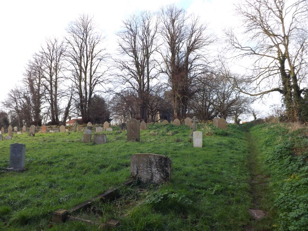
| Memorials | : | 43 |
| Location | : | Cantley, Broadland District, England |
| Coordinate | : | 52.5826600, 1.5137200 |
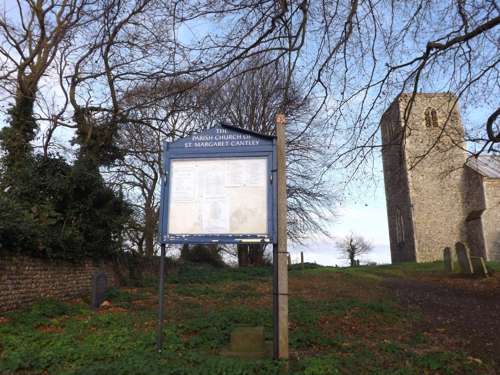
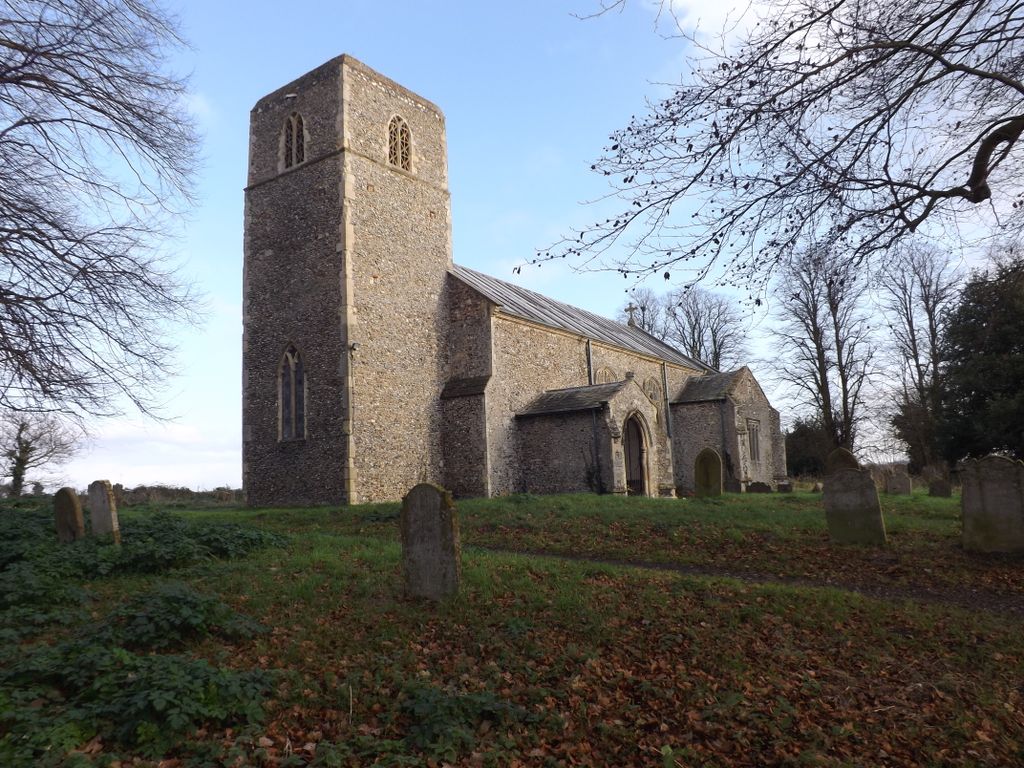
| Description | : | Cantley is a village and civil parish in Norfolk lying within the Broads Special Protection Area. The village lies on the north bank of the River Yare, east of the city of Norwich, and south-west of the town of Great Yarmouth. For the purposes of local government, the parish falls within the district of Broadland. Cantley is well known for its sugar beet factory, the first sugar beet processing factory in the UK, constructed in 1912. At the far end of Church Road in the middle of the village |
frequently asked questions (FAQ):
-
Where is St. Margaret Churchyard?
St. Margaret Churchyard is located at Church Road Cantley, Broadland District ,Norfolk , NR13 3SNEngland.
-
St. Margaret Churchyard cemetery's updated grave count on graveviews.com?
7 memorials
-
Where are the coordinates of the St. Margaret Churchyard?
Latitude: 52.5826600
Longitude: 1.5137200
Nearby Cemetories:
1. St. Botolph's Churchyard
Limpenhoe, Broadland District, England
Coordinate: 52.5811500, 1.5340800
2. St. Edmund's Church Cemetery
Southwood, Broadland District, England
Coordinate: 52.5918620, 1.5306067
3. St Edmund
Broadland District, England
Coordinate: 52.5930000, 1.5290000
4. St. Edmund's Churchyard
Broadland District, England
Coordinate: 52.5932110, 1.5299120
5. St. Mary's Churchyard
Hassingham, Broadland District, England
Coordinate: 52.5958770, 1.4963330
6. Langley Abbey
Langley with Hardley, South Norfolk District, England
Coordinate: 52.5719000, 1.4875700
7. Freethorpe Methodist Churchyard
Freethorpe, Broadland District, England
Coordinate: 52.5879310, 1.5537940
8. Hardley Methodist Chapel
Langley with Hardley, South Norfolk District, England
Coordinate: 52.5577290, 1.4957960
9. All Saints Churchyard
Freethorpe, Broadland District, England
Coordinate: 52.5938200, 1.5557200
10. St. Nicholas' Churchyard
Buckenham, Broadland District, England
Coordinate: 52.5995590, 1.4770110
11. St. Mary's Churchyard, Moulton
Beighton, Broadland District, England
Coordinate: 52.6044880, 1.5465020
12. St Margaret's Churchyard
Hardley Street, South Norfolk District, England
Coordinate: 52.5522980, 1.5170630
13. St. Michaels's Church Cemetery
Langley with Hardley, South Norfolk District, England
Coordinate: 52.5552220, 1.4727530
14. St. Edmund's Churchyard
South Burlingham, Broadland District, England
Coordinate: 52.6199020, 1.5034420
15. All Saints Churchyard
Beighton, Broadland District, England
Coordinate: 52.6198800, 1.5244000
16. Ss Peter and Paul Churchyard
Halvergate, Broadland District, England
Coordinate: 52.6037400, 1.5688100
17. St Peter's Churchyard
Carleton St Peter, South Norfolk District, England
Coordinate: 52.5680520, 1.4514100
18. St. Andrew's Churchyard
Wickhampton, Broadland District, England
Coordinate: 52.5927910, 1.5819000
19. St. Peter's Churchyard
Strumpshaw, Broadland District, England
Coordinate: 52.6163970, 1.4688640
20. St John the Baptist Churchyard
Reedham, Broadland District, England
Coordinate: 52.5660500, 1.5807900
21. All Saints Churchyard
Chedgrave, South Norfolk District, England
Coordinate: 52.5409130, 1.4831200
22. St. Peter's Churchyard
Tunstall, Broadland District, England
Coordinate: 52.6158200, 1.5689500
23. St Gregory Churchyard
Heckingham, South Norfolk District, England
Coordinate: 52.5350940, 1.5144710
24. St. Peter's Churchyard
Lingwood, Broadland District, England
Coordinate: 52.6274580, 1.4866730