
| Memorials | : | 0 |
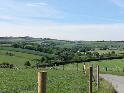
| Location | : | Cheselbourne, West Dorset District, England |
| Coordinate | : | 50.8001920, -2.3413970 |
| Description | : | From Kelly's Dorsetshire Directory 1915: "CHESILBORNE (or Cheselbourne) is a parish and small village, 8 miles north-east from Dorchester station, on the Great Western and London and South Western railway, 8 north-west from Bere Regis, and 11 south-west from Blandford, in the Western division of the county, Whiteway hundred, Cerne petty sessional division and union, Dorchester county court district, rural deanery of Whitchurch (Bere Regis portion), archdeaconry of Dorset and diocese of Salisbury. The church of St. Martin is an ancient edifice of flint and stone in the Gothic style, consisting of chancel, nave, aisles, north and south porches and... Read More |
frequently asked questions (FAQ):
-
Where is St Martin?
St Martin is located at Cheselbourne, West Dorset District ,Dorset ,England.
-
St Martin cemetery's updated grave count on graveviews.com?
0 memorials
-
Where are the coordinates of the St Martin?
Latitude: 50.8001920
Longitude: -2.3413970
Nearby Cemetories:
1. St Andrew's Church
Melcombe Horsey, West Dorset District, England
Coordinate: 50.8177370, -2.3238320
2. All Saints Churchyard
Dewlish, West Dorset District, England
Coordinate: 50.7827870, -2.3202580
3. All Saints Churchyard
Hilton, North Dorset District, England
Coordinate: 50.8258900, -2.3103000
4. Milton Abbey
Milton Abbas, North Dorset District, England
Coordinate: 50.8198430, -2.2876720
5. St John The Baptist
Piddletrenthide, West Dorset District, England
Coordinate: 50.8192530, -2.4021230
6. St James' Churchyard
Milton Abbas, North Dorset District, England
Coordinate: 50.8152850, -2.2760600
7. St Andrew Churchyard
Milborne St Andrew, North Dorset District, England
Coordinate: 50.7757960, -2.2833520
8. St Mary the Virgin Churchyard
Piddlehinton, West Dorset District, England
Coordinate: 50.7732980, -2.4045680
9. St. Mary the Virgin Churchyard
Puddletown, West Dorset District, England
Coordinate: 50.7484670, -2.3434700
10. All Saints Churchyard
Piddletrenthide, West Dorset District, England
Coordinate: 50.8053720, -2.4242110
11. All Saints Churchyard
Stoke Wake, North Dorset District, England
Coordinate: 50.8569100, -2.3358050
12. St Peter and St Paul Churchyard
Mappowder, North Dorset District, England
Coordinate: 50.8527740, -2.3773230
13. Alton Pancras Cemetery
Alton Pancras, West Dorset District, England
Coordinate: 50.8203710, -2.4289390
14. St. Mary's Church
Woolland, North Dorset District, England
Coordinate: 50.8618600, -2.3194300
15. St. Andrew's Churchyard
Winterborne Houghton, North Dorset District, England
Coordinate: 50.8388922, -2.2565686
16. St Mary's Churchyard
Winterborne Whitechurch, North Dorset District, England
Coordinate: 50.8004000, -2.2340000
17. St. Laurence's Churchyard
Affpuddle, Purbeck District, England
Coordinate: 50.7426680, -2.2772280
18. St Eustace Churchyard
Ibberton, North Dorset District, England
Coordinate: 50.8672550, -2.3004360
19. St. Mary and St. James Churchyard
Hazelbury Bryan, North Dorset District, England
Coordinate: 50.8736000, -2.3520000
20. St. Mary's Churchyard
Winterborne Stickland, North Dorset District, England
Coordinate: 50.8406500, -2.2361600
21. Holy Rood Churchyard
Buckland Newton, West Dorset District, England
Coordinate: 50.8461660, -2.4453910
22. All Saints
Nether Cerne, West Dorset District, England
Coordinate: 50.7824394, -2.4695370
23. Cerne Abbey
Cerne Abbas, West Dorset District, England
Coordinate: 50.8106000, -2.4754000
24. St Mary Churchyard
Cerne Abbas, West Dorset District, England
Coordinate: 50.8095040, -2.4756200