
| Memorials | : | 0 |
| Location | : | Langdon Hills, Basildon District, England |
| Coordinate | : | 51.5511770, 0.4113210 |
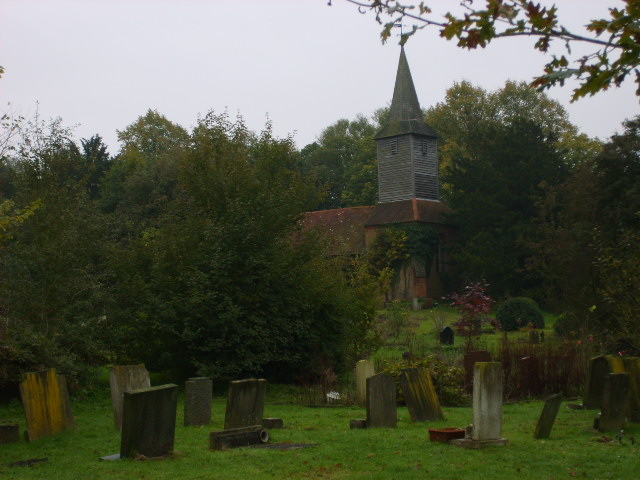
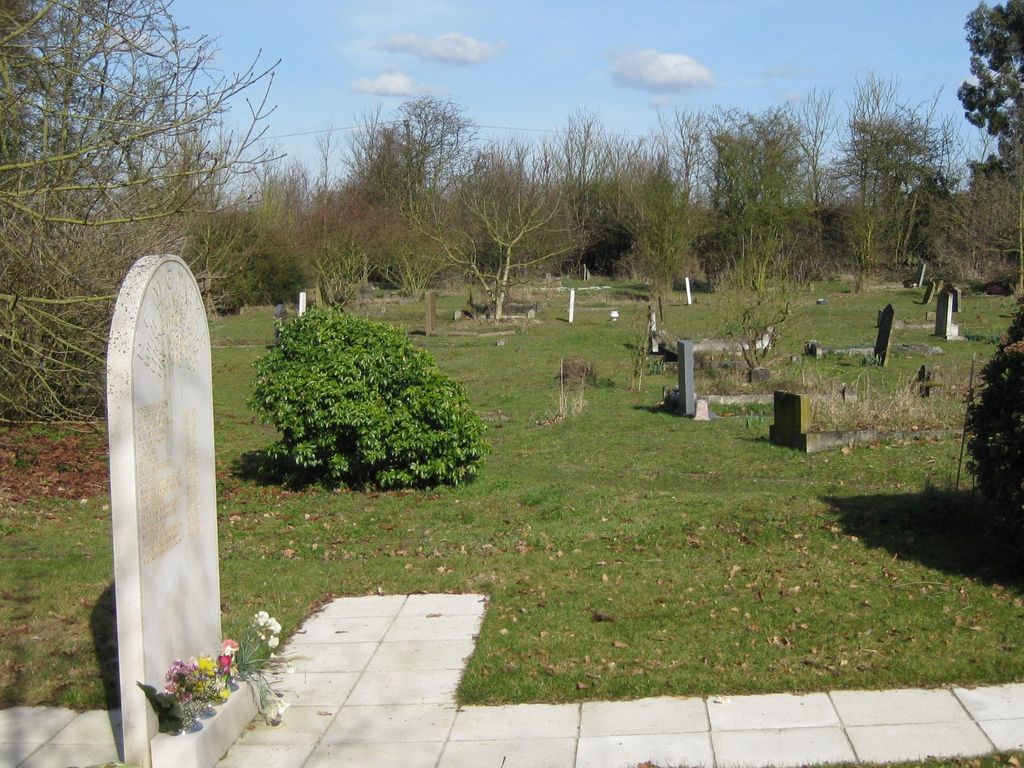
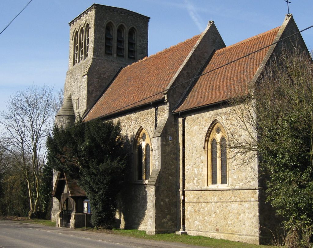
| Description | : | St. Mary and All Saints Church is a working church located in The High Road, Langdon Hills, Basildon, SS16 6HY, and has it’s churchyard located a short distance away in Old Church Hill It is believed a church has existed on the Old Church site since at least 1366 according to the list of Rectors. Langdon Hills takes its derivation from a number of sources including the Doomsday Book reference to Langeduna meaning Long Hill, a name that fits the physical location of the Old Church. It’s geographical designation has changed somewhat over the years with its association... Read More |
frequently asked questions (FAQ):
-
Where is St Mary and All Saints Churchyard?
St Mary and All Saints Churchyard is located at Old Church Hill Langdon Hills, Basildon District ,Essex , SS16 6HZEngland.
-
St Mary and All Saints Churchyard cemetery's updated grave count on graveviews.com?
0 memorials
-
Where are the coordinates of the St Mary and All Saints Churchyard?
Latitude: 51.5511770
Longitude: 0.4113210

Nearby Cemetories:
1. St Mary Churchyard Dunton Wayletts
Brentwood, Brentwood Borough, England
Coordinate: 51.5695480, 0.3850580
2. St Peter and St Paul Churchyard
Horndon-on-the-hill, Thurrock Unitary Authority, England
Coordinate: 51.5239220, 0.4048270
3. St Nicholas Churchyard
Laindon, Basildon District, England
Coordinate: 51.5792046, 0.4341750
4. St Mary the Virgin Churchyard
Bulphan, Thurrock Unitary Authority, England
Coordinate: 51.5476280, 0.3591910
5. All Saints Churchyard
Vange, Basildon District, England
Coordinate: 51.5533240, 0.4723390
6. St. Margaret's Churchyard
Stanford-le-Hope, Thurrock Unitary Authority, England
Coordinate: 51.5141520, 0.4260190
7. Corringham Cemetery
Corringham, Thurrock Unitary Authority, England
Coordinate: 51.5268450, 0.4651920
8. Stanford-le-Hope Cemetery
Stanford-le-Hope, Thurrock Unitary Authority, England
Coordinate: 51.5104870, 0.4313190
9. St. Mary the Virgin Churchyard
Corringham, Thurrock Unitary Authority, England
Coordinate: 51.5225460, 0.4631320
10. All Saints Churchyard
East Horndon, Brentwood Borough, England
Coordinate: 51.5808500, 0.3591000
11. St Michael Churchyard
Fobbing, Thurrock Unitary Authority, England
Coordinate: 51.5278690, 0.4752220
12. St. Giles and All Saints Churchyard
Orsett, Thurrock Unitary Authority, England
Coordinate: 51.5127200, 0.3683180
13. St Mary the Virgin Churchyard
Little Burstead, Basildon District, England
Coordinate: 51.5980180, 0.4074970
14. St John the Baptist Churchyard
Mucking, Thurrock Unitary Authority, England
Coordinate: 51.5044510, 0.4268880
15. Herongate Wood Cemetery
Herongate, Brentwood Borough, England
Coordinate: 51.5959206, 0.3759600
16. Great Burstead Cemetery
Great Burstead, Basildon District, England
Coordinate: 51.6030660, 0.4287890
17. St. Mary Magdalene Churchyard
Great Burstead, Basildon District, England
Coordinate: 51.6039050, 0.4252480
18. All Saints and Saint Faith Churchyard
Childerditch, Brentwood Borough, England
Coordinate: 51.5796560, 0.3278980
19. St. Michael's Churchyard
Pitsea, Basildon District, England
Coordinate: 51.5620520, 0.5067230
20. Linford Methodist Churchyard
Linford, Thurrock Unitary Authority, England
Coordinate: 51.4908160, 0.4087900
21. St. Peter Churchyard
Little Warley, Brentwood Borough, England
Coordinate: 51.5738020, 0.3138180
22. St Nicholas Churchyard
Ingrave, Brentwood Borough, England
Coordinate: 51.6035800, 0.3425560
23. St Mary Churchyard
Ramsden Crays, Basildon District, England
Coordinate: 51.6123140, 0.4656740
24. Chadwell St Mary Cemetery
Chadwell St Mary, Thurrock Unitary Authority, England
Coordinate: 51.4858260, 0.3695060