
| Memorials | : | 1 |
| Location | : | Childerditch, Brentwood Borough, England |
| Coordinate | : | 51.5796560, 0.3278980 |
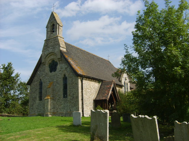
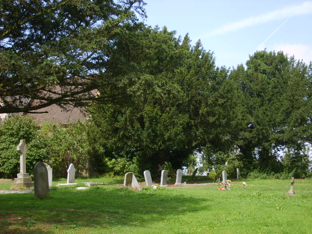
| Description | : | Childerditch is a small village of scattered houses, 3 miles South South East of Brentwood, much of which formerly belonged to Lord Petre, the lord of the manors of Childerditch Hall and Tillingham Hall.The 'ditch' ending in Childerditch refers to the stream which flows through the parish, while 'Childer' may be from Celia, which is an old river name. The village stands in Childerditch Lane which was bisected by the construction of the A127, the London to Southend Arterial Road. The village is now north of this road. All Saints and St. Faiths church is a small brick building. on... Read More |
frequently asked questions (FAQ):
-
Where is All Saints and Saint Faith Churchyard?
All Saints and Saint Faith Churchyard is located at Childerditch, Brentwood Borough ,Essex ,England.
-
All Saints and Saint Faith Churchyard cemetery's updated grave count on graveviews.com?
1 memorials
-
Where are the coordinates of the All Saints and Saint Faith Churchyard?
Latitude: 51.5796560
Longitude: 0.3278980
Nearby Cemetories:
1. St. Peter Churchyard
Little Warley, Brentwood Borough, England
Coordinate: 51.5738020, 0.3138180
2. The Old Churchyard
Great Warley, Brentwood Borough, England
Coordinate: 51.5719550, 0.3023490
3. All Saints Churchyard
East Horndon, Brentwood Borough, England
Coordinate: 51.5808500, 0.3591000
4. St Mary the Virgin Churchyard
Great Warley, Brentwood Borough, England
Coordinate: 51.5863490, 0.2920150
5. St Nicholas Churchyard
Ingrave, Brentwood Borough, England
Coordinate: 51.6035800, 0.3425560
6. Woodman Road Cemetery
Great Warley, Brentwood Borough, England
Coordinate: 51.6084860, 0.3060510
7. Herongate Wood Cemetery
Herongate, Brentwood Borough, England
Coordinate: 51.5959206, 0.3759600
8. Lorne Road Cemetery
Great Warley, Brentwood Borough, England
Coordinate: 51.6091530, 0.2969270
9. St Mary Churchyard Dunton Wayletts
Brentwood, Brentwood Borough, England
Coordinate: 51.5695480, 0.3850580
10. St Mary the Virgin Churchyard
Bulphan, Thurrock Unitary Authority, England
Coordinate: 51.5476280, 0.3591910
11. Lorne Road Cemetery
Brentwood, Brentwood Borough, England
Coordinate: 51.6107450, 0.2894590
12. Brentwood Cathedral Burial Grounds
Brentwood, Brentwood Borough, England
Coordinate: 51.6196720, 0.3064440
13. St Thomas of Canterbury Churchyard
Brentwood, Brentwood Borough, England
Coordinate: 51.6196970, 0.3046240
14. London Road Cemetery
Brentwood, Brentwood Borough, England
Coordinate: 51.6169890, 0.2901580
15. St. Mary Magdalene Churchyard
North Ockendon, London Borough of Havering, England
Coordinate: 51.5404030, 0.2875930
16. All Saints Churchyard
Cranham, London Borough of Havering, England
Coordinate: 51.5522750, 0.2660270
17. All Saints Churchyard
Hutton, Brentwood Borough, England
Coordinate: 51.6241150, 0.3608210
18. St Mary the Virgin Churchyard
Shenfield, Brentwood Borough, England
Coordinate: 51.6320590, 0.3185650
19. St Mary the Virgin Churchyard
Little Burstead, Basildon District, England
Coordinate: 51.5980180, 0.4074970
20. St Laurence Churchyard
Upminster, London Borough of Havering, England
Coordinate: 51.5557430, 0.2478680
21. St Peter Churchyard
South Weald, Brentwood Borough, England
Coordinate: 51.6215858, 0.2684350
22. Upminster Cemetery
Corbets Tey, London Borough of Havering, England
Coordinate: 51.5433330, 0.2592730
23. South Essex Crematorium
Upminster, London Borough of Havering, England
Coordinate: 51.5433380, 0.2583840
24. Cherry Orchard Congregational Church
South Ockendon, Thurrock Unitary Authority, England
Coordinate: 51.5241770, 0.2976050