
| Memorials | : | 12 |
| Location | : | Pamber, Basingstoke and Deane Borough, England |
| Coordinate | : | 51.3194500, -1.1279200 |
frequently asked questions (FAQ):
-
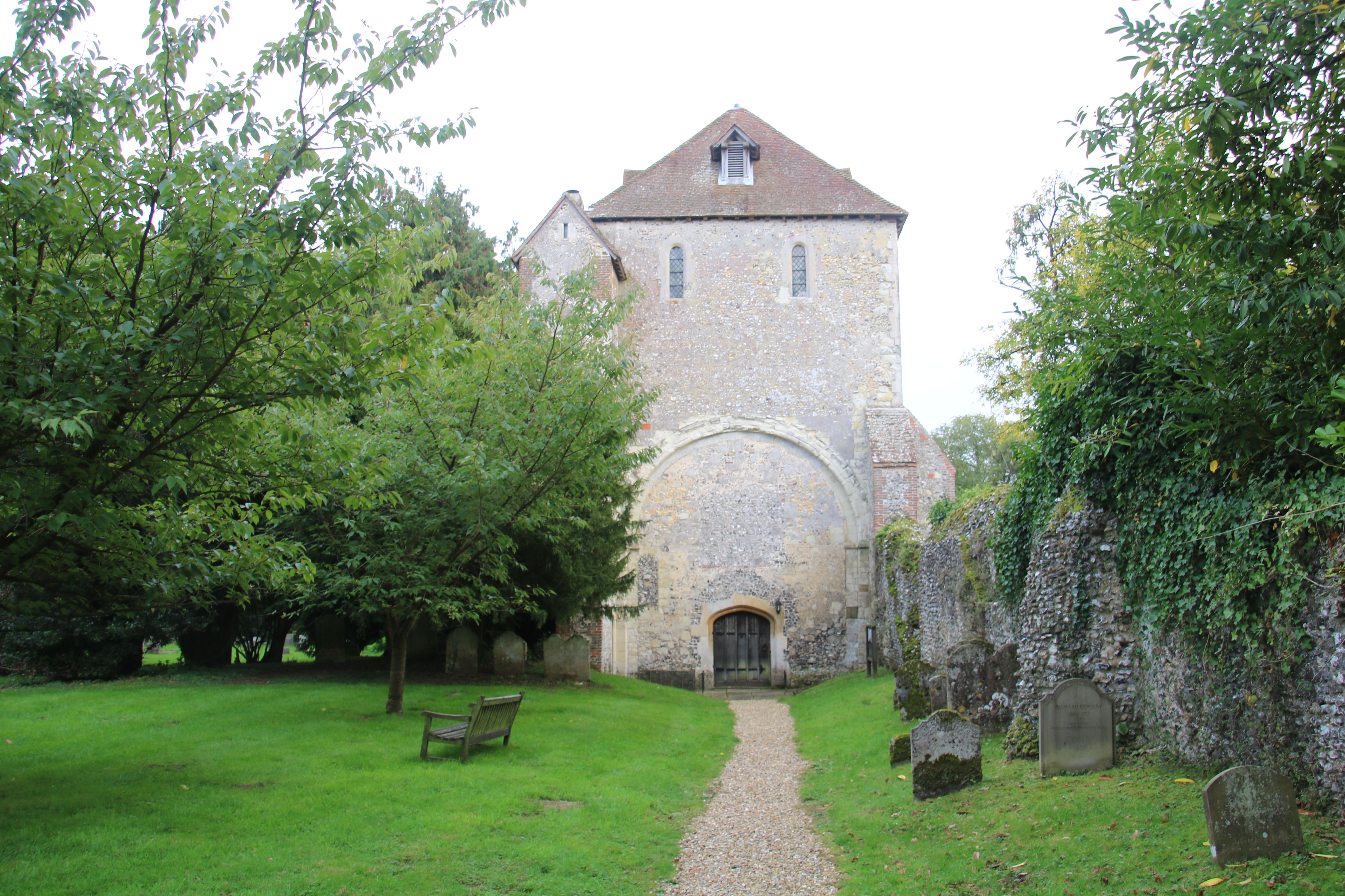
Where is St. Mary and St. John the Baptist Churchyard?
St. Mary and St. John the Baptist Churchyard is located at Pamber, Basingstoke and Deane Borough ,Hampshire , RG26 5QDEngland.
-
St. Mary and St. John the Baptist Churchyard cemetery's updated grave count on graveviews.com?
12 memorials
-
Where are the coordinates of the St. Mary and St. John the Baptist Churchyard?
Latitude: 51.3194500
Longitude: -1.1279200
Nearby Cemetories:
1. Christ Church Churchyard
Ramsdell, Basingstoke and Deane Borough, England
Coordinate: 51.3131100, -1.1558500
2. Tadley Cemetery
Tadley, Basingstoke and Deane Borough, England
Coordinate: 51.3356900, -1.1435800
3. St Peter Churchyard
Tadley, Basingstoke and Deane Borough, England
Coordinate: 51.3359400, -1.1433300
4. All Saints Churchyard
Monk Sherborne, Basingstoke and Deane Borough, England
Coordinate: 51.2981040, -1.1288260
5. St Andrew Churchyard
Sherborne St John, Basingstoke and Deane Borough, England
Coordinate: 51.2955000, -1.1069200
6. St Stephen Churchyard
Baughurst, Basingstoke and Deane Borough, England
Coordinate: 51.3354800, -1.1657100
7. St James Churchyard
Bramley, Basingstoke and Deane Borough, England
Coordinate: 51.3263740, -1.0757240
8. St Lawrence Churchyard
Wootton St Lawrence, Basingstoke and Deane Borough, England
Coordinate: 51.2751600, -1.1522800
9. St Mary the Virgin Churchyard
Silchester, Basingstoke and Deane Borough, England
Coordinate: 51.3564000, -1.0775700
10. St Catherine Churchyard
Wolverton, Basingstoke and Deane Borough, England
Coordinate: 51.3236500, -1.2097700
11. St Saviour Churchyard
Mortimer West End, Basingstoke and Deane Borough, England
Coordinate: 51.3682600, -1.0912800
12. South View Cemetery
Basingstoke, Basingstoke and Deane Borough, England
Coordinate: 51.2693510, -1.0911620
13. St. Thomas of Canterbury Churchyard
Worting, Basingstoke and Deane Borough, England
Coordinate: 51.2621430, -1.1405070
14. St. Leonard's Churchyard
Sherfield on Loddon, Basingstoke and Deane Borough, England
Coordinate: 51.3061100, -1.0376400
15. Worting Road Cemetery
Basingstoke, Basingstoke and Deane Borough, England
Coordinate: 51.2623970, -1.1049700
16. St. Michael's Churchyard
Basingstoke, Basingstoke and Deane Borough, England
Coordinate: 51.2652400, -1.0885200
17. St Mary Churchyard
Basingstoke, Basingstoke and Deane Borough, England
Coordinate: 51.2652010, -1.0818960
18. St Paul Churchyard
Ashford Hill, Basingstoke and Deane Borough, England
Coordinate: 51.3556440, -1.2120460
19. All Saints Churchyard
Hannington, Basingstoke and Deane Borough, England
Coordinate: 51.2956100, -1.2285200
20. St Mary Churchyard
Old Basing, Basingstoke and Deane Borough, England
Coordinate: 51.2715280, -1.0467700
21. Old Basing Cemetery
Old Basing, Basingstoke and Deane Borough, England
Coordinate: 51.2736710, -1.0397679
22. St John the Baptist
Padworth, West Berkshire Unitary Authority, England
Coordinate: 51.3911075, -1.1198134
23. St Mary Churchyard
Kingsclere, Basingstoke and Deane Borough, England
Coordinate: 51.3244900, -1.2474000
24. St John Churchyard and Garden of Remembrance
Oakley, Basingstoke and Deane Borough, England
Coordinate: 51.2468300, -1.1689700