
| Memorials | : | 60 |
| Location | : | Colkirk, Breckland Borough, England |
| Coordinate | : | 52.8021610, 0.8433730 |
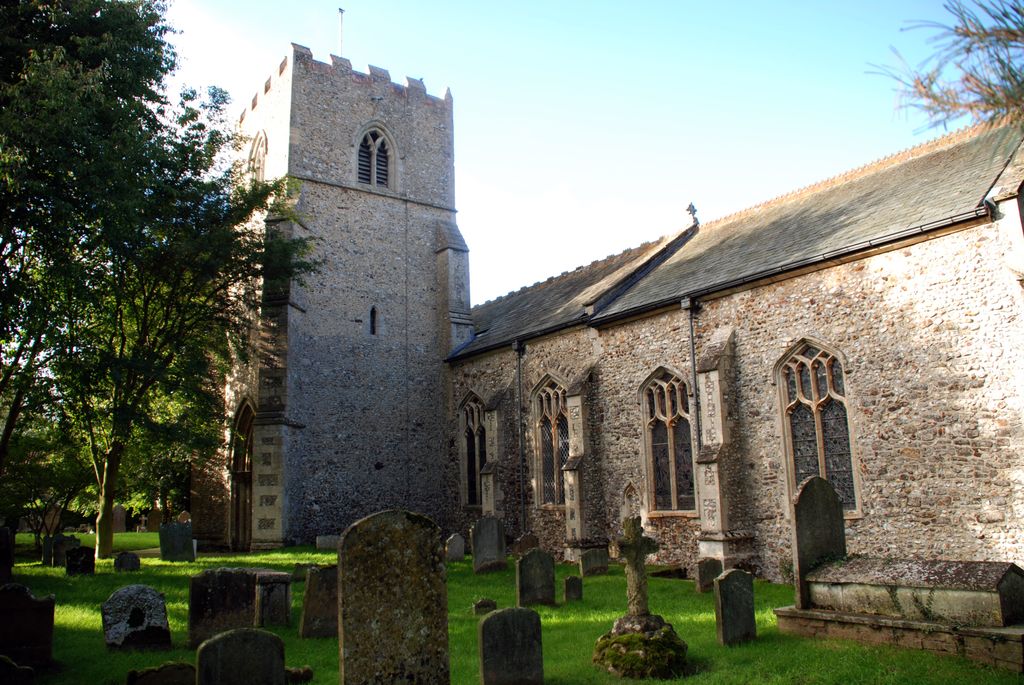
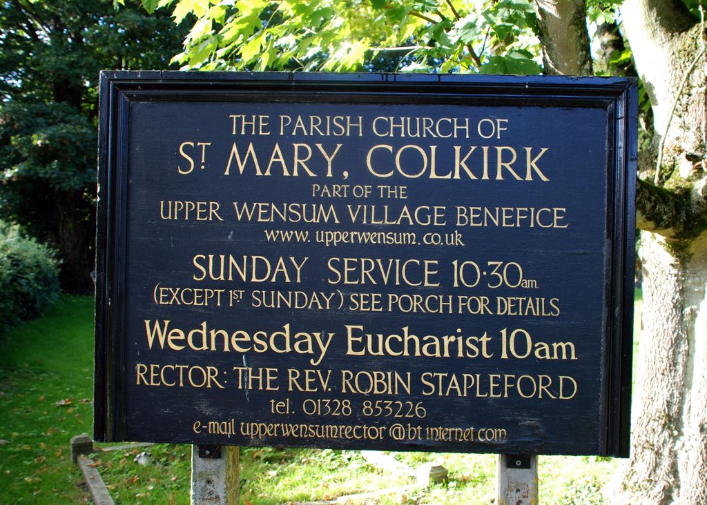
| Description | : | The churchyard for the Parish Church of Saint Mary the Virgin, Colkirk with Oxwick and Pattesley. Church registers date from 1538. The earliest gravestone is dated 1676. The parish is still active, and is part of the Upper Wensum Village Benefice in the Burnham and Walsingham Deanery in the Diocese of Norwich. Source: Websites of the Diocese of Norwich |
frequently asked questions (FAQ):
-
Where is St Mary the Virgin Churchyard?
St Mary the Virgin Churchyard is located at Church Road, adjacent to the village green ('The Campyngland') Colkirk, Breckland Borough ,Norfolk , NR21 7NPEngland.
-
St Mary the Virgin Churchyard cemetery's updated grave count on graveviews.com?
60 memorials
-
Where are the coordinates of the St Mary the Virgin Churchyard?
Latitude: 52.8021610
Longitude: 0.8433730
Nearby Cemetories:
1. All Saints Churchyard
Oxwick, Breckland Borough, England
Coordinate: 52.7917630, 0.8316080
2. St Peter & St Paul Churchyard
Fakenham, North Norfolk District, England
Coordinate: 52.8308090, 0.8474920
3. Fakenham Cemetery
Fakenham, North Norfolk District, England
Coordinate: 52.8324060, 0.8500670
4. St Edmund Churchyard
Horningtoft, Breckland Borough, England
Coordinate: 52.7706250, 0.8681250
5. St Mary Churchyard
East Raynham, North Norfolk District, England
Coordinate: 52.7946530, 0.7864240
6. Fakenham Creake Road Cemetery
Fakenham, North Norfolk District, England
Coordinate: 52.8403170, 0.8348050
7. St. Andrew's Churchyard
Great Ryburgh, North Norfolk District, England
Coordinate: 52.8072980, 0.9094190
8. All Saint's Churchyard
Helhoughton, North Norfolk District, England
Coordinate: 52.8038639, 0.7713343
9. All Saints Churchyard (Ruins)
Ryburgh, North Norfolk District, England
Coordinate: 52.8105000, 0.9181000
10. St. Peter's Churchyard
Dunton, North Norfolk District, England
Coordinate: 52.8375460, 0.7887910
11. St. Bartholomew's Churchyard
Brisley, Breckland Borough, England
Coordinate: 52.7558730, 0.8895380
12. St. John the Baptist Churchyard
Mileham, Breckland Borough, England
Coordinate: 52.7397340, 0.8454250
13. St Andrew Churchyard
Little Snoring, North Norfolk District, England
Coordinate: 52.8551400, 0.8990400
14. All Saints Churchyard
East Barsham, North Norfolk District, England
Coordinate: 52.8666620, 0.8459870
15. All Saints Churchyard
Kettlestone, North Norfolk District, England
Coordinate: 52.8468600, 0.9205100
16. Assumption of the Blessed Virgin Mary Churchyard
Barsham, North Norfolk District, England
Coordinate: 52.8667710, 0.8283940
17. St. Mary's Churchyard
East Bilney, Breckland Borough, England
Coordinate: 52.7382920, 0.8961870
18. St. John the Baptist Chapelyard
Fulmodeston, North Norfolk District, England
Coordinate: 52.8397799, 0.9440578
19. St. Mary's Churchyard
Fulmodeston, North Norfolk District, England
Coordinate: 52.8306490, 0.9558700
20. St. Andrews Churchyard
Guist, Breckland Borough, England
Coordinate: 52.7908600, 0.9650200
21. All Saints Churchyard
North Barsham, North Norfolk District, England
Coordinate: 52.8777330, 0.8451480
22. St Mary The Virgin Churchyard
Great Snoring, North Norfolk District, England
Coordinate: 52.8736000, 0.8914000
23. St. Mary the Virgin Churchyard
North Elmham, Breckland Borough, England
Coordinate: 52.7546410, 0.9443500
24. Christ Church Churchyard
Fulmodeston, North Norfolk District, England
Coordinate: 52.8385680, 0.9569670