
| Memorials | : | 171 |
| Location | : | North Elmham, Breckland Borough, England |
| Coordinate | : | 52.7546410, 0.9443500 |
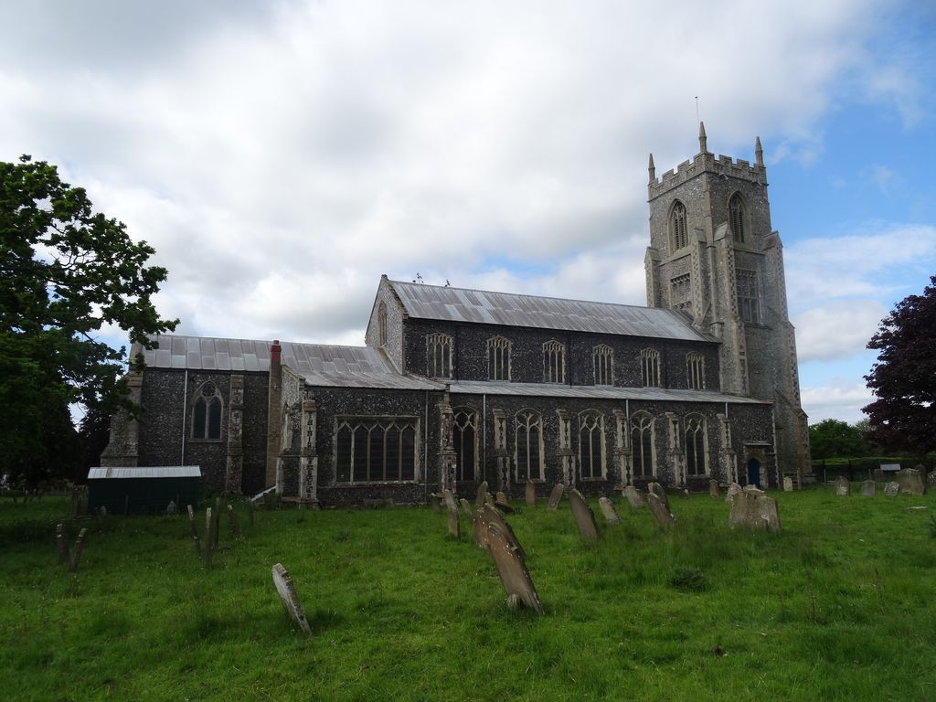
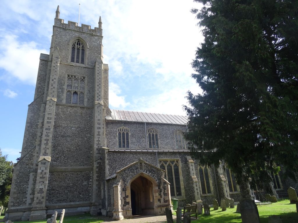
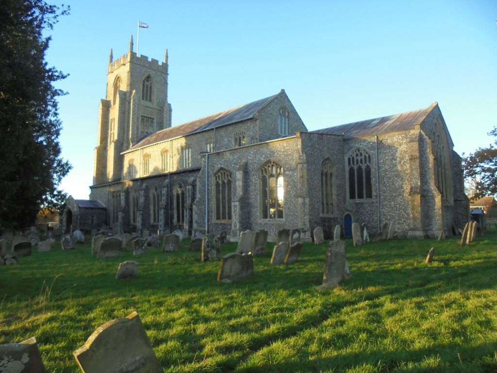
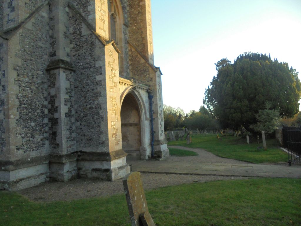
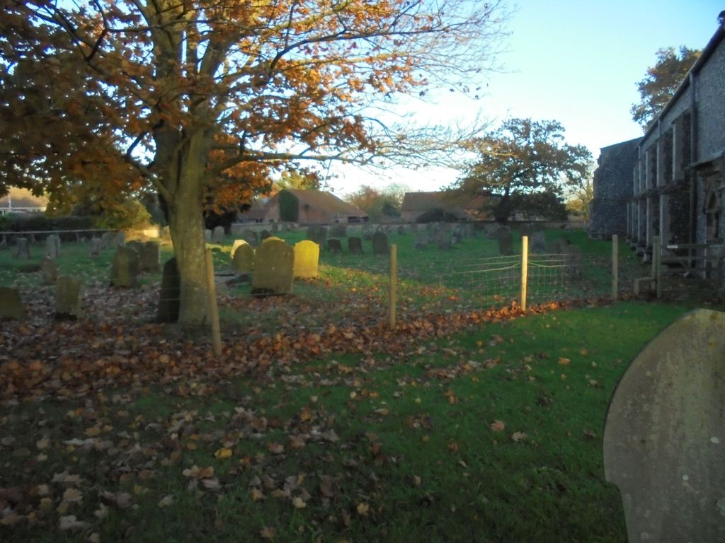
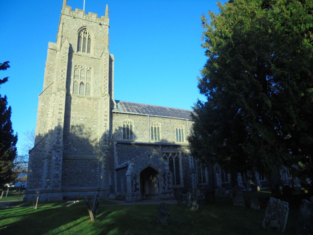
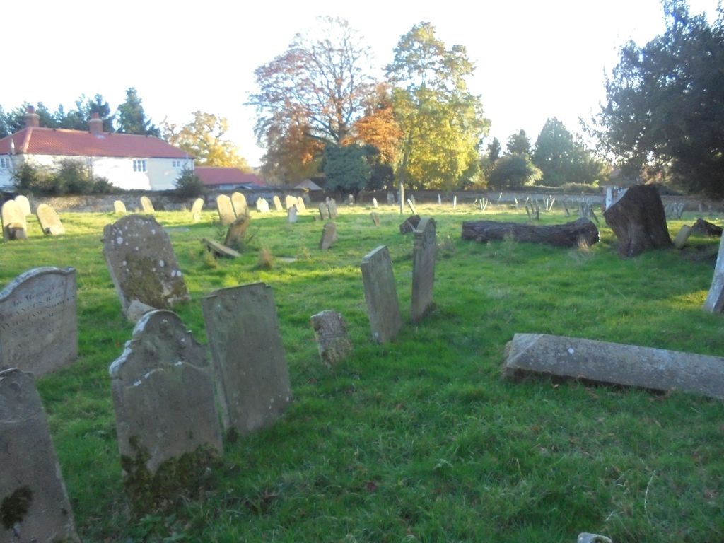
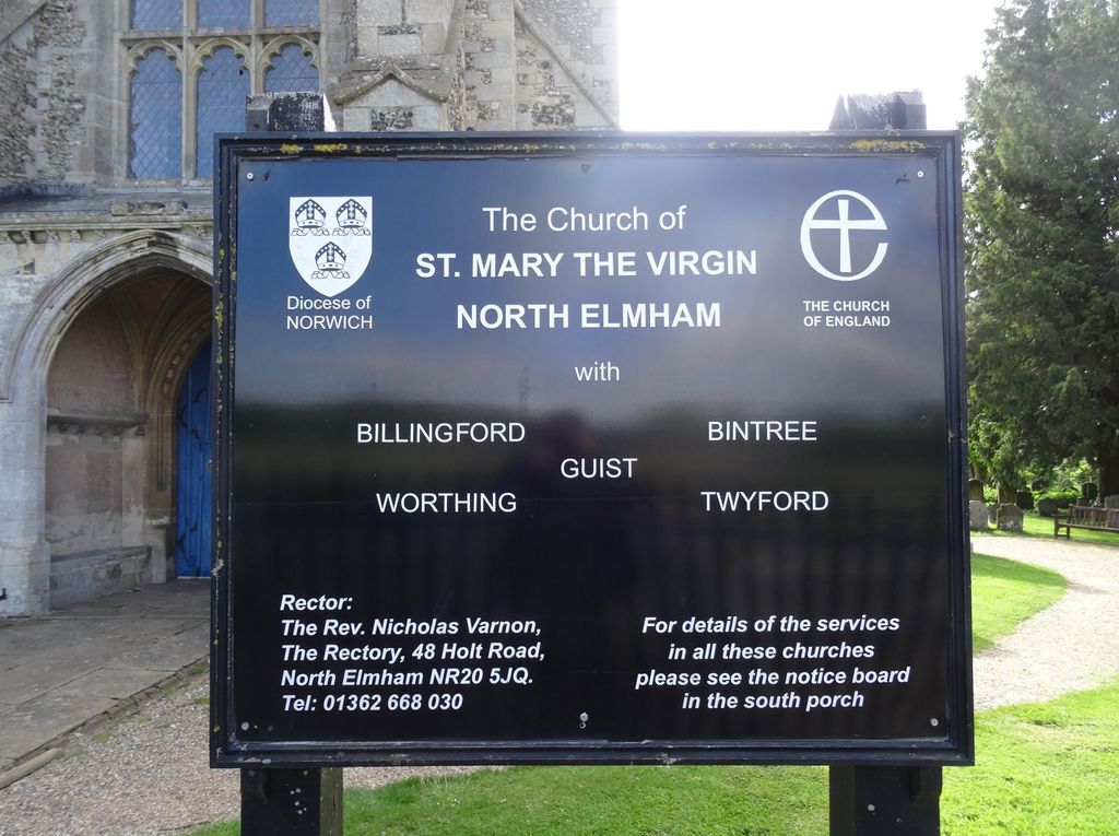
| Description | : | St Mary the Virgin is a large, ornate parish church located on Holt Road at the north end of the village of North Elmham in Norfolk. St Mary’s originated in the 12th century when it replaced the local Anglo-Saxon cathedral as a place of worship, the cathedral being transferred to Thetford in 1071 and then to Norwich in 1095. The church stands on a hilltop immediately to the south of the Saxon cathedral. Excavations have demonstrated that it stands on the southern edge of the cathedral graveyard. St Mary’s has been added to and restored over the centuries. The extensive... Read More |
frequently asked questions (FAQ):
-
Where is St. Mary the Virgin Churchyard?
St. Mary the Virgin Churchyard is located at Holt Road North Elmham, Breckland Borough ,Norfolk , NR20 5JUEngland.
-
St. Mary the Virgin Churchyard cemetery's updated grave count on graveviews.com?
171 memorials
-
Where are the coordinates of the St. Mary the Virgin Churchyard?
Latitude: 52.7546410
Longitude: 0.9443500
Nearby Cemetories:
1. St. Peter's Churchyard
Billingford, Breckland Borough, England
Coordinate: 52.7443680, 0.9812590
2. St. Mary Magdalene Churchyard
Beetley, Breckland Borough, England
Coordinate: 52.7283590, 0.9215840
3. St Swithun's Churchyard
Bintree, Breckland Borough, England
Coordinate: 52.7709594, 0.9886811
4. St. Bartholomew's Churchyard
Brisley, Breckland Borough, England
Coordinate: 52.7558730, 0.8895380
5. St. Mary's Churchyard
East Bilney, Breckland Borough, England
Coordinate: 52.7382920, 0.8961870
6. St. Andrews Churchyard
Guist, Breckland Borough, England
Coordinate: 52.7908600, 0.9650200
7. St. Andrews Churchyard
Hoe, Breckland Borough, England
Coordinate: 52.7084840, 0.9555160
8. St Edmund Churchyard
Horningtoft, Breckland Borough, England
Coordinate: 52.7706250, 0.8681250
9. Holy Innocents Churchyard
Foulsham, Broadland District, England
Coordinate: 52.7848400, 1.0121600
10. St Mary's Churchyard
Bylaugh, Breckland Borough, England
Coordinate: 52.7245880, 1.0136460
11. All Saints Churchyard
Bawdeswell, Breckland Borough, England
Coordinate: 52.7469490, 1.0307670
12. Bawdeswell Cemetery
Bawdeswell, Breckland Borough, England
Coordinate: 52.7446450, 1.0328570
13. St. Andrew's Churchyard
Great Ryburgh, North Norfolk District, England
Coordinate: 52.8072980, 0.9094190
14. All Saints Churchyard (Ruins)
Ryburgh, North Norfolk District, England
Coordinate: 52.8105000, 0.9181000
15. St. Mary's Churchyard
Gressenhall, Breckland Borough, England
Coordinate: 52.7017300, 0.8980110
16. St. John the Baptist Churchyard
Mileham, Breckland Borough, England
Coordinate: 52.7397340, 0.8454250
17. East Dereham Cemetery
East Dereham, Breckland Borough, England
Coordinate: 52.6861090, 0.9446600
18. St. Andrew and St. Peter Churchyard
Longham, Breckland Borough, England
Coordinate: 52.7085850, 0.8586910
19. Saint Mary the Virgin Churchyard
Elsing, Breckland Borough, England
Coordinate: 52.7076070, 1.0354460
20. St Nicholas Churchyard
East Dereham, Breckland Borough, England
Coordinate: 52.6810280, 0.9379390
21. St. Mary's Churchyard
Fulmodeston, North Norfolk District, England
Coordinate: 52.8306490, 0.9558700
22. St. Mary's Churchyard
Sparham, Breckland Borough, England
Coordinate: 52.7349340, 1.0661850
23. St Mary the Virgin Churchyard
Colkirk, Breckland Borough, England
Coordinate: 52.8021610, 0.8433730
24. All Saints Churchyard
Oxwick, Breckland Borough, England
Coordinate: 52.7917630, 0.8316080