
| Memorials | : | 0 |
| Location | : | Stour Provost, North Dorset District, England |
| Coordinate | : | 50.9926020, -2.2948470 |
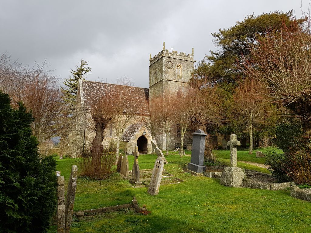
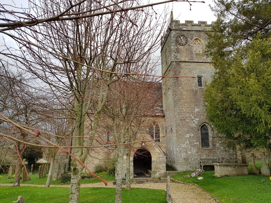
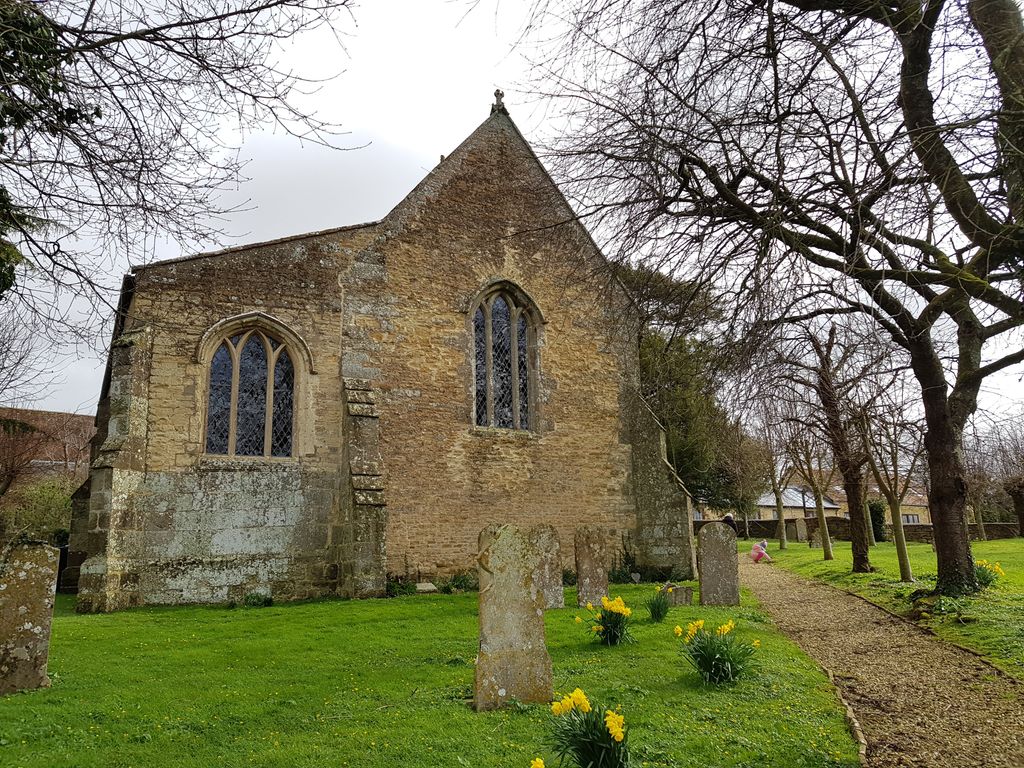
| Description | : | The Parish Church of St. Michael & All Angels stands near the centre of the village. It has walls of rubble, squared rubble and ashlar; the roofs are covered with stone slates and, in part, with Welsh slates. The Nave and chancel arch are of the early 14th century; a small lancet window in the nave which appears to be more in the style of the 13th century could be a late survival, or perhaps is from an older building. The South Tower is of the 15th century with 17th-century rebuilding of the upper part, and 19th-century repairs. The N.... Read More |
frequently asked questions (FAQ):
-
Where is St. Michael & All Angels Churchyard?
St. Michael & All Angels Churchyard is located at Church Lane Stour Provost, North Dorset District ,Dorset , SP8 5RZEngland.
-
St. Michael & All Angels Churchyard cemetery's updated grave count on graveviews.com?
0 memorials
-
Where are the coordinates of the St. Michael & All Angels Churchyard?
Latitude: 50.9926020
Longitude: -2.2948470
Nearby Cemetories:
1. St Mary Magdalene Churchyard
Fifehead Magdalen, North Dorset District, England
Coordinate: 50.9933080, -2.3108970
2. Christ Church
East Stour, North Dorset District, England
Coordinate: 51.0048020, -2.2882840
3. St Andrew's Churchyard
Todber, North Dorset District, England
Coordinate: 50.9794600, -2.2863750
4. Our Lady's church
Marnhull, North Dorset District, England
Coordinate: 50.9805432, -2.3110536
5. Marnhull Garden Cemetery
Marnhull, North Dorset District, England
Coordinate: 50.9732060, -2.3135975
6. All Saints Churchyard
North Dorset District, England
Coordinate: 50.9894410, -2.2541640
7. Saint Gregory Churchyard
Marnhull, North Dorset District, England
Coordinate: 50.9677060, -2.3121550
8. All Saints Churchyard
Kington Magna, North Dorset District, England
Coordinate: 51.0072810, -2.3320080
9. St Margaret Churchyard
Margaret Marsh, North Dorset District, England
Coordinate: 50.9668372, -2.2548074
10. St John The Baptist Churchyard
Buckhorn Weston, North Dorset District, England
Coordinate: 51.0212870, -2.3481780
11. Civic Cemetery
Buckhorn Weston, North Dorset District, England
Coordinate: 51.0212440, -2.3484600
12. St. Mary the Virgin Churchyard
Gillingham, North Dorset District, England
Coordinate: 51.0383080, -2.2776020
13. Gillingham Garden of Rememberance
Gillingham, North Dorset District, England
Coordinate: 51.0393211, -2.2795574
14. St. Thomas Churchyard
East Orchard, North Dorset District, England
Coordinate: 50.9605010, -2.2386630
15. Gillingham New Cemetery
Gillingham, North Dorset District, England
Coordinate: 51.0408540, -2.2811650
16. St Peters Church Hinton St Mary
Hinton St Mary, North Dorset District, England
Coordinate: 50.9439710, -2.3051250
17. St Luke’s Church
West Orchard, North Dorset District, England
Coordinate: 50.9470000, -2.2522300
18. St John's Churchyard
Motcombe, North Dorset District, England
Coordinate: 51.0073350, -2.2083450
19. St James Churchyard
Shaftesbury, North Dorset District, England
Coordinate: 51.0007100, -2.2037560
20. St. Mary's Churchyard
Motcombe, North Dorset District, England
Coordinate: 51.0263000, -2.2165000
21. St Nicholas' Churchyard
Manston, North Dorset District, England
Coordinate: 50.9347400, -2.2627530
22. Holy Trinity Churchyard
Shaftesbury, North Dorset District, England
Coordinate: 51.0058250, -2.1994730
23. Shaftesbury Abbey Ruins
Shaftesbury, North Dorset District, England
Coordinate: 51.0053000, -2.1986000
24. St Mary Churchyard
Stalbridge, North Dorset District, England
Coordinate: 50.9623690, -2.3808740