
| Memorials | : | 0 |
| Location | : | Gillingham, North Dorset District, England |
| Phone | : | 01747 823588 |
| Website | : | gillinghamdorset-tc.gov.uk |
| Coordinate | : | 51.0393211, -2.2795574 |
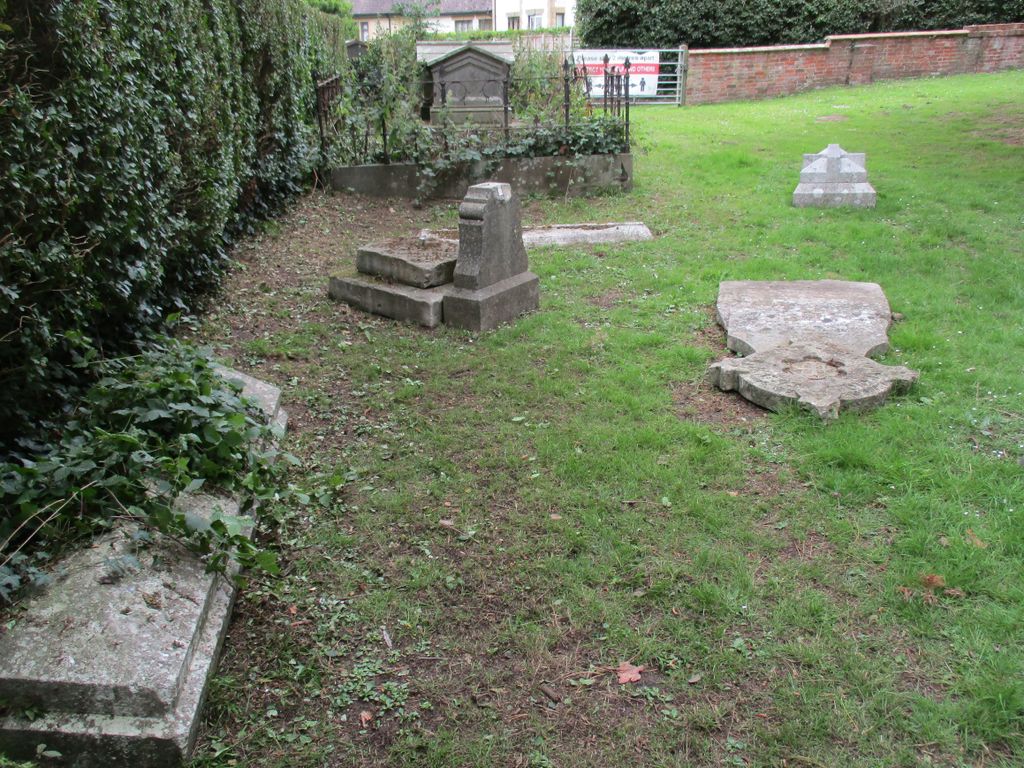
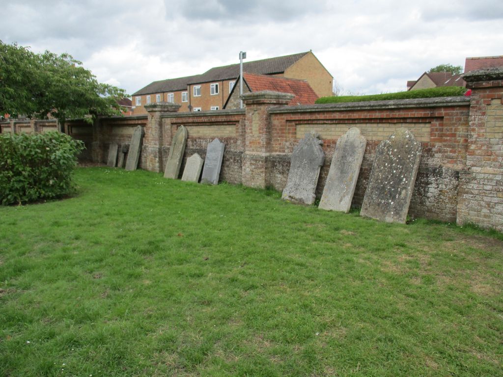
| Description | : | The Garden of Remembrance is located on Cemetery Road. It opened in 1861 and closed in 1954. Since it closure trees have been planted by families in memory of their loved ones and also from time to time ashes are scattered in the area. The area is now a green space for quiet reflection and is no longer a functioning cemetery. Headstones have been moved to the perimeter wall of the site. It is managed by Gillingham Town Council. |
frequently asked questions (FAQ):
-
Where is Gillingham Garden of Rememberance?
Gillingham Garden of Rememberance is located at Cemetery Road Gillingham, North Dorset District ,Dorset ,England.
-
Gillingham Garden of Rememberance cemetery's updated grave count on graveviews.com?
0 memorials
-
Where are the coordinates of the Gillingham Garden of Rememberance?
Latitude: 51.0393211
Longitude: -2.2795574


Nearby Cemetories:
1. St. Mary the Virgin Churchyard
Gillingham, North Dorset District, England
Coordinate: 51.0383080, -2.2776020
2. Gillingham New Cemetery
Gillingham, North Dorset District, England
Coordinate: 51.0408540, -2.2811650
3. St. Simon & St Jude Church Milton on Stour
Gillingham, North Dorset District, England
Coordinate: 51.0569980, -2.2843840
4. St Nicholas Churchyard
Silton, North Dorset District, England
Coordinate: 51.0630170, -2.3123390
5. Christ Church
East Stour, North Dorset District, England
Coordinate: 51.0048020, -2.2882840
6. St. Mary's Churchyard
Motcombe, North Dorset District, England
Coordinate: 51.0263000, -2.2165000
7. St Lawrence Churchyard
Cucklington, South Somerset District, England
Coordinate: 51.0487190, -2.3507950
8. All Saints Churchyard
Kington Magna, North Dorset District, England
Coordinate: 51.0072810, -2.3320080
9. St George's Churchyard
Bourton, North Dorset District, England
Coordinate: 51.0715490, -2.3321690
10. St John The Baptist Churchyard
Buckhorn Weston, North Dorset District, England
Coordinate: 51.0212870, -2.3481780
11. Bourton Village Cemetery
Bourton, North Dorset District, England
Coordinate: 51.0715890, -2.3337900
12. Civic Cemetery
Buckhorn Weston, North Dorset District, England
Coordinate: 51.0212440, -2.3484600
13. St. Michael & All Angels Churchyard
Stour Provost, North Dorset District, England
Coordinate: 50.9926020, -2.2948470
14. St Mary Magdalene Churchyard
Fifehead Magdalen, North Dorset District, England
Coordinate: 50.9933080, -2.3108970
15. All Saints Churchyard
North Dorset District, England
Coordinate: 50.9894410, -2.2541640
16. St John's Churchyard
Motcombe, North Dorset District, England
Coordinate: 51.0073350, -2.2083450
17. St Andrew's Churchyard
Todber, North Dorset District, England
Coordinate: 50.9794600, -2.2863750
18. Holy Trinity Churchyard
Shaftesbury, North Dorset District, England
Coordinate: 51.0058250, -2.1994730
19. St. Michael Churchyard
Pen Selwood, South Somerset District, England
Coordinate: 51.0816300, -2.3499200
20. Shaftesbury Abbey Ruins
Shaftesbury, North Dorset District, England
Coordinate: 51.0053000, -2.1986000
21. St James Churchyard
Shaftesbury, North Dorset District, England
Coordinate: 51.0007100, -2.2037560
22. St Peter's Church
Shaftesbury, North Dorset District, England
Coordinate: 51.0057190, -2.1967650
23. Our Lady's church
Marnhull, North Dorset District, England
Coordinate: 50.9805432, -2.3110536
24. St. Rumbold Churchyard
Cann, North Dorset District, England
Coordinate: 51.0036070, -2.1904180