
| Memorials | : | 32 |
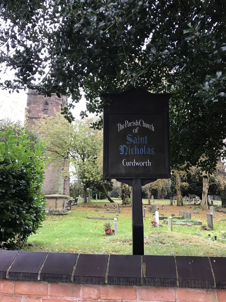
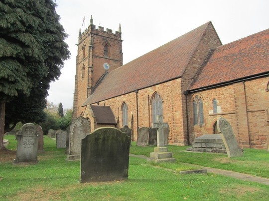
| Location | : | Curdworth, North Warwickshire Borough, England |
| Coordinate | : | 52.5326700, -1.7388000 |
| Description | : | There are 9 war graves here and a number of 'In Remembrance' inscriptions to the fallen of both World Wars. A 'Family Tree' has been created on Ancestry which contains more details for these, but attempts to capture all those interred within its grounds. The link below is to the entry for second lieutenant Conrade William Jacot Royal Flying Corps who died 22 June 1917. He is also entered here on this site as Find A Grave Memorial# 107546582 http://trees.ancestry.co.uk/tree/68814682/person/34185246127 From there the tree can be explored. |
frequently asked questions (FAQ):
-
Where is St Nicholas Churchyard?
St Nicholas Churchyard is located at Glebe Fields (off Coleshill Road), Curdworth, North Warwickshire Borough ,Warwickshire , B76 9ESEngland.
-
St Nicholas Churchyard cemetery's updated grave count on graveviews.com?
31 memorials
-
Where are the coordinates of the St Nicholas Churchyard?
Latitude: 52.5326700
Longitude: -1.7388000
Nearby Cemetories:
1. Old Churchyard
Water Orton, North Warwickshire Borough, England
Coordinate: 52.5201200, -1.7422100
2. St Peter & St Paul Churchyard
Water Orton, North Warwickshire Borough, England
Coordinate: 52.5174100, -1.7407100
3. Saint Chad's Churchyard
Wishaw, North Warwickshire Borough, England
Coordinate: 52.5486700, -1.7408600
4. St John The Baptist Churchyard
Lea Marston, North Warwickshire Borough, England
Coordinate: 52.5319000, -1.6998000
5. St. John's Churchyard
Walmley, Metropolitan Borough of Birmingham, England
Coordinate: 52.5394480, -1.7995369
6. Coleshill Cemetery
Coleshill, North Warwickshire Borough, England
Coordinate: 52.4983150, -1.7030310
7. Woodlands Cemetery and Crematorium
Solihull, Metropolitan Borough of Solihull, England
Coordinate: 52.4920570, -1.7304810
8. Woodlands Cemetery and Crematorium
Coleshill, North Warwickshire Borough, England
Coordinate: 52.4918650, -1.7306260
9. St. Mary and St. Margaret Churchyard
Castle Bromwich, Metropolitan Borough of Solihull, England
Coordinate: 52.5068700, -1.7918100
10. Sutton New Hall Cemetery
Sutton Coldfield, Metropolitan Borough of Birmingham, England
Coordinate: 52.5676300, -1.7843800
11. SS Peter & Paul Churchyard
Kingsbury, North Warwickshire Borough, England
Coordinate: 52.5639340, -1.6842370
12. St Giles Churchyard
Nether Whitacre, North Warwickshire Borough, England
Coordinate: 52.5329400, -1.6606670
13. St John the Baptist Churchyard
Middleton, North Warwickshire Borough, England
Coordinate: 52.5826140, -1.7406020
14. Sutton Coldfield Cemetery
Sutton Coldfield, Metropolitan Borough of Birmingham, England
Coordinate: 52.5668200, -1.8146000
15. Sutton Coldfield Cemetery Extension
Sutton Coldfield, Metropolitan Borough of Birmingham, England
Coordinate: 52.5687500, -1.8138500
16. St Thomas of Canterbury
Erdington, Metropolitan Borough of Birmingham, England
Coordinate: 52.5283500, -1.8356200
17. Holy Trinity Churchyard
Sutton Coldfield, Metropolitan Borough of Birmingham, England
Coordinate: 52.5641890, -1.8216280
18. Erdington Greek Orthodox Churchyard
Erdington, Metropolitan Borough of Birmingham, England
Coordinate: 52.5267800, -1.8369700
19. St Cuthbert Churchyard
Shustoke, North Warwickshire Borough, England
Coordinate: 52.5162210, -1.6434000
20. St. Michael's Churchyard
Boldmere, Metropolitan Borough of Birmingham, England
Coordinate: 52.5421250, -1.8393150
21. St. Barnabas Churchyard
Erdington, Metropolitan Borough of Birmingham, England
Coordinate: 52.5225500, -1.8392400
22. Sutton Coldfield Crematorium
Sutton Coldfield, Metropolitan Borough of Birmingham, England
Coordinate: 52.5869060, -1.7886810
23. St Peter Churchyard
Drayton Bassett, Lichfield District, England
Coordinate: 52.5993180, -1.7165990
24. Oscott College Cemetery
Sutton Coldfield, Metropolitan Borough of Birmingham, England
Coordinate: 52.5406600, -1.8512000