| Memorials | : | 0 |
| Location | : | Water Orton, North Warwickshire Borough, England |
| Coordinate | : | 52.5201200, -1.7422100 |
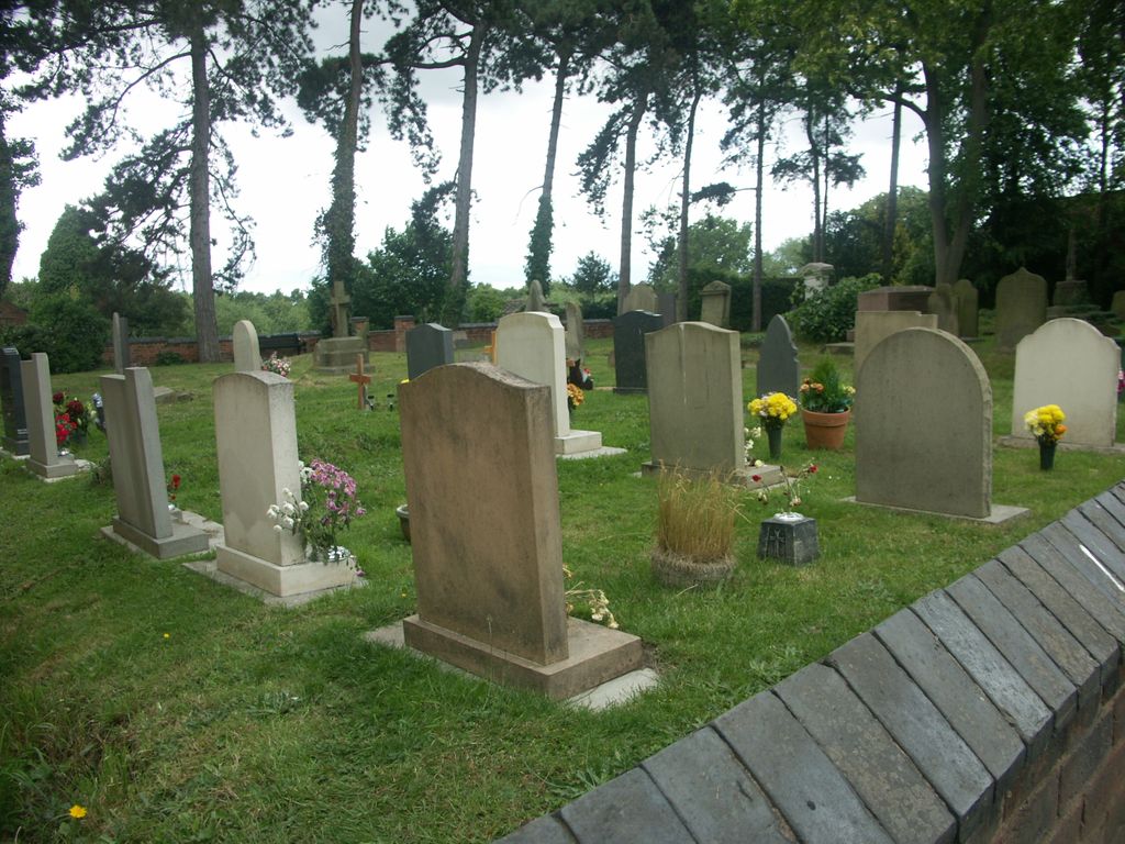
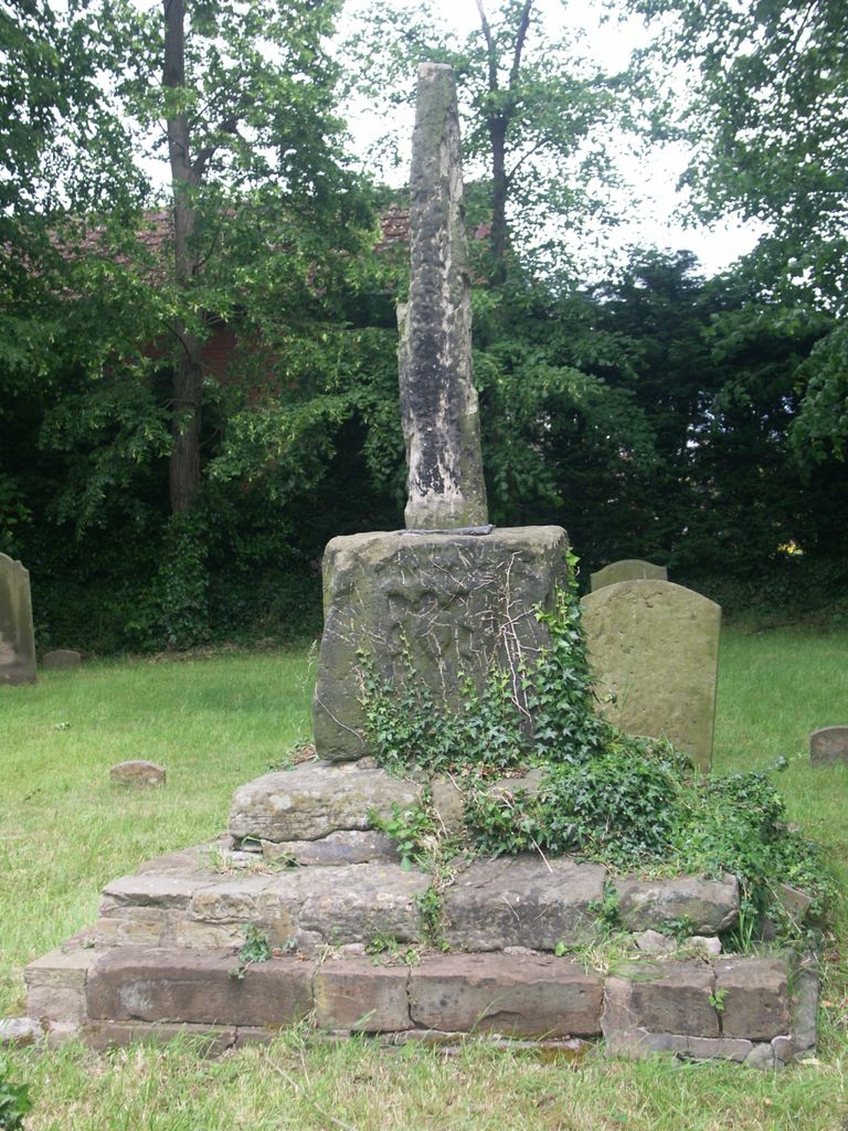
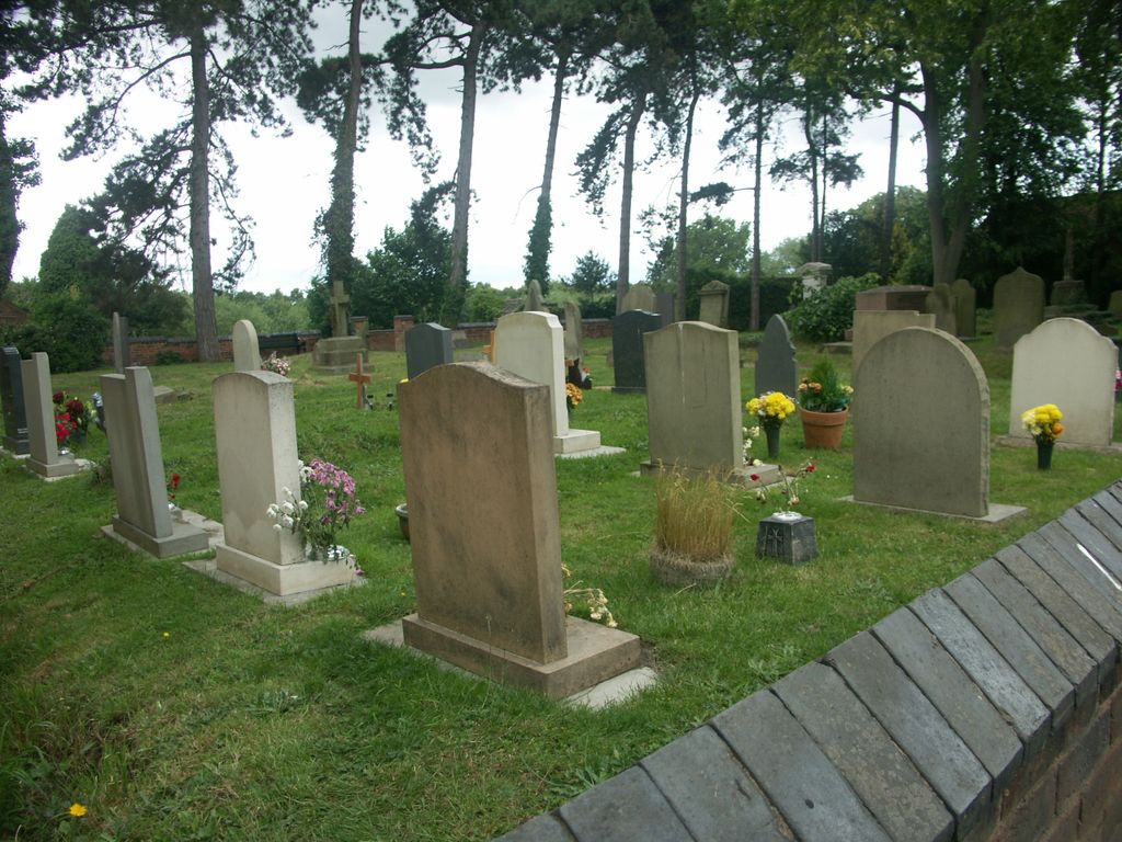
| Description | : | Water Orton Church was probably built on the site of the 1347 Orton Chapel. In 1872 it was replaced by the newly built Church of St. Peter & St. Paul in New Road, and subsequently became a Chapel of Ease. It was demolished about 1887. The little Altar and a plain silver chalice are preserved in the new church. All that now remains is the churchyard burial area, and the remains of an old preaching cross. As of 2015 a number of recent burials had taken place. |
frequently asked questions (FAQ):
-
Where is Old Churchyard?
Old Churchyard is located at Old Church Road Water Orton, North Warwickshire Borough ,Warwickshire , B46 1NJEngland.
-
Old Churchyard cemetery's updated grave count on graveviews.com?
0 memorials
-
Where are the coordinates of the Old Churchyard?
Latitude: 52.5201200
Longitude: -1.7422100
Nearby Cemetories:
1. St Peter & St Paul Churchyard
Water Orton, North Warwickshire Borough, England
Coordinate: 52.5174100, -1.7407100
2. St Nicholas Churchyard
Curdworth, North Warwickshire Borough, England
Coordinate: 52.5326700, -1.7388000
3. St John The Baptist Churchyard
Lea Marston, North Warwickshire Borough, England
Coordinate: 52.5319000, -1.6998000
4. Saint Chad's Churchyard
Wishaw, North Warwickshire Borough, England
Coordinate: 52.5486700, -1.7408600
5. Woodlands Cemetery and Crematorium
Solihull, Metropolitan Borough of Solihull, England
Coordinate: 52.4920570, -1.7304810
6. Woodlands Cemetery and Crematorium
Coleshill, North Warwickshire Borough, England
Coordinate: 52.4918650, -1.7306260
7. Coleshill Cemetery
Coleshill, North Warwickshire Borough, England
Coordinate: 52.4983150, -1.7030310
8. St. Mary and St. Margaret Churchyard
Castle Bromwich, Metropolitan Borough of Solihull, England
Coordinate: 52.5068700, -1.7918100
9. St. John's Churchyard
Walmley, Metropolitan Borough of Birmingham, England
Coordinate: 52.5394480, -1.7995369
10. St Giles Churchyard
Nether Whitacre, North Warwickshire Borough, England
Coordinate: 52.5329400, -1.6606670
11. Sutton New Hall Cemetery
Sutton Coldfield, Metropolitan Borough of Birmingham, England
Coordinate: 52.5676300, -1.7843800
12. SS Peter & Paul Churchyard
Kingsbury, North Warwickshire Borough, England
Coordinate: 52.5639340, -1.6842370
13. St Thomas of Canterbury
Erdington, Metropolitan Borough of Birmingham, England
Coordinate: 52.5283500, -1.8356200
14. Erdington Greek Orthodox Churchyard
Erdington, Metropolitan Borough of Birmingham, England
Coordinate: 52.5267800, -1.8369700
15. St. Edburgha's Churchyard
Yardley, Metropolitan Borough of Birmingham, England
Coordinate: 52.4745600, -1.8027400
16. St. Barnabas Churchyard
Erdington, Metropolitan Borough of Birmingham, England
Coordinate: 52.5225500, -1.8392400
17. St Cuthbert Churchyard
Shustoke, North Warwickshire Borough, England
Coordinate: 52.5162210, -1.6434000
18. St. Margaret's Churchyard
Ward End, Metropolitan Borough of Birmingham, England
Coordinate: 52.4953100, -1.8341300
19. St John the Baptist Churchyard
Middleton, North Warwickshire Borough, England
Coordinate: 52.5826140, -1.7406020
20. St. Michael's Churchyard
Boldmere, Metropolitan Borough of Birmingham, England
Coordinate: 52.5421250, -1.8393150
21. Sutton Coldfield Cemetery
Sutton Coldfield, Metropolitan Borough of Birmingham, England
Coordinate: 52.5668200, -1.8146000
22. Sutton Coldfield Cemetery Extension
Sutton Coldfield, Metropolitan Borough of Birmingham, England
Coordinate: 52.5687500, -1.8138500
23. Holy Trinity Churchyard
Sutton Coldfield, Metropolitan Borough of Birmingham, England
Coordinate: 52.5641890, -1.8216280
24. St Michael & All Angels Churchyard
Maxstoke, North Warwickshire Borough, England
Coordinate: 52.4791940, -1.6541150


