
| Memorials | : | 1 |
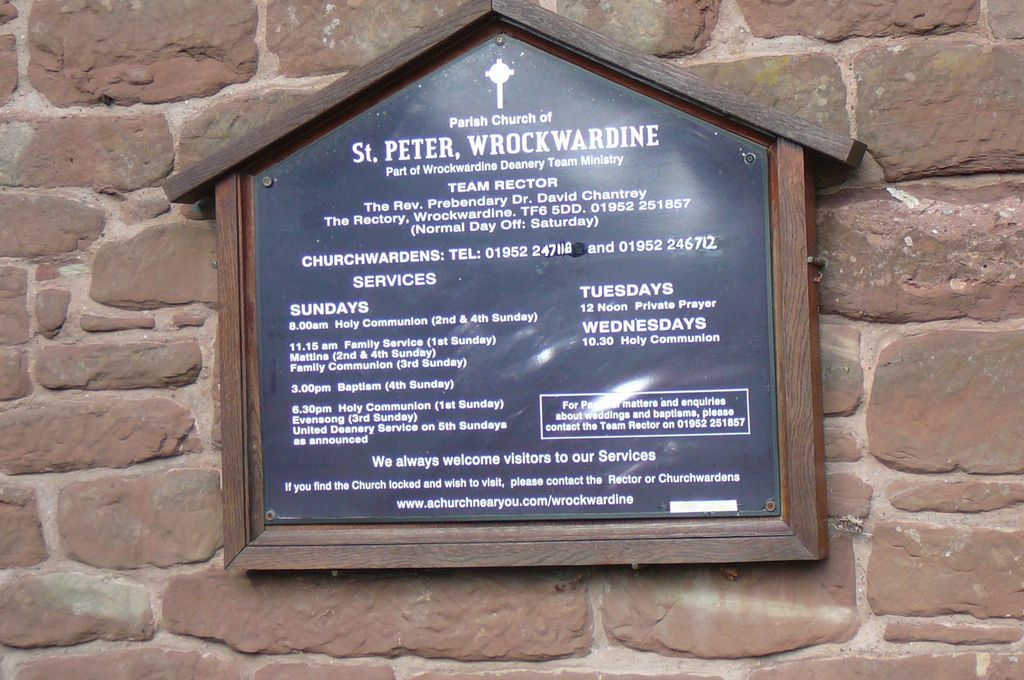
| Location | : | Wrockwardine, Telford and Wrekin Unitary Authority, England |
| Website | : | www.wrockwardinedeanery.org.uk/#churches |
| Coordinate | : | 52.7047350, -2.5569500 |
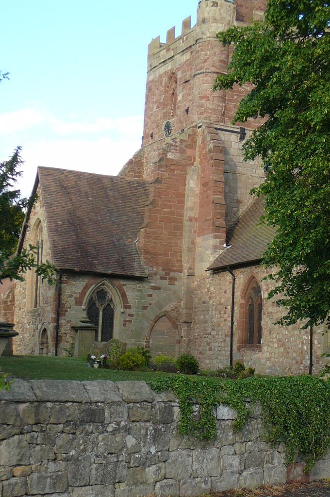
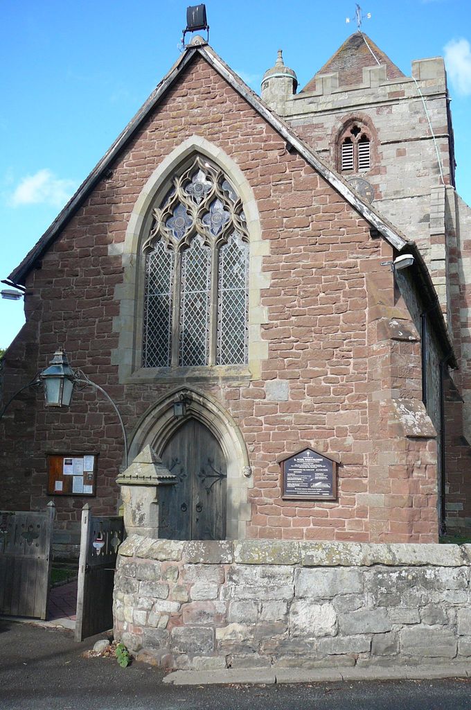
| Description | : | St. Peter's church, Wrockwardine is thought to be of Saxon origin. The Domesday Book of 1068 refers to a church and a priest(Odelerius) in the settlement. There have been changes to the church over the centuries, but since the Perpendicular age (late fourteenth century) there have been few major alterations. The church building now consists of a nave and chancel, with north and south transepts. The north transept houses the Cludde chapel. There is a fine tower with a ring of six bells, which. have been ringing out over the parish for over 600 years. The churchyard surrounding the church is now... Read More |
frequently asked questions (FAQ):
-
Where is St. Peter's Churchyard?
St. Peter's Churchyard is located at Wrockwardine, Telford and Wrekin Unitary Authority ,Shropshire , TF6 5DGEngland.
-
St. Peter's Churchyard cemetery's updated grave count on graveviews.com?
1 memorials
-
Where are the coordinates of the St. Peter's Churchyard?
Latitude: 52.7047350
Longitude: -2.5569500
Nearby Cemetories:
1. Wellington Cemetery
Wellington, Telford and Wrekin Unitary Authority, England
Coordinate: 52.6958280, -2.5246020
2. All Saints Churchyard
Wellington, Telford and Wrekin Unitary Authority, England
Coordinate: 52.7020230, -2.5177440
3. Saint Catherine Churchyard
Eyton upon the Weald Moors, Telford and Wrekin Unitary Authority, England
Coordinate: 52.7299800, -2.5182200
4. Hadley Cemetery
Leegomery, Telford and Wrekin Unitary Authority, England
Coordinate: 52.7097110, -2.4893660
5. Rodington Cemetery
Rodington, Telford and Wrekin Unitary Authority, England
Coordinate: 52.7273200, -2.6148100
6. St Johns Church
Lawley, Telford and Wrekin Unitary Authority, England
Coordinate: 52.6751550, -2.4932670
7. St. Lawrence's Churchyard
Little Wenlock, Telford and Wrekin Unitary Authority, England
Coordinate: 52.6582070, -2.5234340
8. Red Lake Garden of rest
Telford, Telford and Wrekin Unitary Authority, England
Coordinate: 52.6928969, -2.4715920
9. St. Mary the Virgin Churchyard
Ketley, Telford and Wrekin Unitary Authority, England
Coordinate: 52.6914797, -2.4701998
10. St. Michael & All Angels Churchyard
High Ercall, Telford and Wrekin Unitary Authority, England
Coordinate: 52.7521000, -2.6026400
11. St Mary's & St Leonard's Church Burial Ground
Wombridge, Telford and Wrekin Unitary Authority, England
Coordinate: 52.7014856, -2.4585662
12. Wombridge Cemetery
Oakengates, Telford and Wrekin Unitary Authority, England
Coordinate: 52.7023940, -2.4579990
13. Dawley Baptist Chapel Cemetery
Dawley, Telford and Wrekin Unitary Authority, England
Coordinate: 52.6745400, -2.4689600
14. Holy Trinity Churchyard
Oakengates, Telford and Wrekin Unitary Authority, England
Coordinate: 52.6925070, -2.4562980
15. Holy Trinity Churchyard
Buildwas, Shropshire Unitary Authority, England
Coordinate: 52.6393710, -2.5380180
16. Holy Trinity Church
Wrockwardine, Telford and Wrekin Unitary Authority, England
Coordinate: 52.7105800, -2.4476600
17. St Michael Churchyard
Waters Upton, Telford and Wrekin Unitary Authority, England
Coordinate: 52.7713210, -2.5439270
18. St. Leonard's Churchyard
Dawley, Telford and Wrekin Unitary Authority, England
Coordinate: 52.6695331, -2.4609601
19. St. Luke's Churchyard
Doseley, Telford and Wrekin Unitary Authority, England
Coordinate: 52.6560410, -2.4775480
20. Wrockwardine Wood Methodist Graveyard
Wrockwardine, Telford and Wrekin Unitary Authority, England
Coordinate: 52.7076180, -2.4426530
21. St. Peters Churchyard
Telford and Wrekin Unitary Authority, England
Coordinate: 52.6871100, -2.4404680
22. Coalbrookdale Quaker Burial Ground
Coalbrookdale, Telford and Wrekin Unitary Authority, England
Coordinate: 52.6417080, -2.4952200
23. Holy Trinity Churchyard
Dawley, Telford and Wrekin Unitary Authority, England
Coordinate: 52.6551528, -2.4637860
24. St George's Churchyard
Oakengates, Telford and Wrekin Unitary Authority, England
Coordinate: 52.6952150, -2.4321740