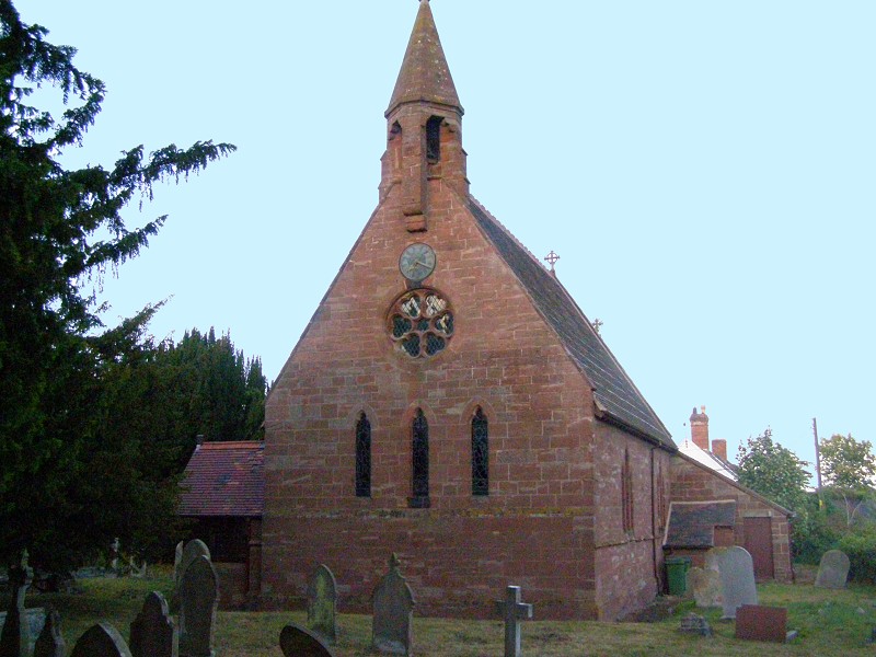
| Memorials | : | 1 |
| Location | : | Waters Upton, Telford and Wrekin Unitary Authority, England |
| Coordinate | : | 52.7713210, -2.5439270 |
| Description | : | The churchyard of St Michael's at Waters Upton is very small, with a correspondingly small number of graves. I visited it on 11 September 2011 to find the grave of my 3x great grandmother and her husband. While there I decided to photograph all the gravestones and other monuments with legible inscriptions so that I could transcribe the inscriptions and upload the information and images to Find A Grave. I managed all but a few of the more recent graves before I ran out of space on my camera's memory card. Of course, I couldn't just take photos, make transcriptions, upload... Read More |
frequently asked questions (FAQ):
-
Where is St Michael Churchyard?
St Michael Churchyard is located at Waters Upton, Telford and Wrekin Unitary Authority ,Shropshire , TF10 8JWEngland.
-
St Michael Churchyard cemetery's updated grave count on graveviews.com?
1 memorials
-
Where are the coordinates of the St Michael Churchyard?
Latitude: 52.7713210
Longitude: -2.5439270
Nearby Cemetories:
1. St. Michael & All Angels Churchyard
High Ercall, Telford and Wrekin Unitary Authority, England
Coordinate: 52.7521000, -2.6026400
2. Tibberton All Saints
Tibberton, Telford and Wrekin Unitary Authority, England
Coordinate: 52.7800660, -2.4741020
3. Saint Catherine Churchyard
Eyton upon the Weald Moors, Telford and Wrekin Unitary Authority, England
Coordinate: 52.7299800, -2.5182200
4. St Michael & All Angels
Childs Ercall, Shropshire Unitary Authority, England
Coordinate: 52.8222524, -2.4975524
5. Rodington Cemetery
Rodington, Telford and Wrekin Unitary Authority, England
Coordinate: 52.7273200, -2.6148100
6. St. Peter's Churchyard
Wrockwardine, Telford and Wrekin Unitary Authority, England
Coordinate: 52.7047350, -2.5569500
7. Hadley Cemetery
Leegomery, Telford and Wrekin Unitary Authority, England
Coordinate: 52.7097110, -2.4893660
8. All Saints Churchyard
Wellington, Telford and Wrekin Unitary Authority, England
Coordinate: 52.7020230, -2.5177440
9. Wellington Cemetery
Wellington, Telford and Wrekin Unitary Authority, England
Coordinate: 52.6958280, -2.5246020
10. St. Peter Church
Edgmond, Telford and Wrekin Unitary Authority, England
Coordinate: 52.7699680, -2.4159730
11. St Oswald's Church Burial Ground
Hinstock, Shropshire Unitary Authority, England
Coordinate: 52.8346100, -2.4577700
12. Talbot Chapel
Longford, Telford and Wrekin Unitary Authority, England
Coordinate: 52.7627400, -2.4081500
13. Holy Trinity Church
Wrockwardine, Telford and Wrekin Unitary Authority, England
Coordinate: 52.7105800, -2.4476600
14. St Luke's Churchyard
Hodnet, Shropshire Unitary Authority, England
Coordinate: 52.8536780, -2.5772160
15. Wombridge Cemetery
Oakengates, Telford and Wrekin Unitary Authority, England
Coordinate: 52.7023940, -2.4579990
16. St Mary's & St Leonard's Church Burial Ground
Wombridge, Telford and Wrekin Unitary Authority, England
Coordinate: 52.7014856, -2.4585662
17. Wrockwardine Wood Methodist Graveyard
Wrockwardine, Telford and Wrekin Unitary Authority, England
Coordinate: 52.7076180, -2.4426530
18. St. Matthew's Churchyard
Donnington Wood, Telford and Wrekin Unitary Authority, England
Coordinate: 52.7148135, -2.4308853
19. Red Lake Garden of rest
Telford, Telford and Wrekin Unitary Authority, England
Coordinate: 52.6928969, -2.4715920
20. St. Mary the Virgin Churchyard
Ketley, Telford and Wrekin Unitary Authority, England
Coordinate: 52.6914797, -2.4701998
21. Saint Michael and All Angels
Chetwynd, Telford and Wrekin Unitary Authority, England
Coordinate: 52.7887300, -2.3935160
22. St Michael and All Angels Churchyard
Lilleshall, Telford and Wrekin Unitary Authority, England
Coordinate: 52.7345610, -2.4032770
23. Chetwynd Churchyard
Newport, Telford and Wrekin Unitary Authority, England
Coordinate: 52.7905280, -2.3916390
24. Holy Trinity Churchyard
Oakengates, Telford and Wrekin Unitary Authority, England
Coordinate: 52.6925070, -2.4562980

