
| Memorials | : | 31 |
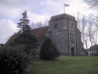
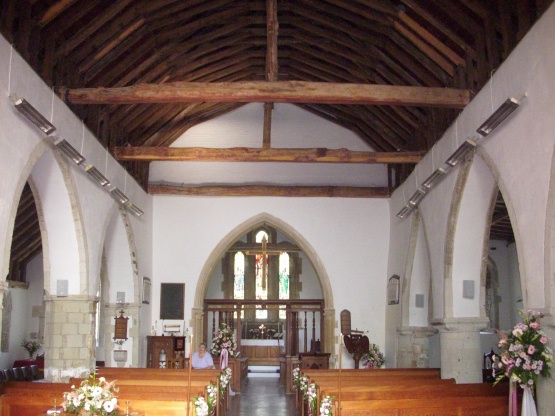
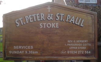
| Location | : | Stoke, Medway Unitary Authority, England |
| Coordinate | : | 51.4452700, 0.6225300 |
frequently asked questions (FAQ):
-
Where is St Peter and St Paul Churchyard?
St Peter and St Paul Churchyard is located at Stoke, Medway Unitary Authority ,Kent ,England.
-
St Peter and St Paul Churchyard cemetery's updated grave count on graveviews.com?
31 memorials
-
Where are the coordinates of the St Peter and St Paul Churchyard?
Latitude: 51.4452700
Longitude: 0.6225300
Nearby Cemetories:
1. Lower Stoke Methodist Chapelyard
Stoke, Medway Unitary Authority, England
Coordinate: 51.4537680, 0.6336680
2. St Mary Churchyard
St Mary Hoo, Medway Unitary Authority, England
Coordinate: 51.4595390, 0.5948850
3. All Saints Churchyard
Allhallows, Medway Unitary Authority, England
Coordinate: 51.4670950, 0.6417880
4. St Margaret Churchyard
High Halstow, Medway Unitary Authority, England
Coordinate: 51.4485130, 0.5598870
5. St. Werburgh Churchyard
Hoo St Werburgh, Medway Unitary Authority, England
Coordinate: 51.4176500, 0.5634340
6. St James Churchyard
Grain, Medway Unitary Authority, England
Coordinate: 51.4585991, 0.7173300
7. St James Churchyard
Cooling, Medway Unitary Authority, England
Coordinate: 51.4552650, 0.5264000
8. Grange Road Cemetery
Gillingham, Medway Unitary Authority, England
Coordinate: 51.3902512, 0.5639850
9. St Mary Magdalene Churchyard
Gillingham, Medway Unitary Authority, England
Coordinate: 51.3903530, 0.5622230
10. St Philip and St James Churchyard
Upnor, Medway Unitary Authority, England
Coordinate: 51.4106250, 0.5250480
11. Woodlands Cemetery
Gillingham, Medway Unitary Authority, England
Coordinate: 51.3839989, 0.5680000
12. St Mary the Virgin Churchyard
Upchurch, Swale Borough, England
Coordinate: 51.3764687, 0.6476030
13. St George Churchyard
Chatham, Medway Unitary Authority, England
Coordinate: 51.3974070, 0.5346770
14. St Margaret of Antioch Churchyard
Lower Halstow, Swale Borough, England
Coordinate: 51.3752975, 0.6711660
15. Brompton War Memorial
Chatham, Medway Unitary Authority, England
Coordinate: 51.3932140, 0.5293660
16. Convent of the Good Shepherd
Canvey Island, Castle Point Borough, England
Coordinate: 51.5214345, 0.5899587
17. St. Barnabas Church
Gillingham, Medway Unitary Authority, England
Coordinate: 51.3801400, 0.5505370
18. Saint Helen Churchyard
Cliffe, Medway Unitary Authority, England
Coordinate: 51.4619600, 0.4975900
19. Canvey Island 1953 Flood Memorial
Canvey Island, Castle Point Borough, England
Coordinate: 51.5231500, 0.5930740
20. Holy Trinity Churchyard
Queenborough, Swale Borough, England
Coordinate: 51.4174080, 0.7443560
21. St Margaret Churchyard
Rainham, Medway Unitary Authority, England
Coordinate: 51.3629990, 0.6085000
22. Chatham Naval Memorial
Chatham, Medway Unitary Authority, England
Coordinate: 51.3836479, 0.5321670
23. St. Katherine Churchyard
Canvey Island, Castle Point Borough, England
Coordinate: 51.5207340, 0.5626850
24. St Mary Churchyard
Chatham, Medway Unitary Authority, England
Coordinate: 51.3874550, 0.5244280