
| Memorials | : | 0 |
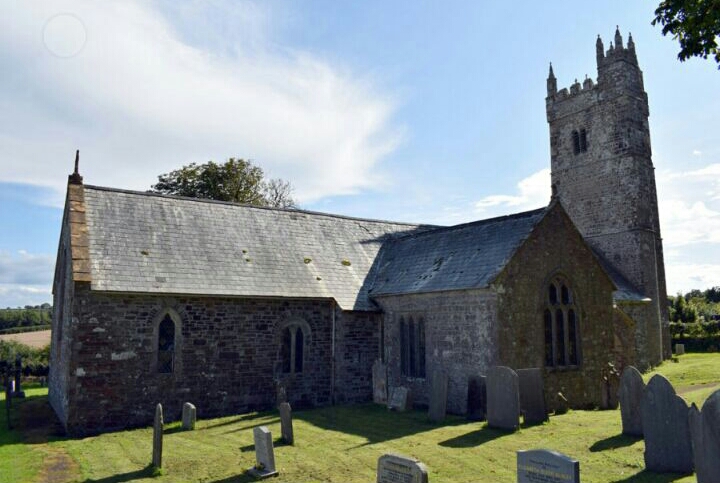
| Location | : | Ashwater, Torridge District, England |
| Coordinate | : | 50.7342290, -4.2873920 |
frequently asked questions (FAQ):
-
Where is St. Peter Churchyard?
St. Peter Churchyard is located at Ashwater, Torridge District ,Devon ,England.
-
St. Peter Churchyard cemetery's updated grave count on graveviews.com?
0 memorials
-
Where are the coordinates of the St. Peter Churchyard?
Latitude: 50.7342290
Longitude: -4.2873920
Nearby Cemetories:
1. Stowford Meadow
Stowford, West Devon Borough, England
Coordinate: 50.7634468, -4.2368540
2. Germansweek
Germansweek, West Devon Borough, England
Coordinate: 50.7260170, -4.2131190
3. St. Giles' Parish Churchyard
St Giles on the Heath, Torridge District, England
Coordinate: 50.6914989, -4.3245055
4. Holy Cross Churchyard
Tetcott, Torridge District, England
Coordinate: 50.7443138, -4.3655843
5. St. Peter & St. James Churchyard
Halwill, Torridge District, England
Coordinate: 50.7731000, -4.2317600
6. Boyton Methodist Chapel
Boyton, Cornwall Unitary Authority, England
Coordinate: 50.7023020, -4.3816220
7. St. Mary the Virgin Churchyard
Bratton Clovelly, West Devon Borough, England
Coordinate: 50.7056360, -4.1773070
8. St Albans Cemetery
Beaworthy, West Devon Borough, England
Coordinate: 50.7734949, -4.1839460
9. Bennacott Chapel
Boyton, Cornwall Unitary Authority, England
Coordinate: 50.7048188, -4.4127882
10. Ss Peter and Paul Churchyard
Holsworthy, Torridge District, England
Coordinate: 50.8107500, -4.3525400
11. St George's Churchyard
Thrushelton, West Devon Borough, England
Coordinate: 50.6674000, -4.1984000
12. Saint Mary's Church Cemetery
Lifton, West Devon Borough, England
Coordinate: 50.6427200, -4.2839200
13. Holsworthy Cemetery
Holsworthy, Torridge District, England
Coordinate: 50.8179000, -4.3473500
14. Providence Methodist Chapel
Beaworthy, West Devon Borough, England
Coordinate: 50.7797801, -4.1607775
15. St. Stephen the Martyr
Launceston, Cornwall Unitary Authority, England
Coordinate: 50.6465400, -4.3702200
16. St Thomas the Apostle Churchyard
Launceston, Cornwall Unitary Authority, England
Coordinate: 50.6411650, -4.3662600
17. Truscott Chapel Cemetery
Launceston, Cornwall Unitary Authority, England
Coordinate: 50.6369820, -4.3600720
18. All Saints Churchyard
Bradford, Torridge District, England
Coordinate: 50.8428590, -4.2440560
19. Woodacott Chapel
Thornbury, Torridge District, England
Coordinate: 50.8470860, -4.2930920
20. Black Torrington Methodist Church
Black Torrington, Torridge District, England
Coordinate: 50.8272639, -4.1792975
21. St Mary's Churchyard
Black Torrington, Torridge District, England
Coordinate: 50.8304800, -4.1812600
22. Holy Cross Church
Highampton, West Devon Borough, England
Coordinate: 50.8214635, -4.1458398
23. St. Pancras Churchyard
Pancrasweek, Torridge District, England
Coordinate: 50.8268500, -4.4201500
24. St. Bridget's Churchyard
Bridestowe, West Devon Borough, England
Coordinate: 50.6854830, -4.1055600