
| Memorials | : | 11 |
| Location | : | Caverswall, Staffordshire Moorlands District, England |
| Coordinate | : | 52.9824410, -2.0733810 |
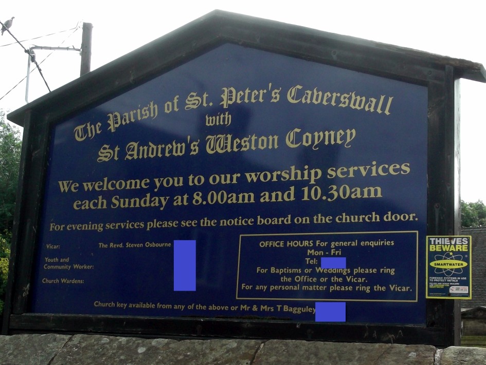
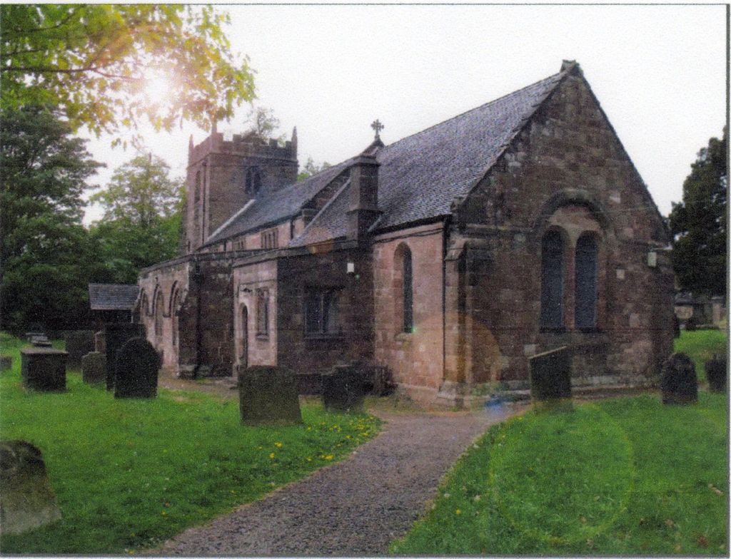
| Description | : | St Peter`s Church was built in the 13th century and it may be the case that the churchyard has been used for burials since that time. Some of the more wealthy and prominent members of the parish have taken the option of interment inside the church. The churchyard is divided into two sections. The lower section is the original part of the churchyard and it is here where the oldest graves are located. At first glance it might appear that there are several areas where there are no graves, in fact some of the older graves are not marked with a... Read More |
frequently asked questions (FAQ):
-
Where is St Peter Churchyard?
St Peter Churchyard is located at Blythe Bridge Road Caverswall, Staffordshire Moorlands District ,Staffordshire , ST11 9EAEngland.
-
St Peter Churchyard cemetery's updated grave count on graveviews.com?
11 memorials
-
Where are the coordinates of the St Peter Churchyard?
Latitude: 52.9824410
Longitude: -2.0733810

Nearby Cemetories:
1. St Peter Churchyard
Forsbrook, Staffordshire Moorlands District, England
Coordinate: 52.9675780, -2.0593040
2. All Saints Churchyard
Dilhorne, Staffordshire Moorlands District, England
Coordinate: 52.9875710, -2.0452820
3. St. James the Less Churchyard
Longton, Stoke-on-Trent Unitary Authority, England
Coordinate: 52.9854360, -2.1291320
4. St. Margaret Churchyard
Draycott, Staffordshire Moorlands District, England
Coordinate: 52.9594640, -2.0297030
5. Resurrection Churchyard
Dresden, Stoke-on-Trent Unitary Authority, England
Coordinate: 52.9781480, -2.1317140
6. Longton Garden of Remembrance
Longton, Stoke-on-Trent Unitary Authority, England
Coordinate: 52.9831560, -2.1359530
7. Longton Cemetery
Longton, Stoke-on-Trent Unitary Authority, England
Coordinate: 52.9833150, -2.1380000
8. St Nicholas Churchyard
Fulford, Stafford Borough, England
Coordinate: 52.9428060, -2.0722970
9. St. Paul's Cemetery
Longton, Stoke-on-Trent Unitary Authority, England
Coordinate: 52.9840874, -2.1408574
10. St. Bartholomews Churchyard
Stoke-on-Trent Unitary Authority, England
Coordinate: 52.9743050, -2.1519670
11. Abbey of St Mary
Abbey Hulton, Stoke-on-Trent Unitary Authority, England
Coordinate: 53.0200000, -2.1300000
12. St Giles ROman Catholic Churchyard
Cheadle, Staffordshire Moorlands District, England
Coordinate: 52.9860280, -1.9889960
13. Fenton Cemetery
Fenton, Stoke-on-Trent Unitary Authority, England
Coordinate: 53.0022180, -2.1545860
14. Christ Church Churchyard
Fenton, Stoke-on-Trent Unitary Authority, England
Coordinate: 52.9977700, -2.1638600
15. All Saints Churchyard
Moddershall, Stafford Borough, England
Coordinate: 52.9296310, -2.1126940
16. St. Mary's Churchyard
Bucknall, Stoke-on-Trent Unitary Authority, England
Coordinate: 53.0240220, -2.1424430
17. St John the Baptist Churchyard
Wetley Rocks, Staffordshire Moorlands District, England
Coordinate: 53.0409100, -2.0555020
18. Britannia Stadium
Stoke-on-Trent, Stoke-on-Trent Unitary Authority, England
Coordinate: 52.9884070, -2.1754520
19. Christ Church Churchyard
Upper Tean, Staffordshire Moorlands District, England
Coordinate: 52.9529687, -1.9831798
20. Barlaston Cemetery
Barlaston, Stafford Borough, England
Coordinate: 52.9433490, -2.1537310
21. St Chad Churchyard
Cheadle, Staffordshire Moorlands District, England
Coordinate: 52.9675320, -1.9729500
22. St. Werburgh Churchyard
Kingsley, Staffordshire Moorlands District, England
Coordinate: 53.0195390, -1.9815730
23. St. Peter ad Vincula Churchyard
Stoke-on-Trent, Stoke-on-Trent Unitary Authority, England
Coordinate: 53.0041250, -2.1812460
24. Sacred Heart Churchyard
Hanley, Stoke-on-Trent Unitary Authority, England
Coordinate: 53.0210590, -2.1737770