
| Memorials | : | 0 |
| Location | : | Dawson, Richardson County, USA |
| Coordinate | : | 40.1464005, -95.8692017 |
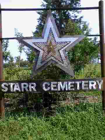
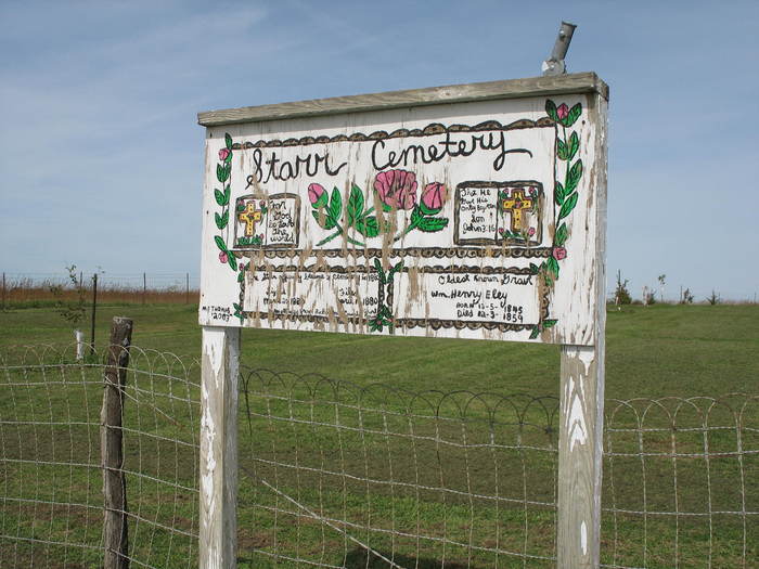
| Description | : | The Starr or Draper Cemetery got its start when Ira D. Draper gave a little more than an acre of land for use as a cemetery when his son, Jasper, died in 1867 at the age of 25. Another son, Lewis, who died in July 1866 at the age of 23 had been buried Iliff Cemetery. His body was then moved to the Starr Cemetery. These young men had been prisoners at Andersonville in Georgia and never regained their health after their return from the Civil War. They share a common headstone. The Cemetery is located 3 miles northwest of... Read More |
frequently asked questions (FAQ):
-
Where is Starr Cemetery?
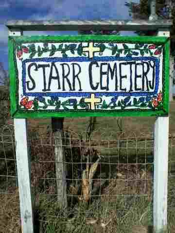
Starr Cemetery is located at Dawson, Richardson County ,Nebraska ,USA.
-
Starr Cemetery cemetery's updated grave count on graveviews.com?
0 memorials
-
Where are the coordinates of the Starr Cemetery?
Latitude: 40.1464005
Longitude: -95.8692017
Nearby Cemetories:
1. Saint Marys Cemetery
Dawson, Richardson County, USA
Coordinate: 40.1307983, -95.8414001
2. Heim Cemetery
Dawson, Richardson County, USA
Coordinate: 40.1380997, -95.8328018
3. Lynchburg Cemetery
Humboldt, Richardson County, USA
Coordinate: 40.1306000, -95.9068985
4. Iliff Cemetery
Dawson, Richardson County, USA
Coordinate: 40.1241989, -95.8127975
5. Mound Cemetery
Humboldt, Richardson County, USA
Coordinate: 40.1960983, -95.8602982
6. Humboldt Cemetery
Humboldt, Richardson County, USA
Coordinate: 40.1610985, -95.9578018
7. Liberty Township Cemetery
Verdon, Richardson County, USA
Coordinate: 40.1597200, -95.7664100
8. Longbranch Cemetery
Humboldt, Richardson County, USA
Coordinate: 40.1996000, -95.9740000
9. Standerford Cemetery
Humboldt, Richardson County, USA
Coordinate: 40.2110000, -95.9656000
10. Bohemian Cemetery
Richardson County, USA
Coordinate: 40.1175003, -95.9955978
11. Liberty-Cornell Cemetery
Verdon, Richardson County, USA
Coordinate: 40.1603000, -95.7375000
12. Pleasant Hill Cemetery
Richardson County, USA
Coordinate: 40.0471992, -95.9075012
13. Four Mile Cemetery
Humboldt, Richardson County, USA
Coordinate: 40.0589000, -95.9455000
14. Dry Branch Pioneer Cemetery
Richardson County, USA
Coordinate: 40.1292000, -96.0100021
15. Stella Cemetery
Stella, Richardson County, USA
Coordinate: 40.2268982, -95.7671967
16. Maple Cemetery
Salem, Richardson County, USA
Coordinate: 40.0792007, -95.7313995
17. Pleasant View Cemetery
Auburn, Nemaha County, USA
Coordinate: 40.2681007, -95.9163971
18. Cupola Cemetery
Verdon, Richardson County, USA
Coordinate: 40.1892014, -95.7086029
19. Wild Rose Cemetery
Richardson County, USA
Coordinate: 40.0161018, -95.8375015
20. Bohemian Cemetery
Table Rock, Pawnee County, USA
Coordinate: 40.1786003, -96.0374985
21. Athens Cemetery
Richardson County, USA
Coordinate: 40.0449982, -95.9852982
22. Verdon Cemetery
Verdon, Richardson County, USA
Coordinate: 40.1450005, -95.6893997
23. Saint Marks Lutheran Cemetery
Verdon, Richardson County, USA
Coordinate: 40.1160100, -95.6864900
24. Prairie Union Cemetery
Shubert, Richardson County, USA
Coordinate: 40.2475800, -95.7150200