
| Memorials | : | 49 |
| Location | : | Humboldt, Richardson County, USA |
| Coordinate | : | 40.1996000, -95.9740000 |
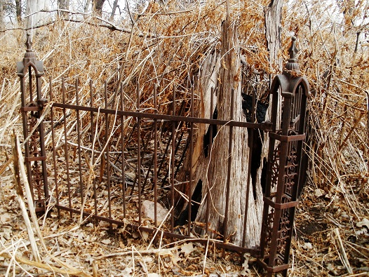
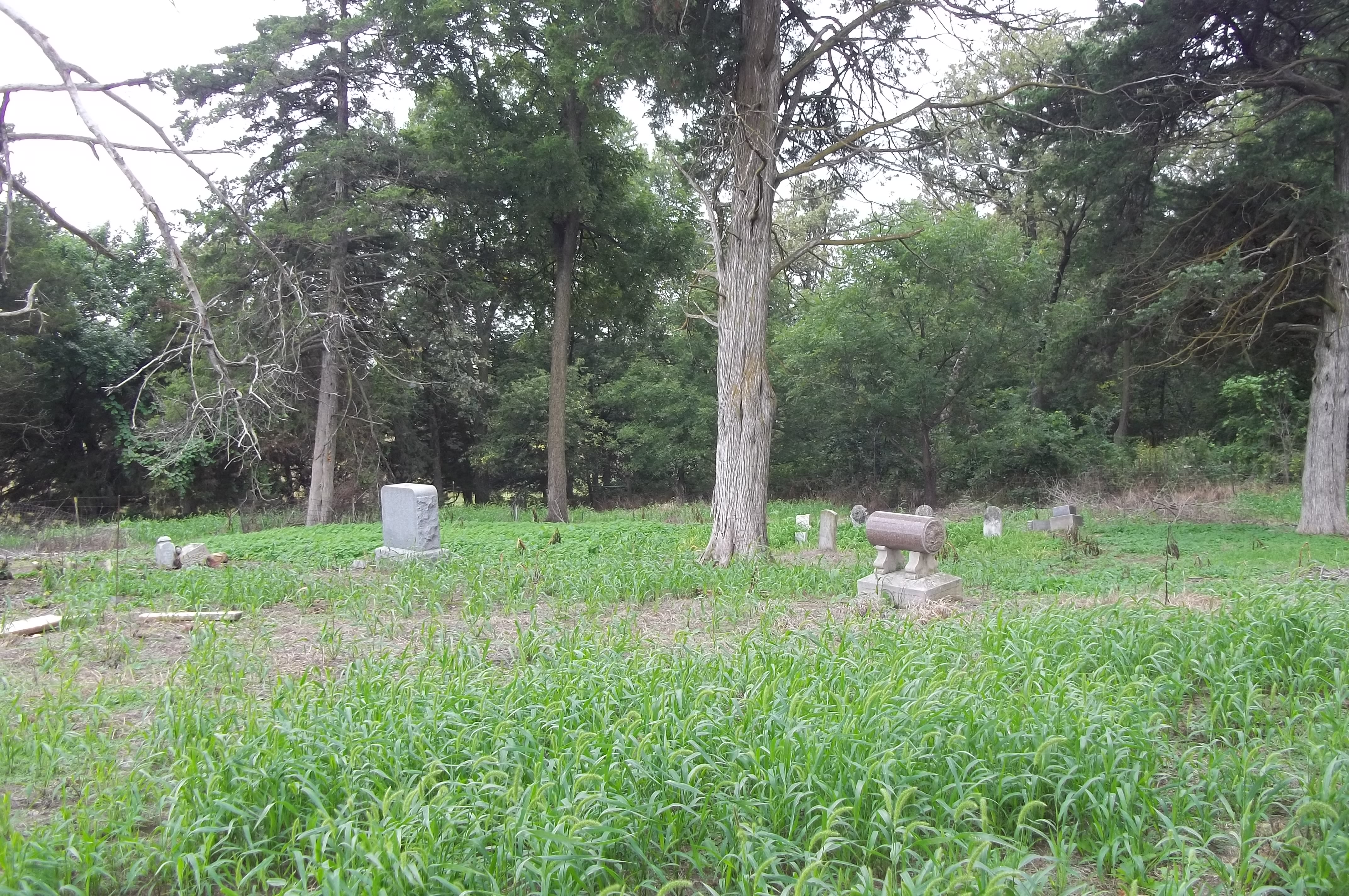
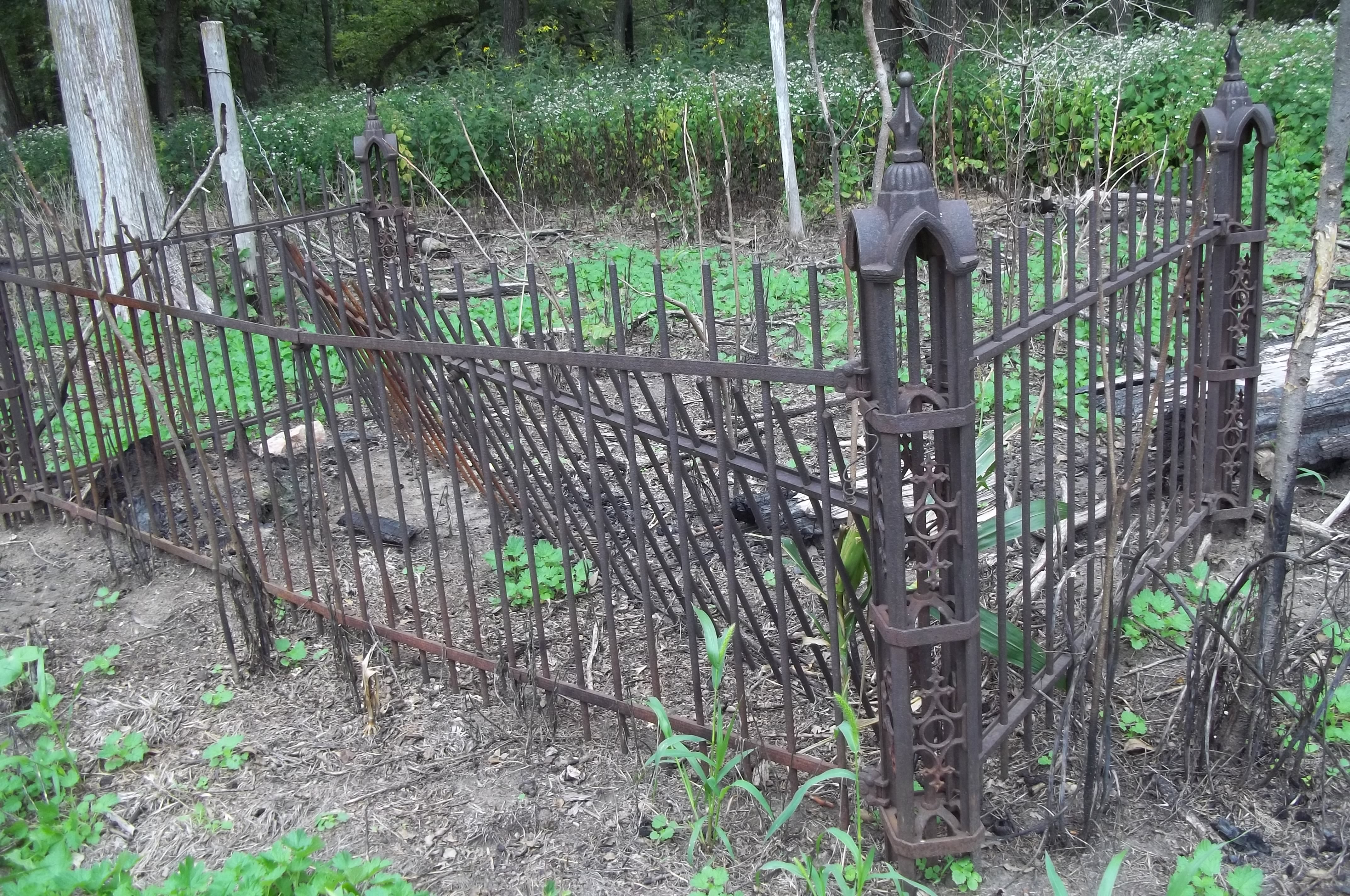
| Description | : | The Longbranch Church, located in Franklin Precinct, section 29, was organized by the SSeventh Day Baptists on July 9, 1863. The first church was built in 1866 and cost $1,000. The last burial was about 1923 and was a Mrs. Olwein, according to the Richardson County History. The building and congregation have passed into history and the cemetery is ill-kept. |
frequently asked questions (FAQ):
-
Where is Longbranch Cemetery?
Longbranch Cemetery is located at Humboldt, Richardson County ,Nebraska ,USA.
-
Longbranch Cemetery cemetery's updated grave count on graveviews.com?
49 memorials
-
Where are the coordinates of the Longbranch Cemetery?
Latitude: 40.1996000
Longitude: -95.9740000
Nearby Cemetories:
1. Standerford Cemetery
Humboldt, Richardson County, USA
Coordinate: 40.2110000, -95.9656000
2. Humboldt Cemetery
Humboldt, Richardson County, USA
Coordinate: 40.1610985, -95.9578018
3. Bohemian Cemetery
Table Rock, Pawnee County, USA
Coordinate: 40.1786003, -96.0374985
4. Saint Johns Cemetery
Table Rock, Pawnee County, USA
Coordinate: 40.2148000, -96.0657000
5. Dry Branch Pioneer Cemetery
Richardson County, USA
Coordinate: 40.1292000, -96.0100021
6. Pleasant View Cemetery
Auburn, Nemaha County, USA
Coordinate: 40.2681007, -95.9163971
7. Mount Zion Cemetery
Nemaha County, USA
Coordinate: 40.2761002, -96.0113983
8. Saint James Lutheran Cemetery
Nemaha County, USA
Coordinate: 40.2757500, -96.0161500
9. Bohemian Cemetery
Richardson County, USA
Coordinate: 40.1175003, -95.9955978
10. Lynchburg Cemetery
Humboldt, Richardson County, USA
Coordinate: 40.1306000, -95.9068985
11. Mound Cemetery
Humboldt, Richardson County, USA
Coordinate: 40.1960983, -95.8602982
12. Starr Cemetery
Dawson, Richardson County, USA
Coordinate: 40.1464005, -95.8692017
13. Table Rock Cemetery
Table Rock, Pawnee County, USA
Coordinate: 40.1791400, -96.1037400
14. East Amish Cemetery
Table Rock, Pawnee County, USA
Coordinate: 40.1310000, -96.0854000
15. Trinity Lutheran Cemetery
Nemaha County, USA
Coordinate: 40.3058014, -96.0093994
16. Saint Marys Cemetery
Dawson, Richardson County, USA
Coordinate: 40.1307983, -95.8414001
17. Heim Cemetery
Dawson, Richardson County, USA
Coordinate: 40.1380997, -95.8328018
18. Clear Creek Cemetery
Table Rock, Pawnee County, USA
Coordinate: 40.2193985, -96.1391983
19. Saint Johns Lutheran Cemetery
Auburn, Nemaha County, USA
Coordinate: 40.3335000, -95.9576000
20. Martin Luther Church Cemetery
Nemaha County, USA
Coordinate: 40.3345040, -96.0098670
21. Four Mile Cemetery
Humboldt, Richardson County, USA
Coordinate: 40.0589000, -95.9455000
22. Beranek Cemetery
Table Rock, Pawnee County, USA
Coordinate: 40.2042007, -96.1607971
23. Howell Cemetery
Nemaha County, USA
Coordinate: 40.3008003, -95.8405991
24. Iliff Cemetery
Dawson, Richardson County, USA
Coordinate: 40.1241989, -95.8127975