
| Memorials | : | 0 |
| Location | : | Øksnes kommune, Norway |
| Website | : | www.vesteraalen.info/oksnes_kirker_krkg_steinlandsfjorden.htm |
| Coordinate | : | 68.8090191, 15.1886369 |
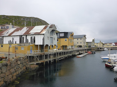
| Description | : | Kirkegården ligger ved Palmåsen, men på østsiden av hovedveien, vel 300 meter fra Steinlandskrysset mot Lifjorden. En stikkvei derfra leder bort til kirkegården. Ifølge protokollen var den første begravelsen 28. desember 1922 (Nanna Hansen fra Steinlandsfjord. Her er det litt usikkerhet om avvikende dødsår). I underkant av 500 personer er gravlagt der. |
frequently asked questions (FAQ):
-
Where is Steinlandsfjorden Kirkegård?
Steinlandsfjorden Kirkegård is located at Øksnes kommune ,Nordland fylke , 8430 MyreNorway.
-
Steinlandsfjorden Kirkegård cemetery's updated grave count on graveviews.com?
0 memorials
-
Where are the coordinates of the Steinlandsfjorden Kirkegård?
Latitude: 68.8090191
Longitude: 15.1886369
Nearby Cemetories:
1. Øksnes Church Cemetery
Breidstrand, Øksnes kommune, Norway
Coordinate: 68.8775071, 14.9716038
2. Myre Cemetery
Myre, Øksnes kommune, Norway
Coordinate: 68.9225400, 15.0947900
3. Selnes
Sortland, Sortland kommune, Norway
Coordinate: 68.7093270, 15.4061230
4. Sortland II Kirke Gravplass
Sortland, Sortland kommune, Norway
Coordinate: 68.7004570, 15.4119250
5. Skjolde
Andøy kommune, Norway
Coordinate: 68.8858256, 15.5001276
6. Sortland I
Sortland, Sortland kommune, Norway
Coordinate: 68.6982860, 15.4144810
7. Klo Kirkegård
Klo, Øksnes kommune, Norway
Coordinate: 68.9751010, 15.1798512
8. Dalsand 2
Sigerfjord, Sortland kommune, Norway
Coordinate: 68.6536880, 15.4920260
9. Dalsand 1
Sortland, Sortland kommune, Norway
Coordinate: 68.6532370, 15.4928830
10. Husjord Gravplass
Øksnes kommune, Norway
Coordinate: 69.0184190, 15.1380521
11. Langenes Church Cemetery
Langenes, Øksnes kommune, Norway
Coordinate: 69.0189000, 15.1559000
12. Ora
Bo i Vesteralen, Bø kommune, Norway
Coordinate: 68.7426940, 14.6006420
13. Skagen Nye
Stokmarknes, Hadsel kommune, Norway
Coordinate: 68.5819300, 15.0285790
14. Skagen gamle Cemetery
Stokmarknes, Hadsel kommune, Norway
Coordinate: 68.5816850, 15.0112670
15. Bjørnskinn Nye Kirkegaard
Bjornskinn, Andøy kommune, Norway
Coordinate: 68.9913670, 15.6408360
16. Hadsel Cemetery
Stokmarknes, Hadsel kommune, Norway
Coordinate: 68.5401200, 14.9895740
17. Duken
Bo i Vesteralen, Bø kommune, Norway
Coordinate: 68.6226250, 14.4371840
18. Ånes
Anes, Andøy kommune, Norway
Coordinate: 69.0606054, 15.7861929
19. Dverberg Church Cemetery
Dverberg, Andøy kommune, Norway
Coordinate: 69.1140238, 15.9815818
20. Sanden Kirkegård
Hadsel kommune, Norway
Coordinate: 68.4336537, 14.6077327
21. Harstad Cemetery
Harstad kommune, Norway
Coordinate: 68.8057550, 16.5113620
22. Trondenes Church
Harstad kommune, Norway
Coordinate: 68.8235890, 16.5619750
23. Strandlandet Kirkegård
Laukvik i Lofoten, Vågan kommune, Norway
Coordinate: 68.3813976, 14.4690575
24. Sørvik Churchyard, Island of Hinnøy
Harstad kommune, Norway
Coordinate: 68.6828290, 16.5295080