| Memorials | : | 0 |
| Location | : | Enger, Kreis Herford, Germany |
| Phone | : | +49 5224 912500 |
| Website | : | www.kg-enger.de |
| Coordinate | : | 52.1394504, 8.5587147 |
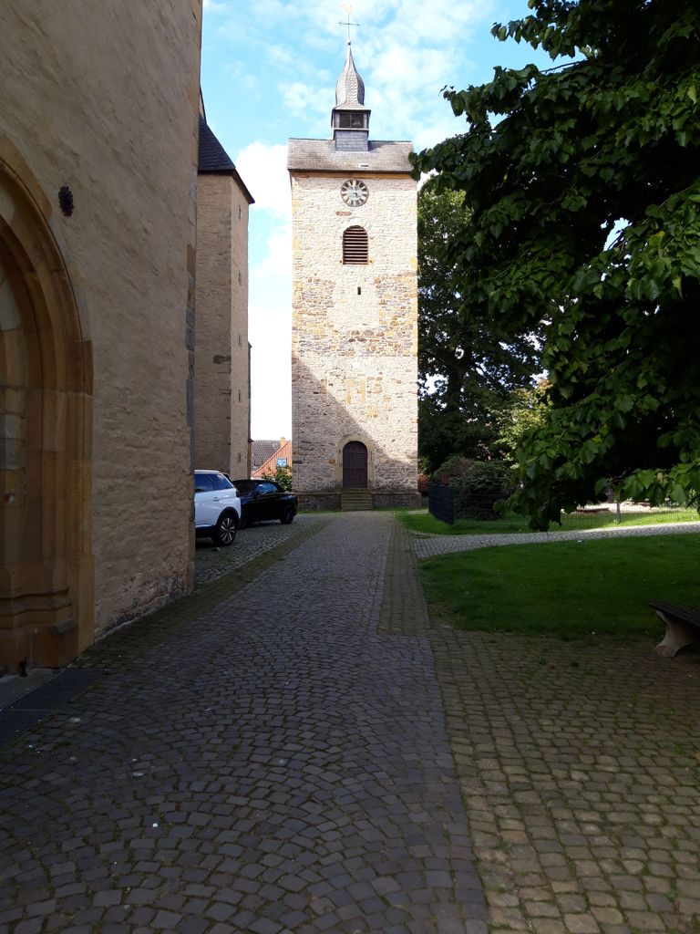
| Description | : | It is the church of Widukind, also known as Wittekind. He was a leader of the Saxons and the main opponent of the Frankish king Charlemagne during the Saxon wars from 777 to 785. It was long assumed that he was buried in the church in Enger. |
frequently asked questions (FAQ):
-
Where is Stiftskirche?
Stiftskirche is located at Kirchplatz 4 Enger, Kreis Herford ,Nordrhein-Westfalen , D-32130Germany.
-
Stiftskirche cemetery's updated grave count on graveviews.com?
0 memorials
-
Where are the coordinates of the Stiftskirche?
Latitude: 52.1394504
Longitude: 8.5587147
Nearby Cemetories:
1. Jüdischer Friedhof Enger
Enger, Kreis Herford, Germany
Coordinate: 52.1491200, 8.5540000
2. Friedhof Herringhausen
Herringhausen, Kreis Herford, Germany
Coordinate: 52.1390021, 8.6089670
3. Friedhof Bustedt
Bünde, Kreis Herford, Germany
Coordinate: 52.1719800, 8.5998300
4. Friedhof Hiddenhausen
Hiddenhausen, Kreis Herford, Germany
Coordinate: 52.1659960, 8.6189470
5. Friedhof Jöllenbeck
Jöllenbeck, Stadtkreis Bielefeld, Germany
Coordinate: 52.0975166, 8.5240429
6. Friedhof Hunnebrock
Bünde, Kreis Herford, Germany
Coordinate: 52.1861500, 8.5741100
7. Feldmarkfriedhof
Bünde, Kreis Herford, Germany
Coordinate: 52.1915100, 8.5971000
8. Friedhof Ahle
Bünde, Kreis Herford, Germany
Coordinate: 52.1955200, 8.5246100
9. Stadt-und Amtsfriedhof
Bünde, Kreis Herford, Germany
Coordinate: 52.1986100, 8.5832000
10. Friedhof Ennigloh I
Bünde, Kreis Herford, Germany
Coordinate: 52.2019800, 8.5638800
11. Friedhof Südlengern
Bünde, Kreis Herford, Germany
Coordinate: 52.1916900, 8.6183800
12. Friedhof Ennigloh II
Bünde, Kreis Herford, Germany
Coordinate: 52.2073900, 8.5508100
13. Friedhof Holsen
Bünde, Kreis Herford, Germany
Coordinate: 52.2055600, 8.5247600
14. Friedhof Hermannstraße
Herford, Kreis Herford, Germany
Coordinate: 52.1104633, 8.6661312
15. Frauenstift Herford
Herford, Kreis Herford, Germany
Coordinate: 52.1156940, 8.6711110
16. Jüdischer Friedhof Herford
Herford, Kreis Herford, Germany
Coordinate: 52.1105000, 8.6680100
17. Friedhof Elverdissen
Elverdissen, Kreis Herford, Germany
Coordinate: 52.0820544, 8.6428304
18. Marienfriedhof
Herford, Kreis Herford, Germany
Coordinate: 52.1191278, 8.6819349
19. Ewiger Frieden
Herford, Kreis Herford, Germany
Coordinate: 52.1364100, 8.6872200
20. Friedhof Spradow
Bünde, Kreis Herford, Germany
Coordinate: 52.2154300, 8.6053400
21. Friedhof an der Marienkirche
Herford, Kreis Herford, Germany
Coordinate: 52.1160000, 8.6871300
22. Friedhof Dünne-Dorf
Bünde, Kreis Herford, Germany
Coordinate: 52.2219400, 8.5886400
23. Friedhof Muckum
Bünde, Kreis Herford, Germany
Coordinate: 52.2235300, 8.5445800
24. Friedhof Habighorst
Bünde, Kreis Herford, Germany
Coordinate: 52.2276000, 8.5625100


