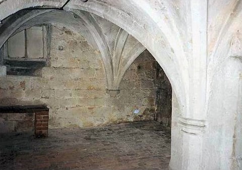
| Memorials | : | 0 |
| Location | : | Stone, Stafford Borough, England |
| Coordinate | : | 52.9013610, -2.1441120 |
| Description | : | An unknown church dedicated to St Wulfad was the site of the Austin Priory of Stone, and its origins are shrouded in legend: Wulfad and his brother Rufin were killed by their father King Wulfhere of Mercia after converting to Christianity against his wishes. Filled with remorse he allowed their mother, Queen Ermenilda, to build the priory on the site of their sons' grave. The Domesday Book has a record of a gift of a carucate (approx 120 acres) of land in what was Walton, and now Stone, made by Achil, a freeman, to his sister. ... Read More |
frequently asked questions (FAQ):
-
Where is Stone Priory?
Stone Priory is located at Lichfield Street Stone, Stafford Borough ,Staffordshire ,England.
-
Stone Priory cemetery's updated grave count on graveviews.com?
0 memorials
-
Where are the coordinates of the Stone Priory?
Latitude: 52.9013610
Longitude: -2.1441120
Nearby Cemetories:
1. St. Michael and St. Wulfad Churchyard
Stone, Stafford Borough, England
Coordinate: 52.9016030, -2.1433420
2. Christ Church Churchyard
Stone, Stafford Borough, England
Coordinate: 52.9042670, -2.1477510
3. St Dominic's Convent Churchyard
Stone, Stafford Borough, England
Coordinate: 52.9106500, -2.1407000
4. Stone Cemetery
Stone, Stafford Borough, England
Coordinate: 52.8874860, -2.1369430
5. St John the Evangelist
Oulton, Stafford Borough, England
Coordinate: 52.9159400, -2.1330400
6. St Saviour Churchyard
Aston-by-Stone, Stafford Borough, England
Coordinate: 52.8841410, -2.1283140
7. All Saints Churchyard
Moddershall, Stafford Borough, England
Coordinate: 52.9296310, -2.1126940
8. Christ Church Churchyard
Hilderstone, Stafford Borough, England
Coordinate: 52.9100990, -2.0755470
9. Barlaston Cemetery
Barlaston, Stafford Borough, England
Coordinate: 52.9433490, -2.1537310
10. St Luke Churchyard
Tittensor, Stafford Borough, England
Coordinate: 52.9407830, -2.1889820
11. All Saints Churchyard
Sandon, Stafford Borough, England
Coordinate: 52.8628160, -2.0696270
12. St Nicholas Churchyard
Fulford, Stafford Borough, England
Coordinate: 52.9428060, -2.0722970
13. All Saints Churchyard
Chebsey, Stafford Borough, England
Coordinate: 52.8546150, -2.2098560
14. All Saints Churchyard
Milwich, Stafford Borough, England
Coordinate: 52.8852590, -2.0443610
15. St James the Great Church
Salt, Stafford Borough, England
Coordinate: 52.8483296, -2.0701182
16. St. Chad's Church, Slindon, Staffordshire
Stafford Borough, England
Coordinate: 52.8870960, -2.2579986
17. Trentham Cemetery
Trentham, Stoke-on-Trent Unitary Authority, England
Coordinate: 52.9665640, -2.1980300
18. St. Bartholomews Churchyard
Stoke-on-Trent Unitary Authority, England
Coordinate: 52.9743050, -2.1519670
19. All Saints Churchyard
Standon, Stafford Borough, England
Coordinate: 52.9119000, -2.2699000
20. Resurrection Churchyard
Dresden, Stoke-on-Trent Unitary Authority, England
Coordinate: 52.9781480, -2.1317140
21. Holy Trinity Churchyard
Eccleshall, Stafford Borough, England
Coordinate: 52.8596600, -2.2575600
22. Longton Garden of Remembrance
Longton, Stoke-on-Trent Unitary Authority, England
Coordinate: 52.9831560, -2.1359530
23. Longton Cemetery
Longton, Stoke-on-Trent Unitary Authority, England
Coordinate: 52.9833150, -2.1380000
24. St Peter's Church
Gayton, Stafford Borough, England
Coordinate: 52.8540363, -2.0327095

