
| Memorials | : | 0 |
| Location | : | Stafford Borough, England |
| Coordinate | : | 52.8870960, -2.2579986 |
frequently asked questions (FAQ):
-
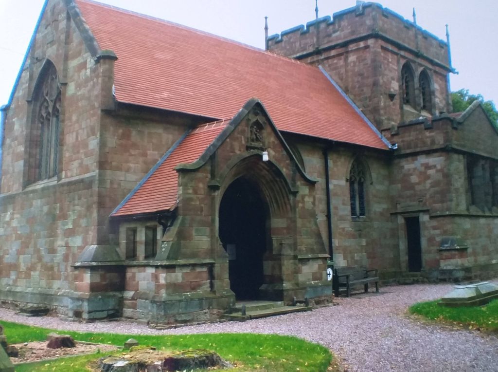
Where is St. Chad's Church, Slindon, Staffordshire?
St. Chad's Church, Slindon, Staffordshire is located at Stafford Borough ,Staffordshire ,England.
-
St. Chad's Church, Slindon, Staffordshire cemetery's updated grave count on graveviews.com?
0 memorials
-
Where are the coordinates of the St. Chad's Church, Slindon, Staffordshire?
Latitude: 52.8870960
Longitude: -2.2579986
Nearby Cemetories:
1. All Saints Churchyard
Standon, Stafford Borough, England
Coordinate: 52.9119000, -2.2699000
2. Holy Trinity Churchyard
Eccleshall, Stafford Borough, England
Coordinate: 52.8596600, -2.2575600
3. All Saints Churchyard
Chebsey, Stafford Borough, England
Coordinate: 52.8546150, -2.2098560
4. St Mary Churchyard
Ellenhall, Stafford Borough, England
Coordinate: 52.8360140, -2.2372270
5. St Peter Churchyard
Broughton, Stafford Borough, England
Coordinate: 52.9003430, -2.3491340
6. St Peter Churchyard
Maer, Newcastle-Under-Lyme Borough, England
Coordinate: 52.9419660, -2.3099140
7. St Luke Churchyard
Tittensor, Stafford Borough, England
Coordinate: 52.9407830, -2.1889820
8. Christ Church Churchyard
Stone, Stafford Borough, England
Coordinate: 52.9042670, -2.1477510
9. St John the Baptist Churchyard
Ashley, Newcastle-Under-Lyme Borough, England
Coordinate: 52.9247740, -2.3541570
10. St Michael and All Angels Churchyard
Adbaston, Stafford Borough, England
Coordinate: 52.8482630, -2.3545010
11. Stone Priory
Stone, Stafford Borough, England
Coordinate: 52.9013610, -2.1441120
12. St. Michael and St. Wulfad Churchyard
Stone, Stafford Borough, England
Coordinate: 52.9016030, -2.1433420
13. Ronton Priory
Ellenhall, Stafford Borough, England
Coordinate: 52.8157600, -2.2414900
14. Stone Cemetery
Stone, Stafford Borough, England
Coordinate: 52.8874860, -2.1369430
15. St Dominic's Convent Churchyard
Stone, Stafford Borough, England
Coordinate: 52.9106500, -2.1407000
16. Ranton All Saints
Ranton, Stafford Borough, England
Coordinate: 52.8151300, -2.2156400
17. St Saviour Churchyard
Aston-by-Stone, Stafford Borough, England
Coordinate: 52.8841410, -2.1283140
18. St John the Evangelist
Oulton, Stafford Borough, England
Coordinate: 52.9159400, -2.1330400
19. St Mary and All Saints Churchyard
Whitmore, Newcastle-Under-Lyme Borough, England
Coordinate: 52.9663190, -2.2838270
20. Barlaston Cemetery
Barlaston, Stafford Borough, England
Coordinate: 52.9433490, -2.1537310
21. Church of St Peter
Norbury, Stafford Borough, England
Coordinate: 52.8084000, -2.3184000
22. Trentham Cemetery
Trentham, Stoke-on-Trent Unitary Authority, England
Coordinate: 52.9665640, -2.1980300
23. All Saints Churchyard
Moddershall, Stafford Borough, England
Coordinate: 52.9296310, -2.1126940
24. St. Swithun's Churchyard
Cheswardine, Shropshire Unitary Authority, England
Coordinate: 52.8660400, -2.4187700