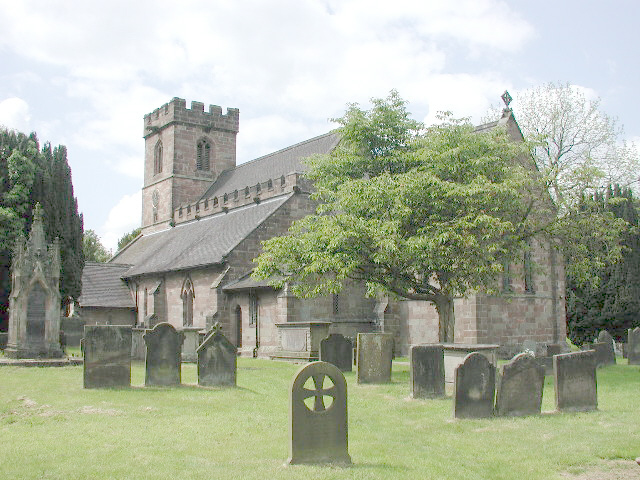
| Memorials | : | 4 |
| Location | : | Standon, Stafford Borough, England |
| Coordinate | : | 52.9119000, -2.2699000 |
| Description | : | The village of Standon is a traditional dairy farming community between Newcastle Under Lyme to the north and Stafford on the South. The Church building dates from 1086 and is mentioned in the Domesday Book. The Church records date from 1558. |
frequently asked questions (FAQ):
-
Where is All Saints Churchyard?
All Saints Churchyard is located at Standon, Stafford Borough ,Staffordshire , ST21 6RNEngland.
-
All Saints Churchyard cemetery's updated grave count on graveviews.com?
4 memorials
-
Where are the coordinates of the All Saints Churchyard?
Latitude: 52.9119000
Longitude: -2.2699000
Nearby Cemetories:
1. St. Chad's Church, Slindon, Staffordshire
Stafford Borough, England
Coordinate: 52.8870960, -2.2579986
2. St Peter Churchyard
Maer, Newcastle-Under-Lyme Borough, England
Coordinate: 52.9419660, -2.3099140
3. St Peter Churchyard
Broughton, Stafford Borough, England
Coordinate: 52.9003430, -2.3491340
4. St John the Baptist Churchyard
Ashley, Newcastle-Under-Lyme Borough, England
Coordinate: 52.9247740, -2.3541570
5. Holy Trinity Churchyard
Eccleshall, Stafford Borough, England
Coordinate: 52.8596600, -2.2575600
6. St Mary and All Saints Churchyard
Whitmore, Newcastle-Under-Lyme Borough, England
Coordinate: 52.9663190, -2.2838270
7. St Luke Churchyard
Tittensor, Stafford Borough, England
Coordinate: 52.9407830, -2.1889820
8. All Saints Churchyard
Chebsey, Stafford Borough, England
Coordinate: 52.8546150, -2.2098560
9. Trentham Cemetery
Trentham, Stoke-on-Trent Unitary Authority, England
Coordinate: 52.9665640, -2.1980300
10. Christ Church Churchyard
Stone, Stafford Borough, England
Coordinate: 52.9042670, -2.1477510
11. Stone Priory
Stone, Stafford Borough, England
Coordinate: 52.9013610, -2.1441120
12. Barlaston Cemetery
Barlaston, Stafford Borough, England
Coordinate: 52.9433490, -2.1537310
13. St. Michael and St. Wulfad Churchyard
Stone, Stafford Borough, England
Coordinate: 52.9016030, -2.1433420
14. St Dominic's Convent Churchyard
Stone, Stafford Borough, England
Coordinate: 52.9106500, -2.1407000
15. St Mary Churchyard
Ellenhall, Stafford Borough, England
Coordinate: 52.8360140, -2.2372270
16. St Michael and All Angels Churchyard
Adbaston, Stafford Borough, England
Coordinate: 52.8482630, -2.3545010
17. St. Matthias Churchyard
Hanford, Stoke-on-Trent Unitary Authority, England
Coordinate: 52.9812170, -2.1962980
18. St John the Evangelist
Oulton, Stafford Borough, England
Coordinate: 52.9159400, -2.1330400
19. Stone Cemetery
Stone, Stafford Borough, England
Coordinate: 52.8874860, -2.1369430
20. Madeley Cemetery
Madeley, Newcastle-Under-Lyme Borough, England
Coordinate: 52.9878150, -2.3395660
21. Saint Mary Church
Mucklestone, Newcastle-Under-Lyme Borough, England
Coordinate: 52.9328620, -2.4098060
22. St Saviour Churchyard
Aston-by-Stone, Stafford Borough, England
Coordinate: 52.8841410, -2.1283140
23. St John the Baptist Churchyard
Keele, Newcastle-Under-Lyme Borough, England
Coordinate: 53.0039410, -2.2848720
24. All Saints Churchyard
Madeley, Newcastle-Under-Lyme Borough, England
Coordinate: 52.9962463, -2.3400240

