
| Memorials | : | 0 |
| Location | : | Sunderland, Metropolitan Borough of Sunderland, England |
| Website | : | www.sunderland.gov.uk/ |
| Coordinate | : | 54.8970430, -1.4216890 |
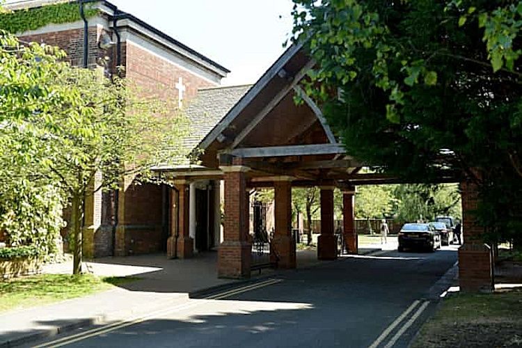
| Description | : | The crematorium is adjacent to Bishopwearmouth Cemetery. Not to be confused with Sunderland Cemetery (Ryhope Road). Opened 26 November 1951, the crematorium and cremation records are maintained by Sunderland City Council |
frequently asked questions (FAQ):
-
Where is Sunderland Crematorium?
Sunderland Crematorium is located at Chester Road Sunderland, Metropolitan Borough of Sunderland ,Tyne and Wear , SR4 5SUEngland.
-
Sunderland Crematorium cemetery's updated grave count on graveviews.com?
0 memorials
-
Where are the coordinates of the Sunderland Crematorium?
Latitude: 54.8970430
Longitude: -1.4216890
Nearby Cemetories:
1. Bishopwearmouth Cemetery
Bishopwearmouth, Metropolitan Borough of Sunderland, England
Coordinate: 54.8996124, -1.4206740
2. St Mary's Church
South Hylton, Metropolitan Borough of Sunderland, England
Coordinate: 54.9064500, -1.4505300
3. Jewish Burial Ground
Ayre's Quay, Metropolitan Borough of Sunderland, England
Coordinate: 54.9115200, -1.3960100
4. Galley's Gill Cemetery
Sunderland, Metropolitan Borough of Sunderland, England
Coordinate: 54.9082914, -1.3913108
5. St Michael's Minster Church
Sunderland, Metropolitan Borough of Sunderland, England
Coordinate: 54.9059555, -1.3887787
6. Castletown Cemetery
Castletown, Metropolitan Borough of Sunderland, England
Coordinate: 54.9167340, -1.4467910
7. Holy Trinity Churchyard
Southwick, Metropolitan Borough of Sunderland, England
Coordinate: 54.9203120, -1.4060260
8. St. Thomas' Church
Sunderland, Metropolitan Borough of Sunderland, England
Coordinate: 54.9066294, -1.3804475
9. Sunderland Friends Burial Ground
Sunderland, Metropolitan Borough of Sunderland, England
Coordinate: 54.9059650, -1.3768230
10. St Leonard RC
Silksworth, Metropolitan Borough of Sunderland, England
Coordinate: 54.8736400, -1.3971900
11. St Matthew's Churchyard
Silksworth, Metropolitan Borough of Sunderland, England
Coordinate: 54.8707006, -1.4090075
12. St Katherine's Chapel
Sunderland, Metropolitan Borough of Sunderland, England
Coordinate: 54.9228508, -1.4422613
13. Southwick Cemetery
Southwick, Metropolitan Borough of Sunderland, England
Coordinate: 54.9269940, -1.4165070
14. Holy Trinity Church Burial
Sunderland, Metropolitan Borough of Sunderland, England
Coordinate: 54.9077830, -1.3688030
15. St Cuthbert's Churchyard
New Herrington, Metropolitan Borough of Sunderland, England
Coordinate: 54.8708720, -1.4579010
16. Sunderland Cemetery
Sunderland, Metropolitan Borough of Sunderland, England
Coordinate: 54.8833700, -1.3660100
17. St Aidan Churchyard
New Herrington, Metropolitan Borough of Sunderland, England
Coordinate: 54.8693700, -1.4680430
18. Ryhope Cemetery
Ryhope, Metropolitan Borough of Sunderland, England
Coordinate: 54.8681320, -1.3708760
19. All Saints Churchyard
Penshaw, Metropolitan Borough of Sunderland, England
Coordinate: 54.8788450, -1.4883190
20. St Peters Parish Churchyard
Monkwearmouth, Metropolitan Borough of Sunderland, England
Coordinate: 54.9341667, -1.3813889
21. Mere Knolls Cemetery
Sunderland, Metropolitan Borough of Sunderland, England
Coordinate: 54.9342990, -1.3738590
22. Boldon Cemetery
West Boldon, Metropolitan Borough of South Tyneside, England
Coordinate: 54.9422300, -1.4491100
23. St. Matthews Churchyard
Newbottle, Metropolitan Borough of Sunderland, England
Coordinate: 54.8575650, -1.4719100
24. Boldon Friends Burial Ground
Boldon, Metropolitan Borough of South Tyneside, England
Coordinate: 54.9424130, -1.4549390