
| Memorials | : | 0 |
| Location | : | Roanoke, Lewis County, USA |
| Coordinate | : | 38.9428950, -80.5282380 |
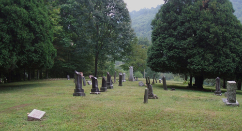
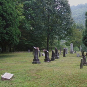
| Description | : | From Interstate I-79 Take exit 91. Go 1.8 miles South on US Route 19 to the "Right Fork Road" on the right , the cemetery is 9 tenths of a mile on this road, up on a hill. Cemetery is in very good condition. |
frequently asked questions (FAQ):
-
Where is Swecker Cemetery?
Swecker Cemetery is located at Roanoke, Lewis County ,West Virginia ,USA.
-
Swecker Cemetery cemetery's updated grave count on graveviews.com?
0 memorials
-
Where are the coordinates of the Swecker Cemetery?
Latitude: 38.9428950
Longitude: -80.5282380
Nearby Cemetories:
1. Oak Grove Cemetery
Lewis County, USA
Coordinate: 38.9641390, -80.5326100
2. Saint Bridget's Church Cemetery
Weston, Lewis County, USA
Coordinate: 38.9319400, -80.5572970
3. Briar Point Cemetery
Walkersville, Lewis County, USA
Coordinate: 38.9438170, -80.4905950
4. Paul T Mitchell Cemetery
Roanoke, Lewis County, USA
Coordinate: 38.9437210, -80.4905340
5. Bailey Cemetery
Weston, Lewis County, USA
Coordinate: 38.9759270, -80.5286020
6. Fairview Cemetery
Roanoke, Lewis County, USA
Coordinate: 38.9306000, -80.4847000
7. Whitesell Cemetery
Lewis County, USA
Coordinate: 38.9307760, -80.4844406
8. Rockford-Pletcher Cemetery (Defunct)
Lewis County, USA
Coordinate: 38.9817009, -80.4963989
9. William L. Smith Cemetery
Roanoke, Lewis County, USA
Coordinate: 38.9228820, -80.4715130
10. Peterson Village Cemetery
Peterson, Lewis County, USA
Coordinate: 38.8938270, -80.5400510
11. Finster Chapel Cemetery
Peterson, Lewis County, USA
Coordinate: 38.9300003, -80.5999985
12. Ward Cemetery
Lewis County, USA
Coordinate: 38.9975860, -80.5051990
13. Jacksonville Cemetery
Weston, Lewis County, USA
Coordinate: 38.8919890, -80.4935740
14. Montgomery Cemetery
Bealls Mills, Lewis County, USA
Coordinate: 38.9648890, -80.6035400
15. Queen Family Cemetery
Copley, Lewis County, USA
Coordinate: 38.9499000, -80.6130000
16. Saint Bernard Church Cemetery
Weston, Lewis County, USA
Coordinate: 38.9928000, -80.5926940
17. Dennison Family Cemetery
Walkersville, Lewis County, USA
Coordinate: 38.8932350, -80.4616670
18. Harrison Grove Cemetery
Lewis County, USA
Coordinate: 39.0107994, -80.5586014
19. Middle Run Cemetery
Weston, Lewis County, USA
Coordinate: 39.0149994, -80.5081024
20. Pumphrey Cemetery
Orlando, Lewis County, USA
Coordinate: 38.9275880, -80.6216500
21. Rittenhouse Cemetery
Walkersville, Lewis County, USA
Coordinate: 38.8812700, -80.4730520
22. Heater Cemetery
Burnsville, Braxton County, USA
Coordinate: 38.9024560, -80.6100370
23. Simons Cemetery
Walkersville, Lewis County, USA
Coordinate: 38.8806490, -80.4731390
24. Hannah Temple Cemetery
Walkersville, Lewis County, USA
Coordinate: 38.8800610, -80.4736130