
| Memorials | : | 0 |
| Location | : | Tucson, Pima County, USA |
| Coordinate | : | 32.2408218, -110.6870422 |
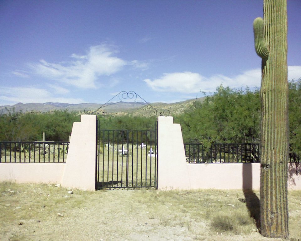
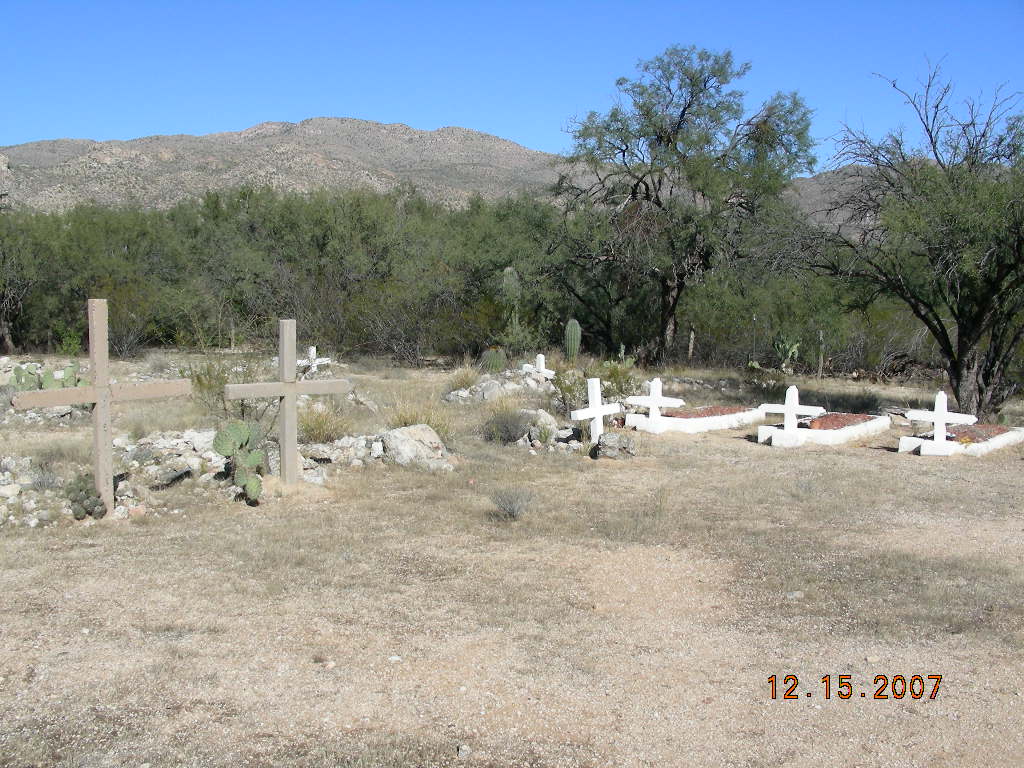
| Description | : | To get to this cemetery, go to the east end of Speedway and follow the road around into The Tanque Verde Guest Ranch. The cemetery is on the left of the road before it curves east to the parking lot. There are 35 identifiable graves. Only 9 of those graves have readable markers. Death certificates may simply name the burial location as "Tanque Verde." Using only death certificates is therefore problematic when attempting to identify the unmarked graves. It is unclear if a person is buried in the nearby "Tanque Verde Cemetery" or this ranch cemetery. Appears on at least one death... Read More |
frequently asked questions (FAQ):
-
Where is Tanque Verde Ranch Cemetery?
Tanque Verde Ranch Cemetery is located at Tucson, Pima County ,Arizona ,USA.
-
Tanque Verde Ranch Cemetery cemetery's updated grave count on graveviews.com?
0 memorials
-
Where are the coordinates of the Tanque Verde Ranch Cemetery?
Latitude: 32.2408218
Longitude: -110.6870422
Nearby Cemetories:
1. Tanque Verde Cemetery
Tanque Verde, Pima County, USA
Coordinate: 32.2391777, -110.7361984
2. All Faiths Memorial Park
Tucson, Pima County, USA
Coordinate: 32.1958008, -110.7596970
3. Immanuel Presbyterian Church Memorial Garden
Tucson, Pima County, USA
Coordinate: 32.2055930, -110.7948940
4. Saint Matthew Episcopal Church Memorial Garden
Tucson, Pima County, USA
Coordinate: 32.2111600, -110.7998000
5. New Spirit Lutheran Church Columbarium
Tucson, Pima County, USA
Coordinate: 32.2167690, -110.8054810
6. Tanque Verde Lutheran Church Columbarium
Tucson, Pima County, USA
Coordinate: 32.2603140, -110.8068040
7. Saguaro Christian Church Memorial Garden
Tucson, Pima County, USA
Coordinate: 32.2202400, -110.8148300
8. Saint Pauls Memorial Garden
Tucson, Pima County, USA
Coordinate: 32.2218020, -110.8207650
9. Rincon Cemetery
Tucson, Pima County, USA
Coordinate: 32.1216660, -110.7129974
10. Saint Albans Episcopal Church Columbarium
Tucson, Pima County, USA
Coordinate: 32.2754600, -110.8381400
11. Fountain of Life Lutheran Church Columbarium
Tucson, Pima County, USA
Coordinate: 32.2122730, -110.8418410
12. Christ Presbyterian Church Memorial Garden
Tucson, Pima County, USA
Coordinate: 32.2214500, -110.8529200
13. Saint Michael and All Angels Episc. Church Garden
Tucson, Pima County, USA
Coordinate: 32.2293400, -110.8569500
14. East Lawn Palms Cemetery and Mortuary
Tucson, Pima County, USA
Coordinate: 32.2543983, -110.8668976
15. Pet Cemetery of Tucson
Tucson, Pima County, USA
Coordinate: 32.2549900, -110.8705500
16. Rincon Congregational Church Columbarium
Tucson, Pima County, USA
Coordinate: 32.2241880, -110.8749300
17. Christ Church United Methodist Memorial Garden
Tucson, Pima County, USA
Coordinate: 32.2304100, -110.8757900
18. Leon Cemetery
Vail, Pima County, USA
Coordinate: 32.0811200, -110.7142310
19. Firemans Cemetery
Tucson, Pima County, USA
Coordinate: 32.1436410, -110.8506770
20. Lutheran Church of the Foothills Memorial Garden
Tucson, Pima County, USA
Coordinate: 32.2993800, -110.8748650
21. Fort Lowell Cemetery
Tucson, Pima County, USA
Coordinate: 32.2616000, -110.8961000
22. Via Rancho Del Lago Roadside Graves
Vail, Pima County, USA
Coordinate: 32.0575470, -110.7024970
23. Saint Marks Presbyterian Church Cemetery
Tucson, Pima County, USA
Coordinate: 32.2330170, -110.9119560
24. Degrazia Gallery in the Sun Family Burial Site
Tucson, Pima County, USA
Coordinate: 32.3208000, -110.8931000