| Memorials | : | 0 |
| Location | : | Ozark County, USA |
| Coordinate | : | 36.6057170, -92.6351000 |
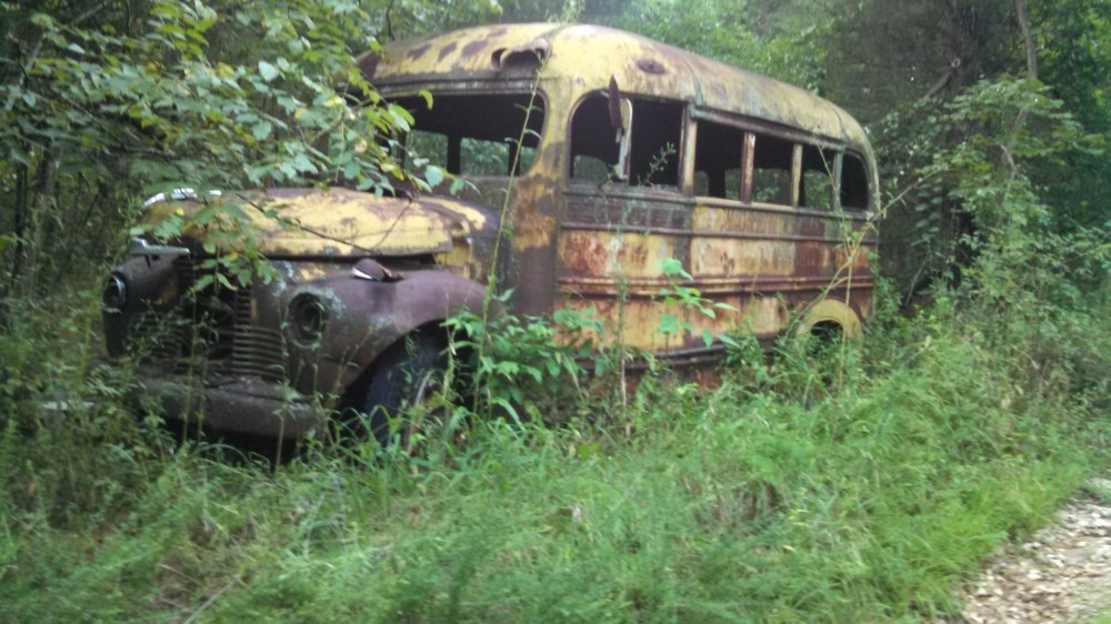
| Description | : | Hutchison Cemetery, T22, R 15, S8 Route D, left on 871 past Shilo Church, left at fence corner to old bus body, four-wheel vehicle needed This burial ground is referred to in the Turnbo Manuscript Vol. III as the Tempy Hutchison graveyard. It is located on Corps of Engineer property and is in a state of disarray and overgrown. There are about five more unmarked graves. This is a very accurate description except that the left at the fence corner is about 0.4 miles from Shiloh Church. The trail getting to the bus body, (something in the 1930s) is... Read More |
frequently asked questions (FAQ):
-
Where is Tempy Hutchison Cemetery?
Tempy Hutchison Cemetery is located at Ozark County ,Missouri ,USA.
-
Tempy Hutchison Cemetery cemetery's updated grave count on graveviews.com?
0 memorials
-
Where are the coordinates of the Tempy Hutchison Cemetery?
Latitude: 36.6057170
Longitude: -92.6351000
Nearby Cemetories:
1. Friend Cemetery
Isabella, Ozark County, USA
Coordinate: 36.5964700, -92.6160600
2. Baker Cemetery
Thornfield, Ozark County, USA
Coordinate: 36.6250000, -92.6205978
3. Isabella Cemetery
Isabella, Ozark County, USA
Coordinate: 36.5831600, -92.6119100
4. Absher Cemetery
Thornfield, Ozark County, USA
Coordinate: 36.6386600, -92.6448300
5. Lutie Cemetery
Theodosia, Ozark County, USA
Coordinate: 36.5828018, -92.6707993
6. Wolf Cemetery
Sundown, Ozark County, USA
Coordinate: 36.5639000, -92.6222000
7. Riggs Cemetery
Ozark County, USA
Coordinate: 36.6531600, -92.6288300
8. Hicks Cemetery
Theodosia, Ozark County, USA
Coordinate: 36.6133003, -92.6996994
9. Wallace Cemetery
Ozark County, USA
Coordinate: 36.6432991, -92.6832962
10. Gaulding Cemetery
Ozark County, USA
Coordinate: 36.6506004, -92.5639038
11. Griffith Cemetery
Longrun, Ozark County, USA
Coordinate: 36.6669006, -92.6917038
12. Longrun Cemetery
Longrun, Ozark County, USA
Coordinate: 36.6498800, -92.7235600
13. Turnbo Cemetery
Pontiac, Ozark County, USA
Coordinate: 36.5212030, -92.6120150
14. Pontiac Cemetery
Pontiac, Ozark County, USA
Coordinate: 36.5205100, -92.6075100
15. Smith Graham Cemetery
Longrun, Ozark County, USA
Coordinate: 36.6456300, -92.7343900
16. Graham and Smith Cemetery
Lutie, Ozark County, USA
Coordinate: 36.6458015, -92.7343979
17. Welch Cemetery
Ozark County, USA
Coordinate: 36.6741982, -92.7074966
18. Piland Cemetery
Thornfield, Ozark County, USA
Coordinate: 36.7086101, -92.6591705
19. Reynolds-Upton Cemetery
Ozark County, USA
Coordinate: 36.5778008, -92.5092010
20. Thornfield House of Prayer Cemetery
Thornfield, Ozark County, USA
Coordinate: 36.7089950, -92.6595450
21. Thornfield Cemetery
Thornfield, Ozark County, USA
Coordinate: 36.7093400, -92.6574600
22. Hart Cemetery
Dugginsville, Ozark County, USA
Coordinate: 36.5097008, -92.7003021
23. Igo-Sallee Cemetery
Pondfork, Ozark County, USA
Coordinate: 36.6972420, -92.7190630
24. Charity Cemetery
Pontiac, Ozark County, USA
Coordinate: 36.5196991, -92.5393982

