
| Memorials | : | 0 |
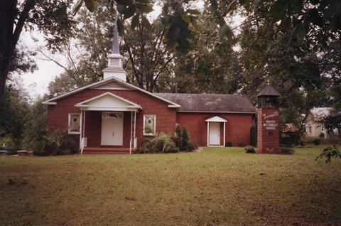
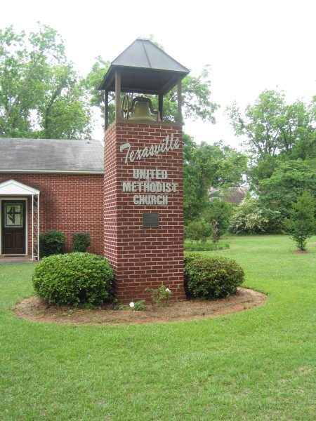
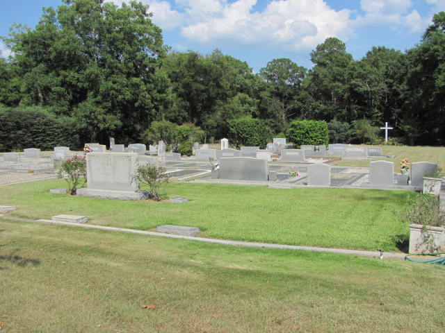
| Location | : | Texasville, Barbour County, USA |
| Coordinate | : | 31.7152996, -85.4227982 |
frequently asked questions (FAQ):
-
Where is Texasville Cemetery?
Texasville Cemetery is located at Texasville, Barbour County ,Alabama ,USA.
-
Texasville Cemetery cemetery's updated grave count on graveviews.com?
0 memorials
-
Where are the coordinates of the Texasville Cemetery?
Latitude: 31.7152996
Longitude: -85.4227982
Nearby Cemetories:
1. Adams Chapel Cemetery
Texasville, Barbour County, USA
Coordinate: 31.7198440, -85.3838320
2. Corinth Baptist Church Cemetery
Barbour County, USA
Coordinate: 31.7075005, -85.4700012
3. New Prospect Freewill Baptist Church Cemetery
Henry County, USA
Coordinate: 31.6741840, -85.4104130
4. Creel Church Cemetery
Pratts, Barbour County, USA
Coordinate: 31.7343998, -85.3696976
5. Spring Hill Cemetery
Blue Springs, Barbour County, USA
Coordinate: 31.6669006, -85.4518967
6. Friendly Assembly of God Church Cemetery
Texasville, Barbour County, USA
Coordinate: 31.7497340, -85.3697770
7. Prospect Baptist Church Cemetery
Barbour County, USA
Coordinate: 31.7625700, -85.4703800
8. Edwin Community Cemetery
Henry County, USA
Coordinate: 31.6660995, -85.3758011
9. Anderson Baptist Church Cemetery
Barbour County, USA
Coordinate: 31.6770992, -85.4850006
10. Helms Cemetery
Barbour County, USA
Coordinate: 31.6891994, -85.4950027
11. Antioch Primitive Baptist Church Cemetery
Clayton, Barbour County, USA
Coordinate: 31.7831300, -85.4317230
12. Tew Cemetery
Barbour County, USA
Coordinate: 31.6480999, -85.4400024
13. Church of Abbeville Cemetery
Henry County, USA
Coordinate: 31.6608570, -85.3727500
14. Saint Michael AME Church Cemetery
Edwin, Henry County, USA
Coordinate: 31.6511870, -85.3901880
15. Lee Cemetery
Baker Hill, Barbour County, USA
Coordinate: 31.7357590, -85.3423980
16. Oakey Grove Promised Land Freewill Baptist Church
Baker Hill, Barbour County, USA
Coordinate: 31.7393800, -85.3421300
17. Shiloh Word Fellowship Cemetery
Blue Springs, Barbour County, USA
Coordinate: 31.6405470, -85.4379620
18. Old Hovey Cemetery
Tyler Crossroads, Barbour County, USA
Coordinate: 31.7458830, -85.5053620
19. Landmark Christian Cemetery
Baker Hill, Barbour County, USA
Coordinate: 31.7242500, -85.3322000
20. Pond Bethel Methodist Church Cemetery
Barbour County, USA
Coordinate: 31.7196999, -85.3308029
21. Bethel Primitive Baptist Church Cemetery
Barbour County, USA
Coordinate: 31.6450005, -85.4841995
22. Pine Level Church Cemetery
Barbour County, USA
Coordinate: 31.7104530, -85.5258408
23. Scotch Cemetery
Barbour County, USA
Coordinate: 31.7922001, -85.3692017
24. Pleasant View Cemetery
Clayton, Barbour County, USA
Coordinate: 31.8061008, -85.4049988