
| Memorials | : | 0 |
| Location | : | Pratts, Barbour County, USA |
| Coordinate | : | 31.7343998, -85.3696976 |
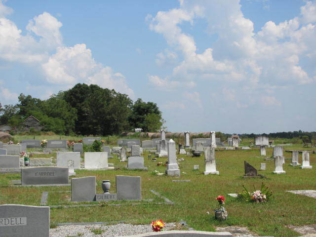
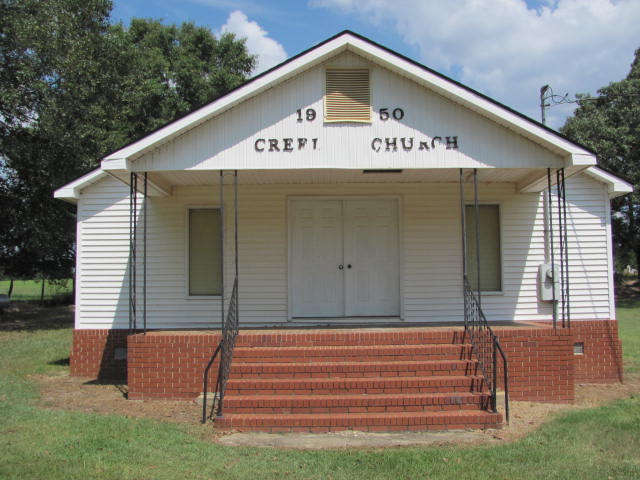
| Description | : | Creel Church Cemetery 188 County Road 67 Pratts, Alabama 36016 Creel Church and Cemetery is located in Southern Barbour County, Alabama. From the junction of SR 131 and CR 67, go south 1.1 miles on CR 67. Creel Church and Cemetery are located on the east side of the road. The cemetery is still in use. |
frequently asked questions (FAQ):
-
Where is Creel Church Cemetery?
Creel Church Cemetery is located at Pratts, Barbour County ,Alabama ,USA.
-
Creel Church Cemetery cemetery's updated grave count on graveviews.com?
0 memorials
-
Where are the coordinates of the Creel Church Cemetery?
Latitude: 31.7343998
Longitude: -85.3696976
Nearby Cemetories:
1. Friendly Assembly of God Church Cemetery
Texasville, Barbour County, USA
Coordinate: 31.7497340, -85.3697770
2. Adams Chapel Cemetery
Texasville, Barbour County, USA
Coordinate: 31.7198440, -85.3838320
3. Lee Cemetery
Baker Hill, Barbour County, USA
Coordinate: 31.7357590, -85.3423980
4. Oakey Grove Promised Land Freewill Baptist Church
Baker Hill, Barbour County, USA
Coordinate: 31.7393800, -85.3421300
5. Landmark Christian Cemetery
Baker Hill, Barbour County, USA
Coordinate: 31.7242500, -85.3322000
6. Pond Bethel Methodist Church Cemetery
Barbour County, USA
Coordinate: 31.7196999, -85.3308029
7. Texasville Cemetery
Texasville, Barbour County, USA
Coordinate: 31.7152996, -85.4227982
8. Walker Cemetery
Barbour County, USA
Coordinate: 31.7872009, -85.3499985
9. Belcher Bethel Baptist Church Cemetery
Baker Hill, Barbour County, USA
Coordinate: 31.7676400, -85.3154950
10. Scotch Cemetery
Barbour County, USA
Coordinate: 31.7922001, -85.3692017
11. New Hope Cemetery
Baker Hill, Barbour County, USA
Coordinate: 31.7936001, -85.3569031
12. Edwin Community Cemetery
Henry County, USA
Coordinate: 31.6660995, -85.3758011
13. New Prospect Freewill Baptist Church Cemetery
Henry County, USA
Coordinate: 31.6741840, -85.4104130
14. Mount Zion Free Will Baptist Church Cemetery
Edwin, Henry County, USA
Coordinate: 31.6853008, -85.3097000
15. Antioch Primitive Baptist Church Cemetery
Clayton, Barbour County, USA
Coordinate: 31.7831300, -85.4317230
16. Church of Abbeville Cemetery
Henry County, USA
Coordinate: 31.6608570, -85.3727500
17. Saint Luke Baptist Church Cemetery
Baker Hill, Barbour County, USA
Coordinate: 31.7821950, -85.2994390
18. Pleasant View Cemetery
Clayton, Barbour County, USA
Coordinate: 31.8061008, -85.4049988
19. New Hope Freewill Baptist Church Cemetery
Henry County, USA
Coordinate: 31.6728200, -85.3137600
20. Mount Mariah Baptist Church Cemetery
Clayton, Barbour County, USA
Coordinate: 31.8110980, -85.4002290
21. Saint Michael AME Church Cemetery
Edwin, Henry County, USA
Coordinate: 31.6511870, -85.3901880
22. County Line Cemetery
Henry County, USA
Coordinate: 31.7024994, -85.2763977
23. Rocky Mount United Methodist Cemetery
Baker Hill, Barbour County, USA
Coordinate: 31.8111992, -85.3223038
24. Johnston Cemetery
Baker Hill, Barbour County, USA
Coordinate: 31.8055992, -85.3103027