
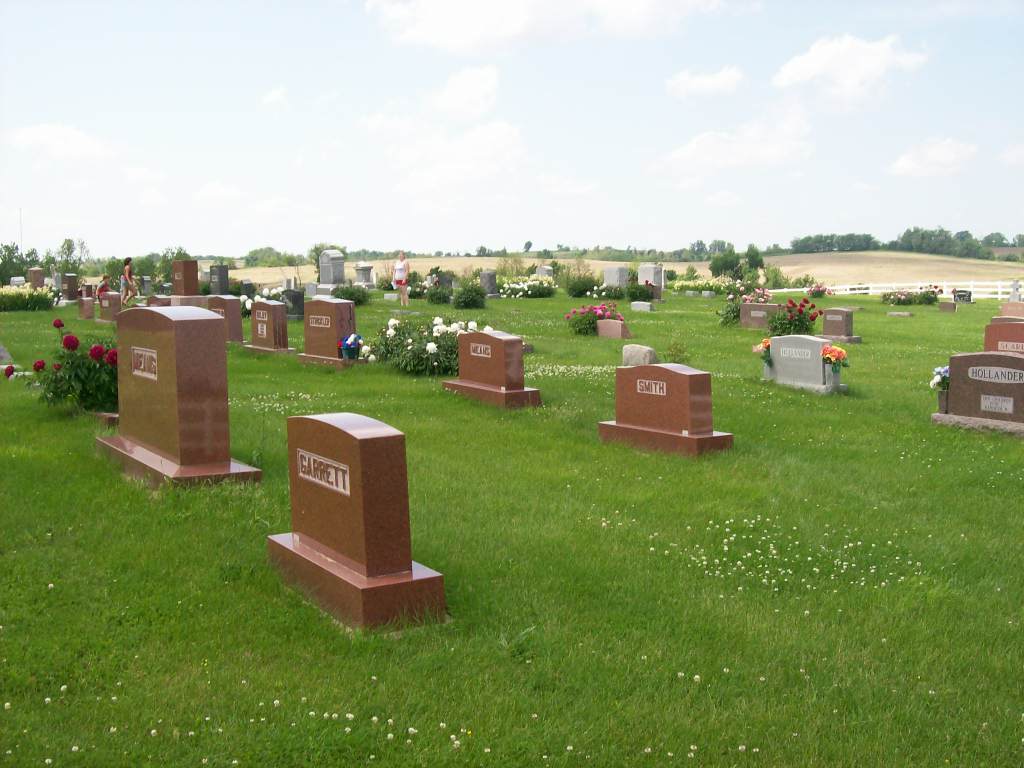
| Memorials | : | 9 |
| Location | : | Craig, Holt County, USA |
| Coordinate | : | 40.2500000, -95.3750000 |
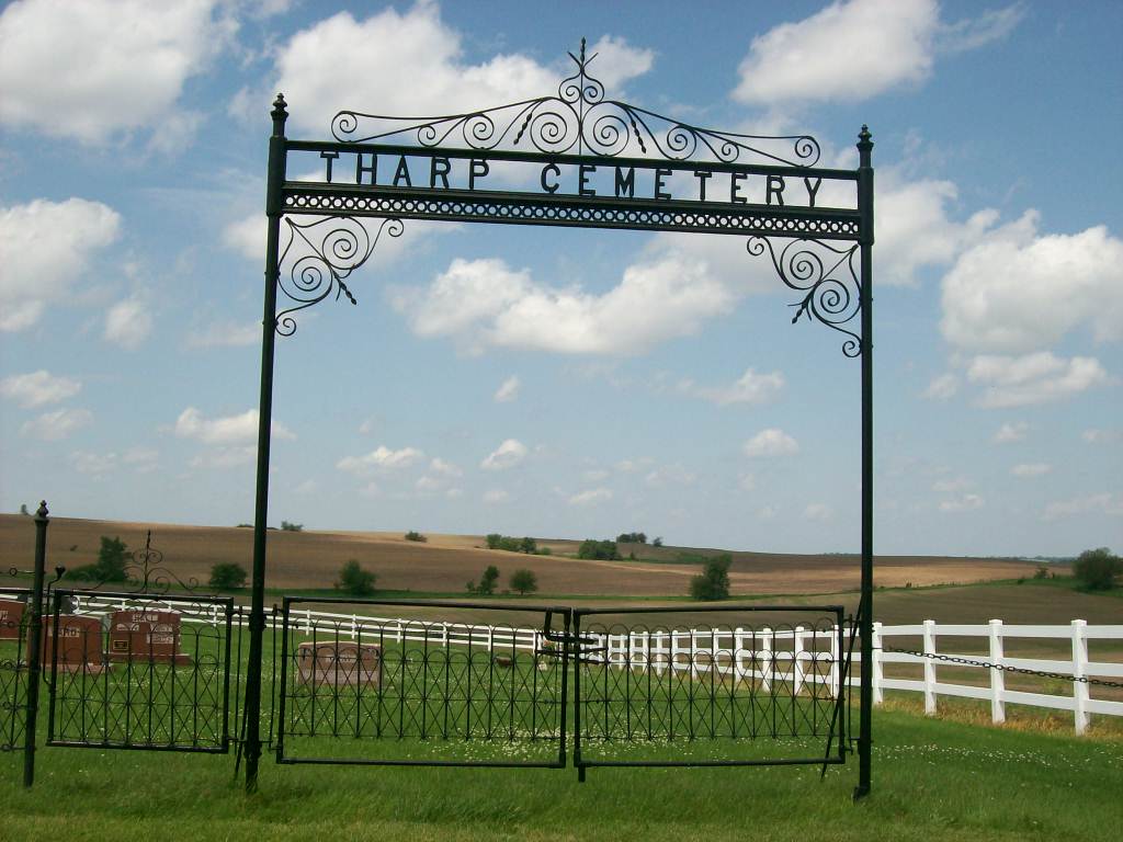
| Description | : | Tharp Cemetery was started ca 1850 by the Tharp family on their farm. In 1902 the Tharp Cemetery Association was formed. Officers were: John H. Hunt, Pres; E.L.Gaffney, Sec.; Roger McCoy, Tres.Trustees were: Sam Thompson, E.E.Hickman, and Hiram True. A second acre was added to the north.The cemetery area was surveyed and plotted. A metal fence across the front was purchased in 1905. This fence is unique (by modern standards). The posts are double metal posts held in place by a finial at the top. The wire passes between the two posts. If wire needs to be tightened there are... Read More |
frequently asked questions (FAQ):
-
Where is Tharp Cemetery?
Tharp Cemetery is located at Craig, Holt County ,Missouri ,USA.
-
Tharp Cemetery cemetery's updated grave count on graveviews.com?
6 memorials
-
Where are the coordinates of the Tharp Cemetery?
Latitude: 40.2500000
Longitude: -95.3750000
Nearby Cemetories:
1. Parrish Cemetery
Craig, Holt County, USA
Coordinate: 40.2277985, -95.3778000
2. Williams Cemetery
Craig, Holt County, USA
Coordinate: 40.2216988, -95.3910980
3. Guilliams Cemetery
Craig, Holt County, USA
Coordinate: 40.2220802, -95.3923569
4. Franklin Burial Site
Fairfax, Atchison County, USA
Coordinate: 40.2740910, -95.3431320
5. Milton Cemetery
Atchison County, USA
Coordinate: 40.2811200, -95.4174400
6. IOOF Cemetery
Craig, Holt County, USA
Coordinate: 40.1985817, -95.3532562
7. Mount Hope Cemetery
Atchison County, USA
Coordinate: 40.2696991, -95.4503021
8. Pleasant Ridge Cemetery
Fairfax, Atchison County, USA
Coordinate: 40.3288994, -95.3758011
9. New Liberty Cemetery
Craig, Holt County, USA
Coordinate: 40.2048187, -95.2866135
10. Beck Cemetery
Atchison County, USA
Coordinate: 40.3222008, -95.4542007
11. English Grove Cemetery
Fairfax, Atchison County, USA
Coordinate: 40.3439000, -95.4439000
12. Walkup Grove Cemetery
Atchison County, USA
Coordinate: 40.3203011, -95.2566986
13. Caton Family Cemetery
Mound City, Holt County, USA
Coordinate: 40.1611980, -95.2748700
14. Anderson Cemetery
Barada, Richardson County, USA
Coordinate: 40.1612200, -95.4771200
15. Arago Cemetery
Richardson County, USA
Coordinate: 40.1519012, -95.4728012
16. Bush Cemetery
Atchison County, USA
Coordinate: 40.3558006, -95.4858017
17. North Bethel Cemetery
Mound City, Holt County, USA
Coordinate: 40.2191307, -95.2010753
18. Half-Breed Cemetery
Nemaha County, USA
Coordinate: 40.2664900, -95.5604900
19. Squaw Creek Burial Site
Fairfax, Atchison County, USA
Coordinate: 40.2912800, -95.1932700
20. Old Mound City Cemetery
Mound City, Holt County, USA
Coordinate: 40.1499560, -95.2372380
21. Saint Deroin Cemetery
Barada, Richardson County, USA
Coordinate: 40.2543983, -95.5682983
22. Saint Johns Catholic Cemetery
Barada, Richardson County, USA
Coordinate: 40.2189000, -95.5683000
23. Saint Peters Evangelical Lutheran Church Cemetery
Richardson County, USA
Coordinate: 40.1752014, -95.5491257
24. Sauer Cemetery
Bigelow, Holt County, USA
Coordinate: 40.1002100, -95.3339900