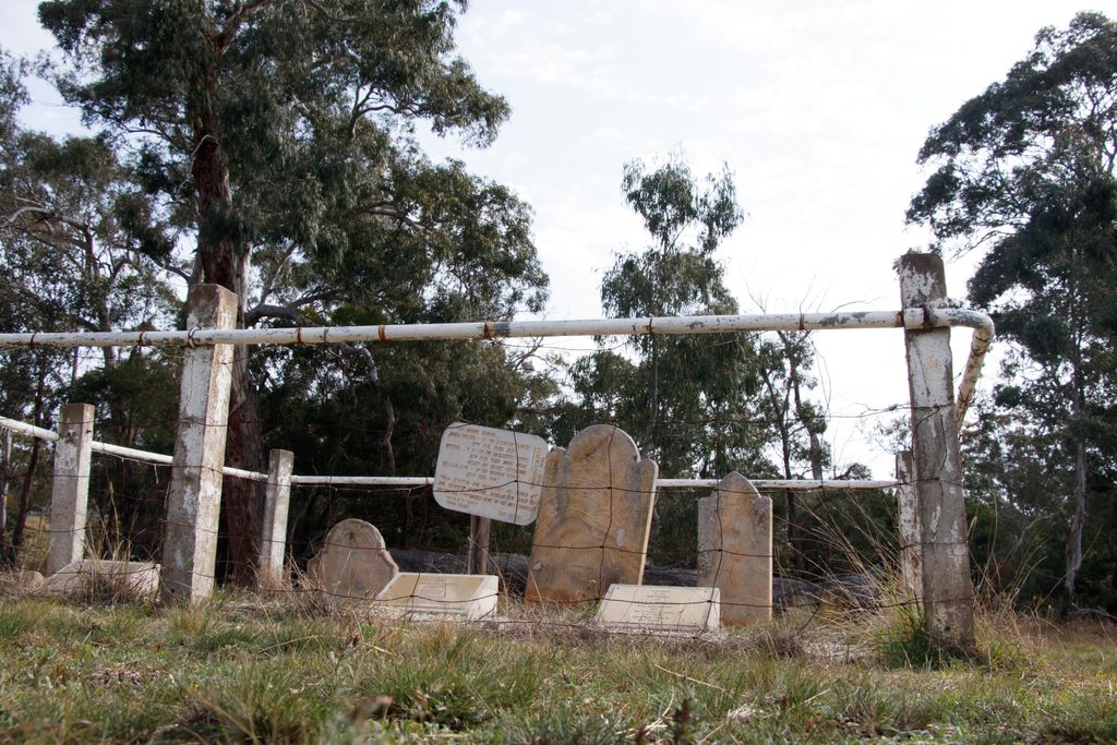
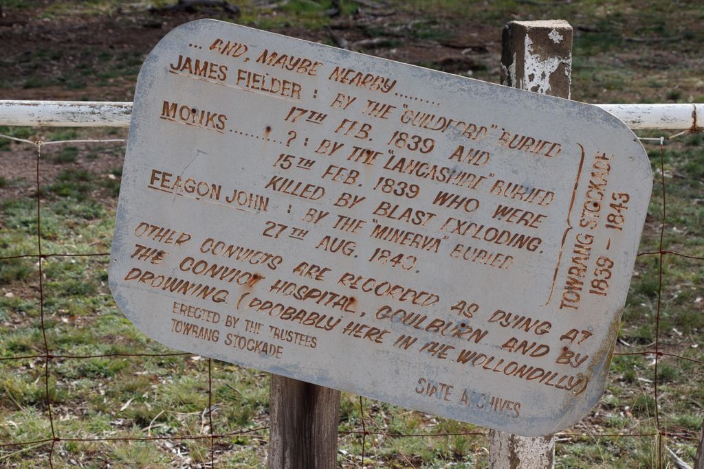
| Memorials | : | 4 |
| Location | : | Boxers Creek, Goulburn Mulwaree Council, Australia |
| Description | : | A small burial ground near the site of the old Towrang Stockade on the Hume Highway, about 7miles/11km north of Goulburn on the river flat across Towrang Creek. Only 3 headstones remain. The Stockade operated 1838-1843, established as part of the construction of Major Mitchell's Great South Road project . |
frequently asked questions (FAQ):
-
Where is Towrang Burialground?
Towrang Burialground is located at No GPS information available Add GPSHume Highway Boxers Creek, Goulburn Mulwaree Council ,New South Wales ,Australia.
-
Towrang Burialground cemetery's updated grave count on graveviews.com?
4 memorials
Nearby Cemetories:
1. Brayton Cemetery
Brayton, Goulburn Mulwaree Council, Australia
Coordinate: -34.7492240, 149.6969980
2. Mummell Catholic cemetery
Mummel, Goulburn Mulwaree Council, Australia
Coordinate: -34.7556340, 149.7150370
3. Murrel Cemetery
Mummel, Goulburn Mulwaree Council, Australia
Coordinate: -34.7588220, 149.5222900
4. Tarago General Cemetery
Tarago, Goulburn Mulwaree Council, Australia
Coordinate: -34.6956160, 149.8507090
5. Goulburn General Cemetery
Goulburn, Goulburn Mulwaree Council, Australia
Coordinate: -34.7086590, 149.6179610
6. Goulburn Jewish Cemetery
Goulburn, Goulburn Mulwaree Council, Australia
Coordinate: -34.8784540, 149.6404940
7. Goulburn Old Cemetery
Goulburn, Goulburn Mulwaree Council, Australia
8. Kenmore Roman Catholic Cemetery
Goulburn, Goulburn Mulwaree Council, Australia
Coordinate: -34.8632150, 149.9422700
9. Merrilla Cemetery
Goulburn, Goulburn Mulwaree Council, Australia
Coordinate: -34.8590005, 149.9432472
10. Murrays Flat Wesleyan Cemetery
Goulburn, Goulburn Mulwaree Council, Australia
Coordinate: -34.7488140, 149.5993110
11. Saint Saviours Anglican Cemetery
Goulburn, Goulburn Mulwaree Council, Australia
Coordinate: -34.9855470, 149.7973600
12. Saint Saviours Cathedral Churchyard
Goulburn, Goulburn Mulwaree Council, Australia
Coordinate: -35.0136720, 149.8632810
13. St Patricks College (now Trinity Catholic College)
Goulburn, Goulburn Mulwaree Council, Australia
Coordinate: -34.7492240, 149.6969980
14. Sts Peter & Paul Old Cathedral
Goulburn, Goulburn Mulwaree Council, Australia
Coordinate: -34.7556340, 149.7150370
15. Parkesbourne Methodist Cemetery
Parkesbourne, Goulburn Mulwaree Council, Australia
Coordinate: -34.7588220, 149.5222900
16. St Johns Anglican Churchyard
Towrang, Goulburn Mulwaree Council, Australia
Coordinate: -34.6956160, 149.8507090
17. Thurlow Methodist Church
Baw Baw, Goulburn Mulwaree Council, Australia
Coordinate: -34.7086590, 149.6179610
18. Komungla General Cemetery
Komungla, Goulburn Mulwaree Council, Australia
Coordinate: -34.8784540, 149.6404940
19. Brisbane meadows
Bungonia, Goulburn Mulwaree Council, Australia
20. Bungonia Cemetery
Bungonia, Goulburn Mulwaree Council, Australia
Coordinate: -34.8632150, 149.9422700
21. Christ Church Anglican Churchyard
Bungonia, Goulburn Mulwaree Council, Australia
Coordinate: -34.8590005, 149.9432472
22. St James Anglican Cemetery
Pomeroy, Goulburn Mulwaree Council, Australia
Coordinate: -34.7488140, 149.5993110
23. Roberts Family Cemetery
Windellama, Goulburn Mulwaree Council, Australia
Coordinate: -34.9855470, 149.7973600
24. Windellama Anglican Cemetery
Windellama, Goulburn Mulwaree Council, Australia
Coordinate: -35.0136720, 149.8632810


