
| Memorials | : | 19 |
| Location | : | Washingtonville, Mahoning County, USA |
| Coordinate | : | 40.9013880, -80.7646550 |
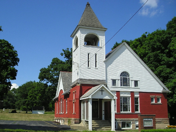
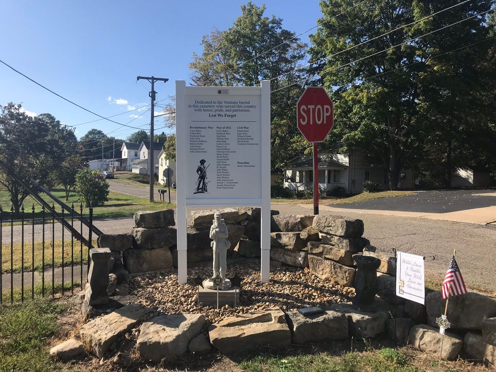
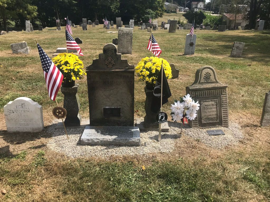
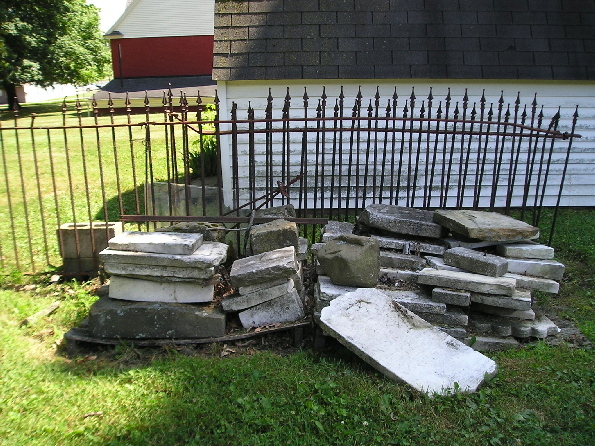
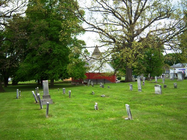
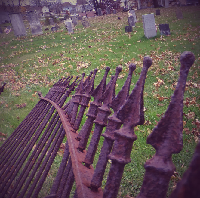
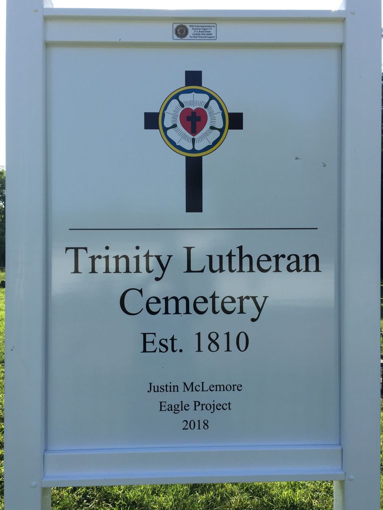
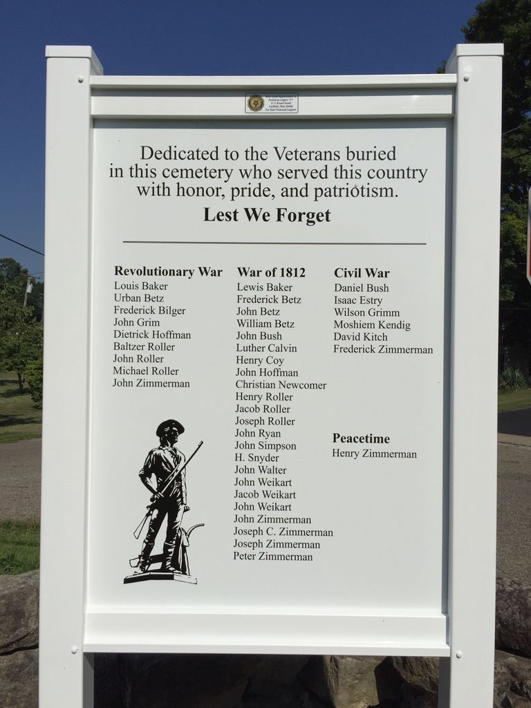
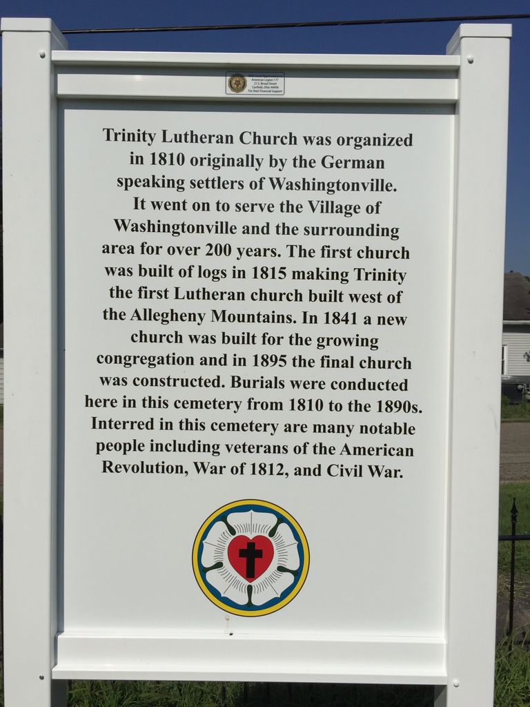
| Description | : | The cemetery is located on the southwest corner of the intersection of High Street and East Street behind (north of) the Trinity Lutheran Church, located on E Main Street. The cemetery is located in Green Township, Mahoning County, Ohio, and is # 2135 (Trinity Lutheran Cemetery / Washingtonville Cemetery / Lutheran Cemetery) in “Ohio Cemeteries 1803-2003”, compiled by the Ohio Genealogical Society. The U.S. Geological Survey (USGS) Geographic Names Information System (GNIS) feature ID for the cemetery is 1963272 (Lutheran Church Cemetery). |
frequently asked questions (FAQ):
-
Where is Trinity Lutheran Cemetery?
Trinity Lutheran Cemetery is located at 150 East Main Street Washingtonville, Mahoning County ,Ohio , 44490USA.
-
Trinity Lutheran Cemetery cemetery's updated grave count on graveviews.com?
18 memorials
-
Where are the coordinates of the Trinity Lutheran Cemetery?
Latitude: 40.9013880
Longitude: -80.7646550
Nearby Cemetories:
1. Robbins Methodist Cemetery
Washingtonville, Mahoning County, USA
Coordinate: 40.9016000, -80.7650800
2. Mount Joy Mennonite Church Cemetery
Leetonia, Columbiana County, USA
Coordinate: 40.8922670, -80.7600100
3. Washingtonville Cemetery
Washingtonville, Mahoning County, USA
Coordinate: 40.9033012, -80.7846985
4. Sharon Mennonite Fellowship Cemetery
Green Township, Mahoning County, USA
Coordinate: 40.9286850, -80.7463390
5. Nold Mennonite Cemetery
Leetonia, Columbiana County, USA
Coordinate: 40.8771820, -80.7394080
6. Esterly Cemetery
Leetonia, Columbiana County, USA
Coordinate: 40.8886700, -80.7270200
7. Pleasant View Mennonite Church Cemetery
Mahoning County, USA
Coordinate: 40.9223400, -80.7266500
8. Oakdale Cemetery
Leetonia, Columbiana County, USA
Coordinate: 40.8666992, -80.7538986
9. Dressel Farm Cemetery
Greenford, Mahoning County, USA
Coordinate: 40.9363770, -80.7745730
10. Callahan Family Cemetery
Greenford, Mahoning County, USA
Coordinate: 40.9160550, -80.8083680
11. Mount Calvary Cemetery
Leetonia, Columbiana County, USA
Coordinate: 40.8630981, -80.7667007
12. Midway Mennonite Church Cemetery
Mahoning County, USA
Coordinate: 40.9243400, -80.7183500
13. Locust Grove Cemetery
Mahoning County, USA
Coordinate: 40.9435300, -80.7631500
14. Zion Hill Church of the Brethren Cemetery
North Lima, Mahoning County, USA
Coordinate: 40.9067700, -80.7052420
15. Greenlawn Cemetery
Greenford, Mahoning County, USA
Coordinate: 40.9430000, -80.7970000
16. Greenford Lutheran Church Cemetery
Mahoning County, USA
Coordinate: 40.9436700, -80.7970200
17. Franklin Square United Methodist Church Cemetery
Franklin Square, Columbiana County, USA
Coordinate: 40.8562902, -80.7902739
18. Christian Cemetery
Greenford, Mahoning County, USA
Coordinate: 40.9438705, -80.8023529
19. Franklin Square Cemetery
Franklin Square, Columbiana County, USA
Coordinate: 40.8580017, -80.8029022
20. Paupers Field
Salem, Columbiana County, USA
Coordinate: 40.8882050, -80.8388590
21. Grandview Cemetery
Salem, Columbiana County, USA
Coordinate: 40.8856010, -80.8405991
22. Cool Springs Cemetery
Fairfield Township, Columbiana County, USA
Coordinate: 40.8486820, -80.7263520
23. Columbiana Cemetery
Columbiana, Columbiana County, USA
Coordinate: 40.8869019, -80.6844025
24. Cool Family Cemetery
Greenford, Mahoning County, USA
Coordinate: 40.9641100, -80.7815880