
| Memorials | : | 1430 |
| Location | : | Berrien Center, Berrien County, USA |
| Coordinate | : | 41.9299431, -86.2727356 |
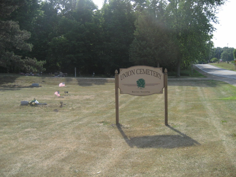
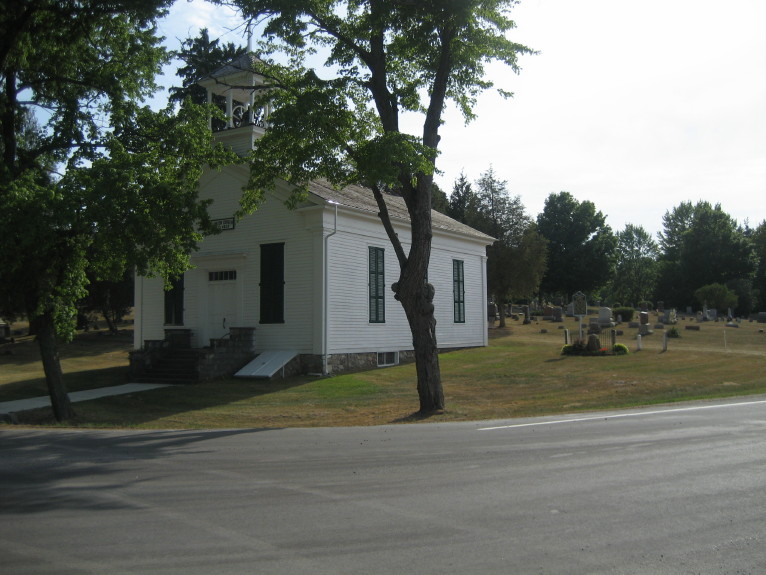
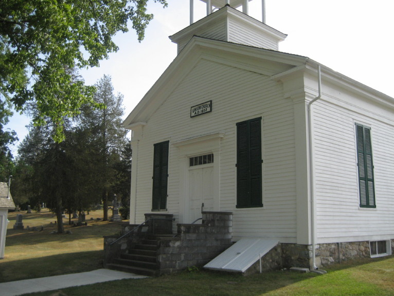
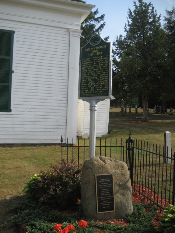
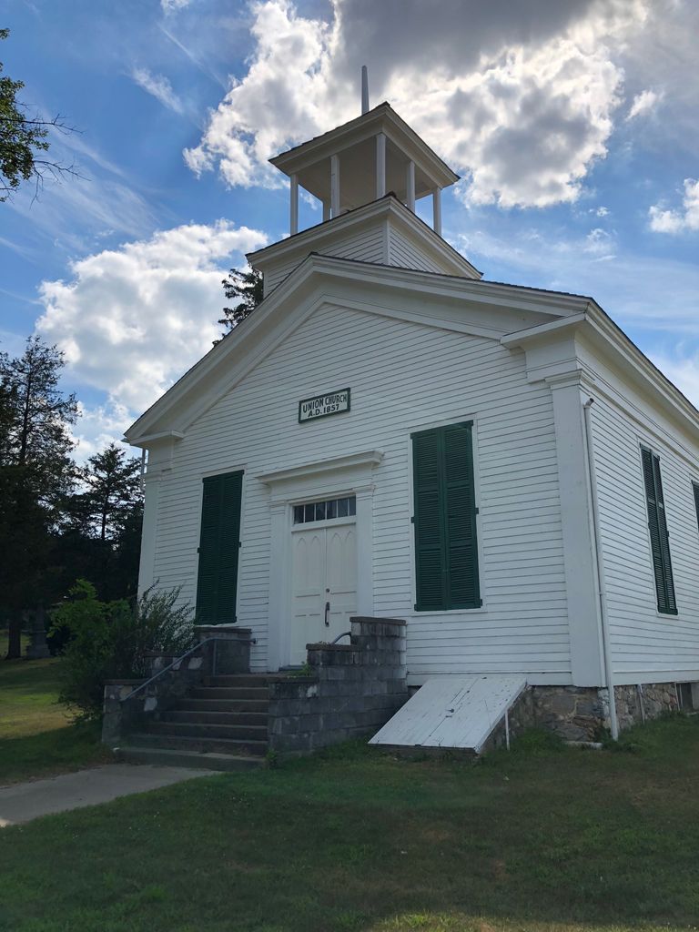
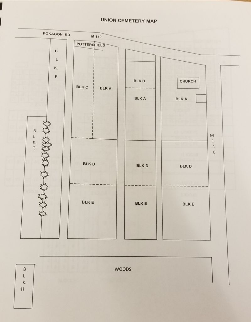
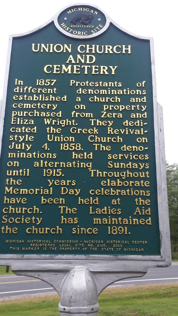
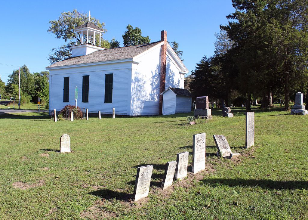
| Description | : | Union Cemetery is located on M-140 at Pokagon Road in Berrien Township. AKA South Union Cemetery In 1857 Protestants of different denominations established a church and cemetery on property purchased from Zera and Eliza Wright. They dedicated the Greek Revival-style Union Church on July 4, 1858. The denominations held services on alternating Sundays until 1915. Throughout the years elaborate Memorial Day celebrations have been held at the church. The Ladies Aid Society has maintained the church since 1891. The U.S. Geological Survey (USGS) Geographic Names Information System (GNIS) feature ID for the cemetery is 2374151 (Berrien Center Cemetery / South Union... Read More |
frequently asked questions (FAQ):
-
Where is Union Cemetery?
Union Cemetery is located at Pokagon Road and Michigan Highway M-140 Berrien Center, Berrien County ,Michigan , 49102USA.
-
Union Cemetery cemetery's updated grave count on graveviews.com?
1430 memorials
-
Where are the coordinates of the Union Cemetery?
Latitude: 41.9299431
Longitude: -86.2727356
Nearby Cemetories:
1. Morris Chapel Cemetery
Niles, Berrien County, USA
Coordinate: 41.9063880, -86.2463880
2. Long Lake Cemetery
Berrien Springs, Berrien County, USA
Coordinate: 41.9185982, -86.3125000
3. Berrien County Poor Farm Cemetery
Berrien Springs, Berrien County, USA
Coordinate: 41.9539700, -86.3028900
4. Maple Grove Cemetery
Eau Claire, Berrien County, USA
Coordinate: 41.9719009, -86.2872009
5. Rodgers Cemetery
Pokagon, Cass County, USA
Coordinate: 41.9169365, -86.2149947
6. Rose Hill Cemetery
Berrien Springs, Berrien County, USA
Coordinate: 41.9331017, -86.3403015
7. Paul Pokagon Burial Site
Pokagon Township, Cass County, USA
Coordinate: 41.9431140, -86.2043500
8. Sumnerville Cemetery
Sumnerville, Cass County, USA
Coordinate: 41.9120483, -86.2047272
9. Franklin Cemetery
Berrien Township, Berrien County, USA
Coordinate: 41.9711110, -86.2236110
10. Caldwell Cemetery
Eau Claire, Berrien County, USA
Coordinate: 41.9860992, -86.2861023
11. Mission Hills Memorial Gardens
Niles, Cass County, USA
Coordinate: 41.9096100, -86.1989200
12. Johnson Cemetery
Niles, Berrien County, USA
Coordinate: 41.8594440, -86.2691660
13. Robert Farry Cemetery
Eau Claire, Berrien County, USA
Coordinate: 42.0002778, -86.2619444
14. Evergreen Cemetery
Pokagon Township, Cass County, USA
Coordinate: 41.9122170, -86.1658550
15. Gilbert Cemetery
Dowagiac, Cass County, USA
Coordinate: 41.9993090, -86.2031190
16. Harrah Road Cemetery
Niles, Berrien County, USA
Coordinate: 41.8425000, -86.3058333
17. Lett Cemetery
Sodus, Berrien County, USA
Coordinate: 42.0038890, -86.3447220
18. Dick Cemetery
Howard Township, Cass County, USA
Coordinate: 41.8511009, -86.2089005
19. Sherwood Cemetery
Buchanan, Berrien County, USA
Coordinate: 41.8669440, -86.3636110
20. Burke Cemetery
Berrien Springs, Berrien County, USA
Coordinate: 41.9216995, -86.3974991
21. Benton Cemetery
Niles, Berrien County, USA
Coordinate: 41.8542190, -86.3501790
22. Colvin Cemetery
Buchanan, Berrien County, USA
Coordinate: 41.8986110, -86.3944440
23. Indian Lake Cemetery
Dowagiac, Cass County, USA
Coordinate: 42.0061110, -86.1941670
24. Ely Graves
Eau Claire, Berrien County, USA
Coordinate: 42.0249920, -86.2361057