
| Memorials | : | 6 |
| Location | : | Buchanan, Berrien County, USA |
| Coordinate | : | 41.8986110, -86.3944440 |
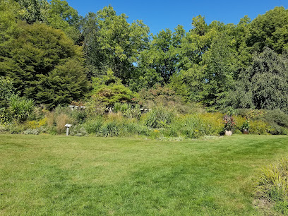
| Description | : | --------------------------------- The family of three Colvin brothers, Absalom, Mason, and Wilkerson Colvin, who came to Michigan from Campbell County Kentucky. ----------------------------------- The Colvin Cemetery is located on the East side of Garr Road, 1/4 mile North of "Little" Glendora Road, in Section 3 of Buchanan township, North of Buchanan, Berrien County Michigan, on what was origionally the Wilkerson Colvin farm. --------------------------------- This cemetery is a "family" cemetery, for the family of Wilkerson Colvin, who owned 275 acres in Section 3, where this cemetery lies, with his brother Absalom Colvin owning adjoining property directly West in Section 4 (where the Colvin School was located), which they had both... Read More |
frequently asked questions (FAQ):
-
Where is Colvin Cemetery?
Colvin Cemetery is located at Buchanan, Berrien County ,Michigan ,USA.
-
Colvin Cemetery cemetery's updated grave count on graveviews.com?
6 memorials
-
Where are the coordinates of the Colvin Cemetery?
Latitude: 41.8986110
Longitude: -86.3944440
Nearby Cemetories:
1. Burke Cemetery
Berrien Springs, Berrien County, USA
Coordinate: 41.9216995, -86.3974991
2. Oak Grove Cemetery
Oronoko, Berrien County, USA
Coordinate: 41.9241982, -86.4122009
3. Sherwood Cemetery
Buchanan, Berrien County, USA
Coordinate: 41.8669440, -86.3636110
4. Boyle Cemetery
Oronoko, Berrien County, USA
Coordinate: 41.9013889, -86.4527778
5. Rose Hill Cemetery
Berrien Springs, Berrien County, USA
Coordinate: 41.9331017, -86.3403015
6. Benton Cemetery
Niles, Berrien County, USA
Coordinate: 41.8542190, -86.3501790
7. Hinman Cemetery
Baroda Township, Berrien County, USA
Coordinate: 41.9272003, -86.4597015
8. Virginians Burying Ground
Buchanan, Berrien County, USA
Coordinate: 41.8373070, -86.3694077
9. Long Lake Cemetery
Berrien Springs, Berrien County, USA
Coordinate: 41.9185982, -86.3125000
10. Salem Cemetery
Oronoko Township, Berrien County, USA
Coordinate: 41.9644012, -86.4278030
11. Kathryn Park Cemetery
Buchanan, Berrien County, USA
Coordinate: 41.8308100, -86.3634230
12. Oak Ridge Cemetery
Buchanan, Berrien County, USA
Coordinate: 41.8244019, -86.3788986
13. Glendora Cemetery
Glendora, Berrien County, USA
Coordinate: 41.8786011, -86.4950027
14. Feather Cemetery
Hinchman, Berrien County, USA
Coordinate: 41.9720955, -86.4356689
15. Bakertown Cemetery
Buchanan, Berrien County, USA
Coordinate: 41.8125000, -86.3975000
16. Harrah Road Cemetery
Niles, Berrien County, USA
Coordinate: 41.8425000, -86.3058333
17. Orchard Hills Country Club Cemetery
Buchanan, Berrien County, USA
Coordinate: 41.8305477, -86.3222168
18. Berrien County Poor Farm Cemetery
Berrien Springs, Berrien County, USA
Coordinate: 41.9539700, -86.3028900
19. Union Cemetery
Berrien Center, Berrien County, USA
Coordinate: 41.9299431, -86.2727356
20. Ruggles Cemetery
Baroda, Berrien County, USA
Coordinate: 41.9644012, -86.4906006
21. Johnson Cemetery
Niles, Berrien County, USA
Coordinate: 41.8594440, -86.2691660
22. Howe Cemetery
Buchanan, Berrien County, USA
Coordinate: 41.7977982, -86.3531036
23. Maple Grove Cemetery
Eau Claire, Berrien County, USA
Coordinate: 41.9719009, -86.2872009
24. Morris Chapel Cemetery
Niles, Berrien County, USA
Coordinate: 41.9063880, -86.2463880