
| Memorials | : | 0 |
| Location | : | Kemper County, USA |
| Coordinate | : | 32.9205520, -88.6855570 |
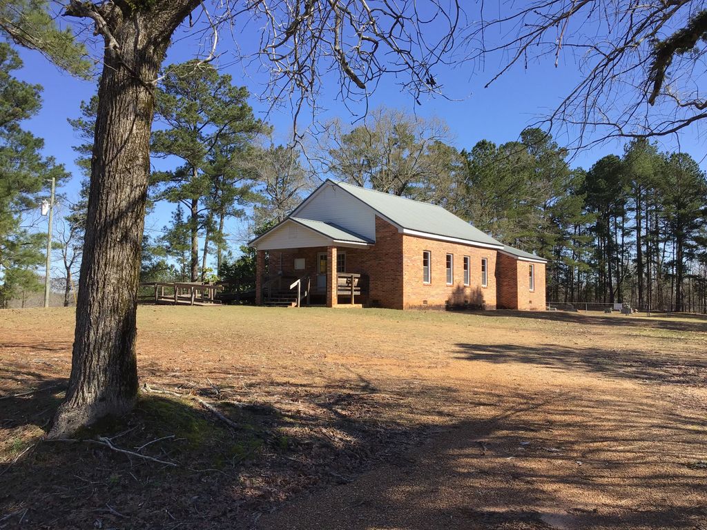
| Description | : | Union Hill Church, a lovely red brick country church with its beautifully kept cemetery behind it, can be found by going north on Hwy 39 from DeKalb (7.5 miles north of Hwy 16), then left onto Gholson Rd. About 4 miles up Gholson Rd. on the right is a dirt road loop, Union Hill East. A short distance onto this loop will bring the church and cemetery into sight on the right. |
frequently asked questions (FAQ):
-
Where is Union Hill Church Cemetery?
Union Hill Church Cemetery is located at Kemper County ,Mississippi ,USA.
-
Union Hill Church Cemetery cemetery's updated grave count on graveviews.com?
0 memorials
-
Where are the coordinates of the Union Hill Church Cemetery?
Latitude: 32.9205520
Longitude: -88.6855570
Nearby Cemetories:
1. Van Devender Cemetery
Kemper County, USA
Coordinate: 32.9085999, -88.6941986
2. Friendship Gholson Cemetery
De Kalb, Kemper County, USA
Coordinate: 32.9262400, -88.7175500
3. Old Friendship Cemetery
De Kalb, Kemper County, USA
Coordinate: 32.9261500, -88.7225800
4. Poorhouse Cemetery
Noxubee County, USA
Coordinate: 32.9592018, -88.6742020
5. Gholson Cemetery
Gholson, Noxubee County, USA
Coordinate: 32.9397011, -88.7313995
6. Pinetucky Cemetery
Noxubee County, USA
Coordinate: 32.9632988, -88.6410980
7. Calhoun Cemetery
Noxubee County, USA
Coordinate: 32.9880981, -88.6853027
8. Spring Hill Cemetery
De Kalb, Kemper County, USA
Coordinate: 32.8525009, -88.6556015
9. Vernon Cemetery
Noxubee County, USA
Coordinate: 32.9272003, -88.7750015
10. Chamberlain Cemetery East
Preston, Kemper County, USA
Coordinate: 32.8657990, -88.7506027
11. Chamberlin Cemetery West
Preston, Kemper County, USA
Coordinate: 32.8656578, -88.7511444
12. Tubb Cemetery
Kemper County, USA
Coordinate: 32.9258003, -88.7789001
13. Tubb Cemetery
Noxubee County, USA
Coordinate: 32.9259600, -88.7789400
14. Old Salem Cemetery
Preston, Kemper County, USA
Coordinate: 32.9254200, -88.7815700
15. Salem Cemetery
Preston, Kemper County, USA
Coordinate: 32.8717003, -88.7664032
16. Cotton Cemetery
Noxubee County, USA
Coordinate: 32.9958000, -88.6343994
17. Hallford Cemetery
De Kalb, Kemper County, USA
Coordinate: 32.8446570, -88.6337900
18. Hailey-Richey Cemetery
Gholson, Noxubee County, USA
Coordinate: 32.9261017, -88.7957993
19. Mamie's Chapel Cemetery
Kemper County, USA
Coordinate: 32.8281870, -88.7145710
20. Mount Pleasant Church Cemetery
Bloomfield, Kemper County, USA
Coordinate: 32.8281800, -88.7145600
21. Felton Cemetery
Wahalak, Kemper County, USA
Coordinate: 32.8532982, -88.6031036
22. Jerusalem Cemetery
De Kalb, Kemper County, USA
Coordinate: 32.8246994, -88.6688995
23. Butler Cemetery
Noxubee County, USA
Coordinate: 32.9794006, -88.7774963
24. Shuqualak Cemetery
Shuqualak, Noxubee County, USA
Coordinate: 32.9789009, -88.5894012