
| Memorials | : | 0 |
| Location | : | Preston, Kemper County, USA |
| Coordinate | : | 32.9254200, -88.7815700 |
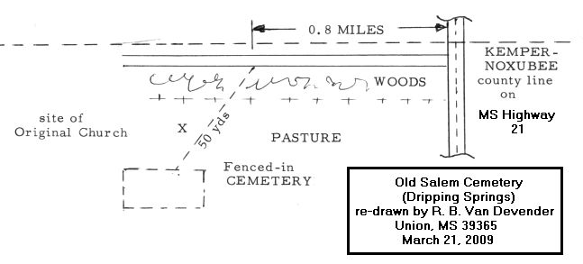
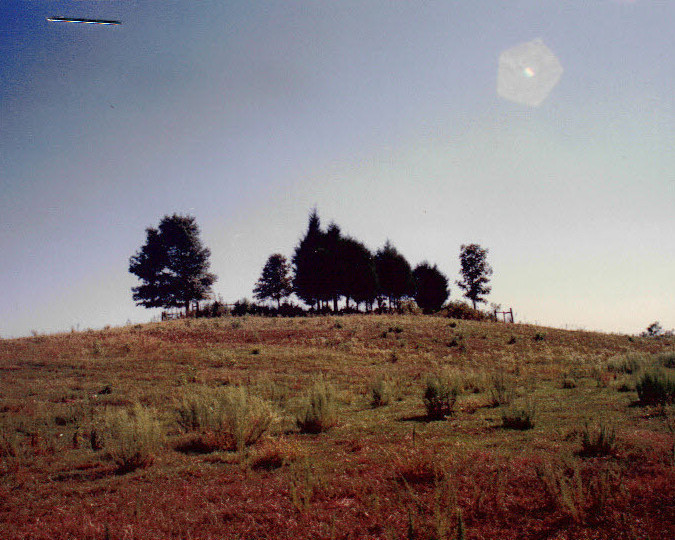
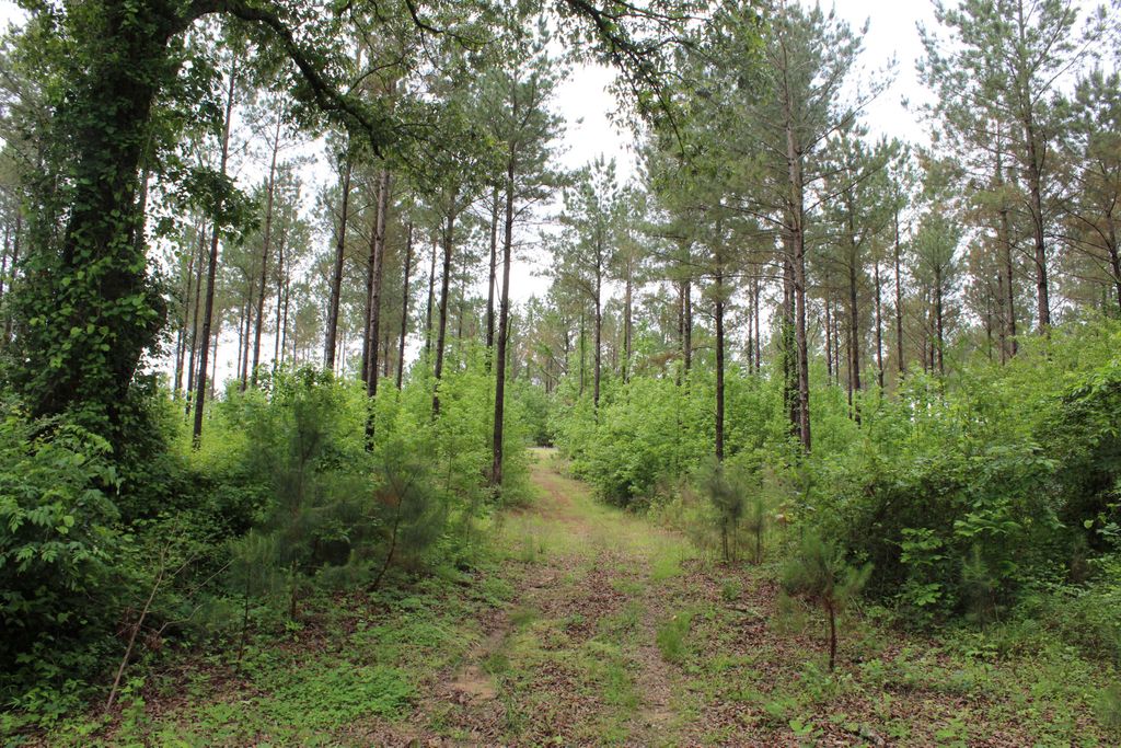
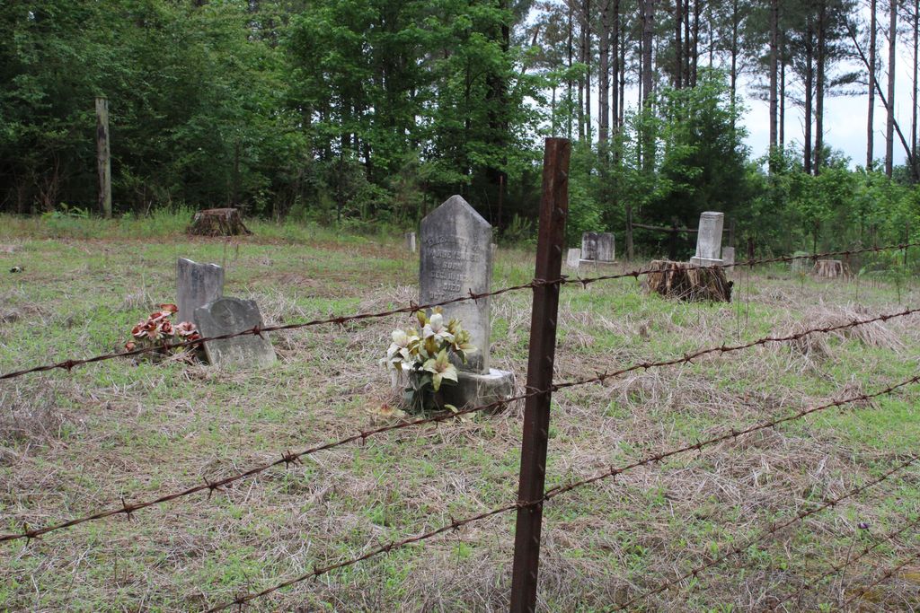
| Description | : | Old Salem Cemetery is located NE of Preston on a road (county line rd) that runs W off of MS 21 and apparently is on the line that divides Kemper from Noxubee County. It is on the south side of the road, which places it in Kemper County. It sits on a hill and would not be readily noticed from the road. |
frequently asked questions (FAQ):
-
Where is Old Salem Cemetery?
Old Salem Cemetery is located at Dripping Springs Preston, Kemper County ,Mississippi ,USA.
-
Old Salem Cemetery cemetery's updated grave count on graveviews.com?
0 memorials
-
Where are the coordinates of the Old Salem Cemetery?
Latitude: 32.9254200
Longitude: -88.7815700
Nearby Cemetories:
1. Tubb Cemetery
Noxubee County, USA
Coordinate: 32.9259600, -88.7789400
2. Tubb Cemetery
Kemper County, USA
Coordinate: 32.9258003, -88.7789001
3. Vernon Cemetery
Noxubee County, USA
Coordinate: 32.9272003, -88.7750015
4. Hailey-Richey Cemetery
Gholson, Noxubee County, USA
Coordinate: 32.9261017, -88.7957993
5. Gholson Cemetery
Gholson, Noxubee County, USA
Coordinate: 32.9397011, -88.7313995
6. Goodin Cemetery
Winston County, USA
Coordinate: 32.9267090, -88.8405000
7. Old Friendship Cemetery
De Kalb, Kemper County, USA
Coordinate: 32.9261500, -88.7225800
8. Friendship Gholson Cemetery
De Kalb, Kemper County, USA
Coordinate: 32.9262400, -88.7175500
9. Butler Cemetery
Noxubee County, USA
Coordinate: 32.9794006, -88.7774963
10. Salem Cemetery
Preston, Kemper County, USA
Coordinate: 32.8717003, -88.7664032
11. Pleasant Springs Presbyterian Church Cemetery
Preston, Kemper County, USA
Coordinate: 32.8832092, -88.8240433
12. Jackson Field Cemetery
Winston County, USA
Coordinate: 32.9476940, -88.8457350
13. Dry Creek Cemetery
Preston, Kemper County, USA
Coordinate: 32.9206009, -88.8507996
14. Mount Pisgah Cemetery
Winston County, USA
Coordinate: 32.9552994, -88.8416977
15. Chamberlin Cemetery West
Preston, Kemper County, USA
Coordinate: 32.8656578, -88.7511444
16. Chamberlain Cemetery East
Preston, Kemper County, USA
Coordinate: 32.8657990, -88.7506027
17. Rosamond Family Cemetery
Handle, Winston County, USA
Coordinate: 32.9352875, -88.8649750
18. Lynville Cemetery
Lynville, Kemper County, USA
Coordinate: 32.8569500, -88.8132400
19. Van Devender Cemetery
Kemper County, USA
Coordinate: 32.9085999, -88.6941986
20. Mount Hebron Old Cemetery
Winston County, USA
Coordinate: 32.9360680, -88.8712760
21. Anderson Cemetery
Fearns Springs, Winston County, USA
Coordinate: 32.9789740, -88.8485520
22. Union Hill Church Cemetery
Kemper County, USA
Coordinate: 32.9205520, -88.6855570
23. Mount Hebron Cemetery
Handle, Winston County, USA
Coordinate: 32.9557991, -88.8724976
24. McGraw-Reed-McDonald Cemetery
Fearns Springs, Winston County, USA
Coordinate: 32.9717000, -88.8651700