
| Memorials | : | 2 |
| Location | : | Preston, Kemper County, USA |
| Coordinate | : | 32.8656578, -88.7511444 |
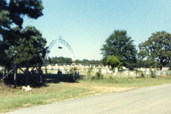
| Description | : | African American Cemetery. Chamberlin Cemetery (note spelling) is actually two cemeteries. The western portion is traditionally African American and the eastern portion is traditionally white. |
frequently asked questions (FAQ):
-
Where is Chamberlin Cemetery West?
Chamberlin Cemetery West is located at Preston, Kemper County ,Mississippi ,USA.
-
Chamberlin Cemetery West cemetery's updated grave count on graveviews.com?
2 memorials
-
Where are the coordinates of the Chamberlin Cemetery West?
Latitude: 32.8656578
Longitude: -88.7511444
Nearby Cemetories:
1. Chamberlain Cemetery East
Preston, Kemper County, USA
Coordinate: 32.8657990, -88.7506027
2. Salem Cemetery
Preston, Kemper County, USA
Coordinate: 32.8717003, -88.7664032
3. Mamie's Chapel Cemetery
Kemper County, USA
Coordinate: 32.8281870, -88.7145710
4. Mount Pleasant Church Cemetery
Bloomfield, Kemper County, USA
Coordinate: 32.8281800, -88.7145600
5. Lynville Cemetery
Lynville, Kemper County, USA
Coordinate: 32.8569500, -88.8132400
6. Pleasant Springs Presbyterian Church Cemetery
Preston, Kemper County, USA
Coordinate: 32.8832092, -88.8240433
7. Van Devender Cemetery
Kemper County, USA
Coordinate: 32.9085999, -88.6941986
8. Tubb Cemetery
Kemper County, USA
Coordinate: 32.9258003, -88.7789001
9. Tubb Cemetery
Noxubee County, USA
Coordinate: 32.9259600, -88.7789400
10. Vernon Cemetery
Noxubee County, USA
Coordinate: 32.9272003, -88.7750015
11. Old Salem Cemetery
Preston, Kemper County, USA
Coordinate: 32.9254200, -88.7815700
12. Old Friendship Cemetery
De Kalb, Kemper County, USA
Coordinate: 32.9261500, -88.7225800
13. Bloomfield Cemetery
De Kalb, Kemper County, USA
Coordinate: 32.8002900, -88.7434500
14. Friendship Gholson Cemetery
De Kalb, Kemper County, USA
Coordinate: 32.9262400, -88.7175500
15. Smyrna Cemetery
Kemper County, USA
Coordinate: 32.8011017, -88.7818985
16. Hailey-Richey Cemetery
Gholson, Noxubee County, USA
Coordinate: 32.9261017, -88.7957993
17. Gholson Cemetery
Gholson, Noxubee County, USA
Coordinate: 32.9397011, -88.7313995
18. Union Hill Church Cemetery
Kemper County, USA
Coordinate: 32.9205520, -88.6855570
19. Jerusalem Cemetery
De Kalb, Kemper County, USA
Coordinate: 32.8246994, -88.6688995
20. Spring Hill Cemetery
De Kalb, Kemper County, USA
Coordinate: 32.8525009, -88.6556015
21. McRae Cemetery
Kemper County, USA
Coordinate: 32.7793999, -88.7102966
22. Goodin Cemetery
Winston County, USA
Coordinate: 32.9267090, -88.8405000
23. Bluff Springs Cemetery
Kemper County, USA
Coordinate: 32.7813988, -88.8139038
24. Dry Creek Cemetery
Preston, Kemper County, USA
Coordinate: 32.9206009, -88.8507996