
| Memorials | : | 76 |
| Location | : | Unionville, Pershing County, USA |
| Coordinate | : | 40.2705000, -118.0629000 |
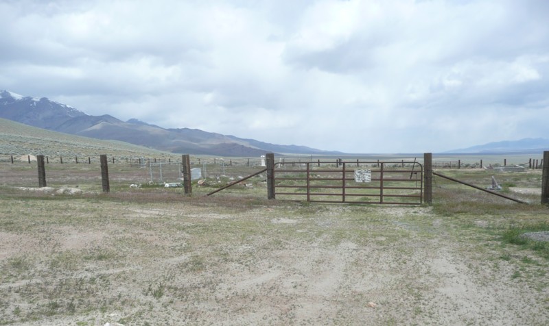
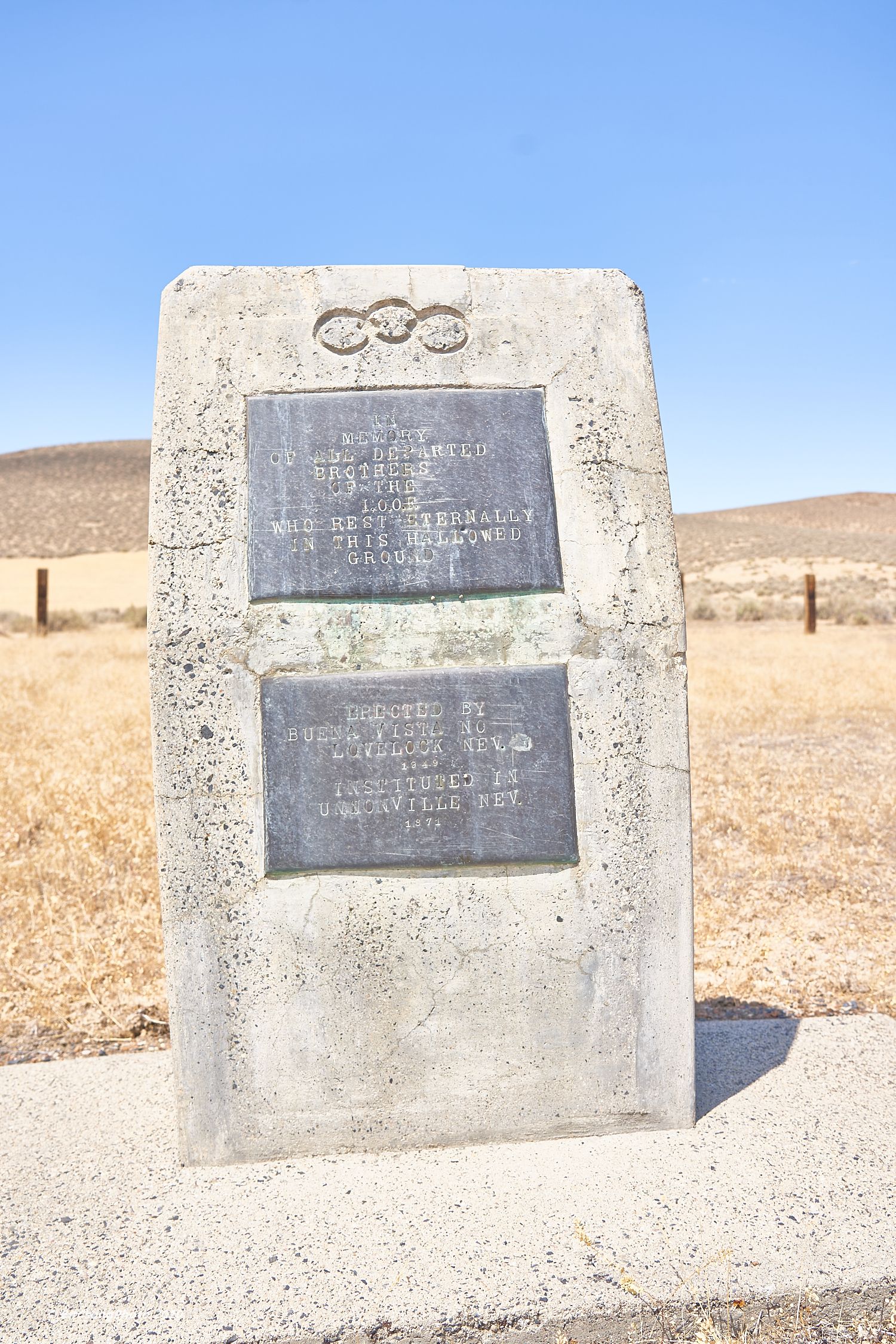
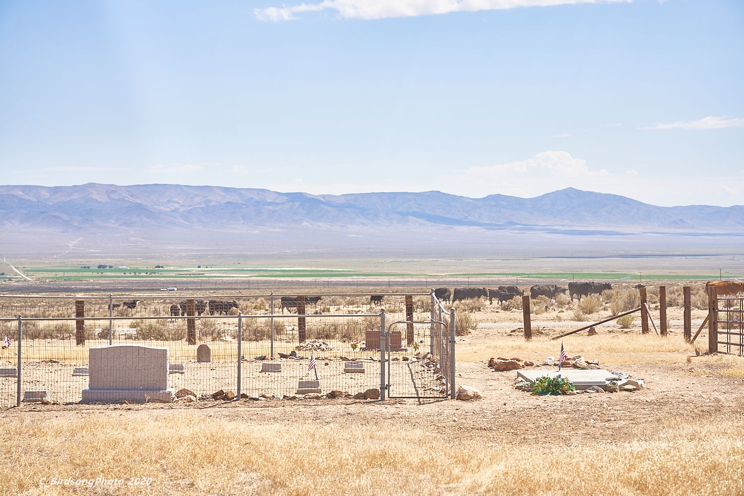
| Description | : | The Unionville Cemetery is located about 1/2 mile east of Unionville. There is no signage for the cemetery but it is completely fenced. Some of the family sites are also fenced within the cemetery. The fenced area inside, that has a newer 'group' marker along with the individual older markers, is probably the 'Pioneer' portion. It dates back to the 1870s when Unionville was a mining town and is still in use today. |
frequently asked questions (FAQ):
-
Where is Unionville Cemetery?
Unionville Cemetery is located at Unionville, Pershing County ,Nevada ,USA.
-
Unionville Cemetery cemetery's updated grave count on graveviews.com?
76 memorials
-
Where are the coordinates of the Unionville Cemetery?
Latitude: 40.2705000
Longitude: -118.0629000
Nearby Cemetories:
1. Alexander Brown Gravesite
Pershing County, USA
Coordinate: 40.0578400, -117.9150900
2. Spence Gravesite
Oreana, Pershing County, USA
Coordinate: 40.3100220, -118.3790120
3. Indian Cemetery
Lovelock, Pershing County, USA
Coordinate: 40.0836983, -118.3206024
4. Humboldt City Cemetery
Humboldt City, Pershing County, USA
Coordinate: 40.5954700, -118.2273200
5. Lone Mountain Cemetery
Lovelock, Pershing County, USA
Coordinate: 40.1932983, -118.5171967
6. Big Meadow Cemetery
Lovelock, Pershing County, USA
Coordinate: 40.1363983, -118.5056000
7. Dun Glen Cemetery
Pershing County, USA
Coordinate: 40.7365800, -117.9377600
8. Antelope Springs Burial Site
Imlay, Pershing County, USA
Coordinate: 40.6897360, -118.4935010
9. Majuba Mountain Cemetery
Pershing County, USA
Coordinate: 40.6903000, -118.4935989
10. Seven Troughs Cemetery
Pershing County, USA
Coordinate: 40.4417992, -118.7649002
11. Farr Ranch Cemetery
Battle Mountain, Lander County, USA
Coordinate: 39.9538610, -117.4256080
12. Guthrie Cemetery
Pershing County, USA
Coordinate: 40.7991900, -117.7201200
13. Dixie Valley Cemetery
Dixie Valley, Churchill County, USA
Coordinate: 39.6521090, -118.1466400
14. Winnemucca Cemetery
Winnemucca, Humboldt County, USA
Coordinate: 40.9617690, -117.7447520
15. Pioneer Cemetery
Winnemucca, Humboldt County, USA
Coordinate: 40.9785000, -117.7407000
16. Galena Cemetery
Battle Mountain, Lander County, USA
Coordinate: 40.5631400, -117.1319700
17. Golconda Cemetery
Golconda, Humboldt County, USA
Coordinate: 40.9511900, -117.4885600
18. Lawrence Ranch Cemetery
Stillwater, Churchill County, USA
Coordinate: 39.5272310, -118.5558870
19. Wonder Cemetery
Middlegate, Churchill County, USA
Coordinate: 39.4247600, -118.0580900
20. Stillwater Indian Cemetery
Stillwater, Churchill County, USA
Coordinate: 39.5210300, -118.6192300
21. Battle Mountain Indian Colony Cemetery
Battle Mountain, Lander County, USA
Coordinate: 40.6524500, -116.9645500
22. Mount Airy Gravesite
Mount Airy, Lander County, USA
Coordinate: 39.5041400, -117.3793700
23. Battle Mountain City Cemetery
Battle Mountain, Lander County, USA
Coordinate: 40.6414986, -116.9406967
24. Gardens Cemetery
Fallon, Churchill County, USA
Coordinate: 39.4751000, -118.7234000