
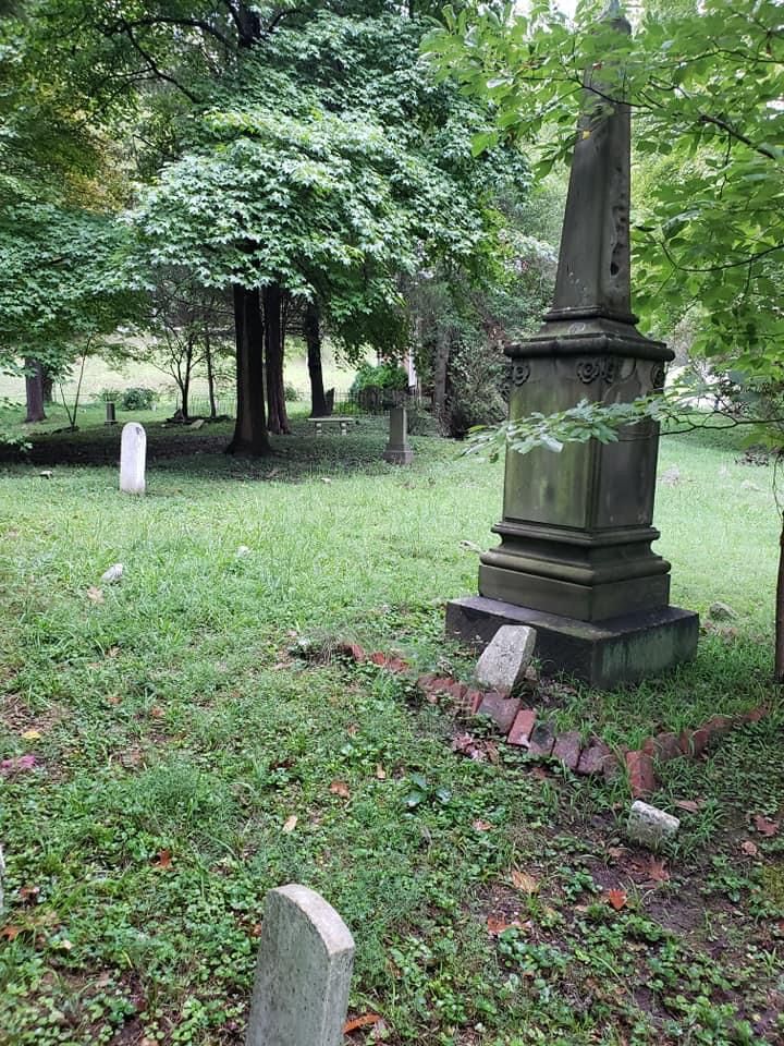
| Memorials | : | 4 |
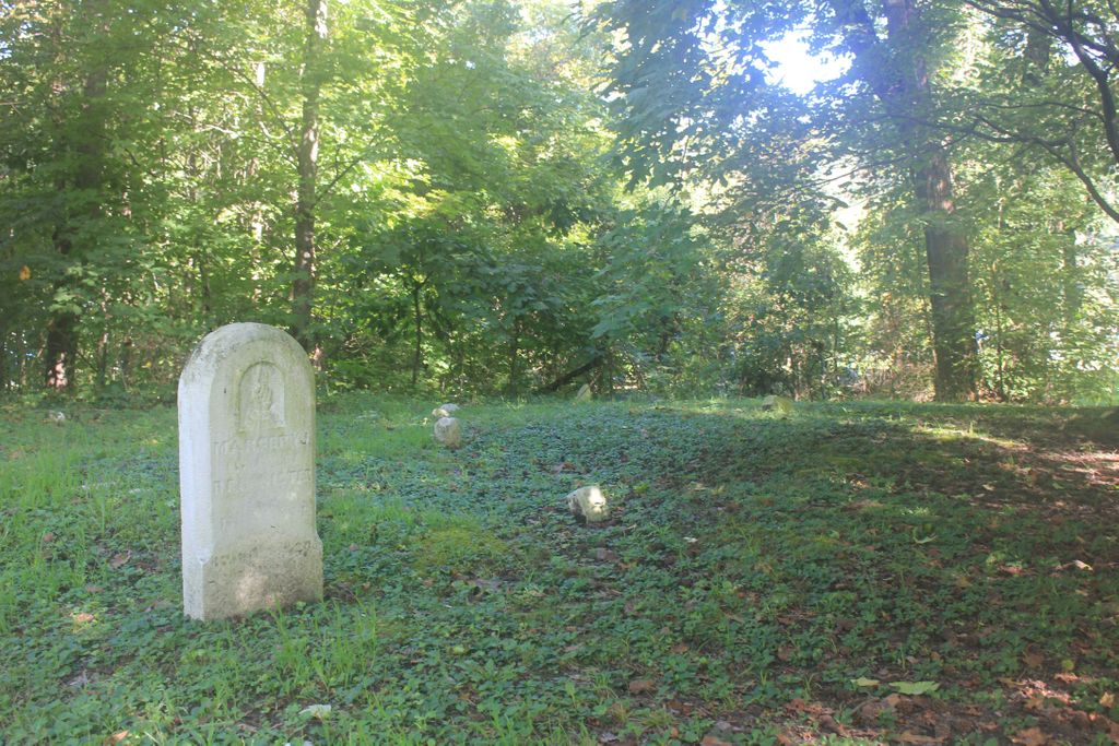
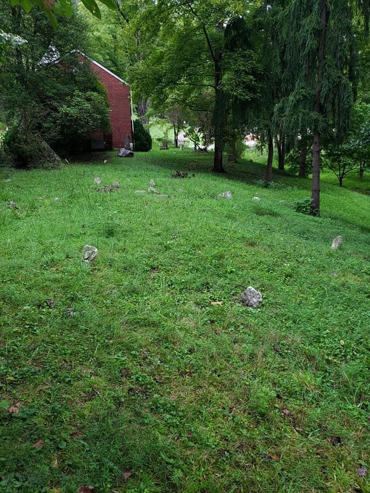
| Location | : | Cedar Grove, Kanawha County, USA |
| Coordinate | : | 38.2176700, -81.4259900 |
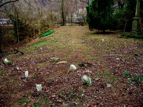
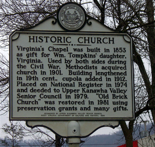
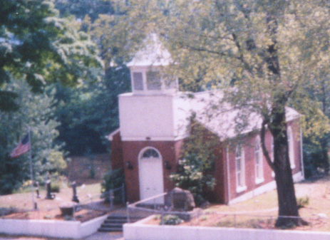
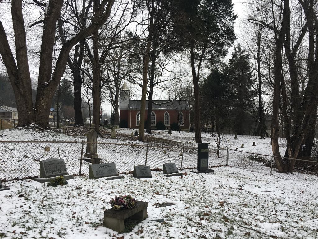
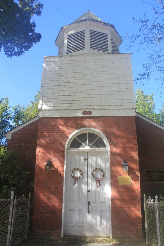
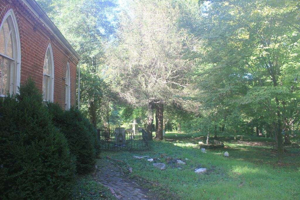
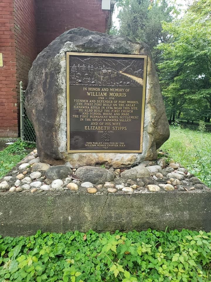
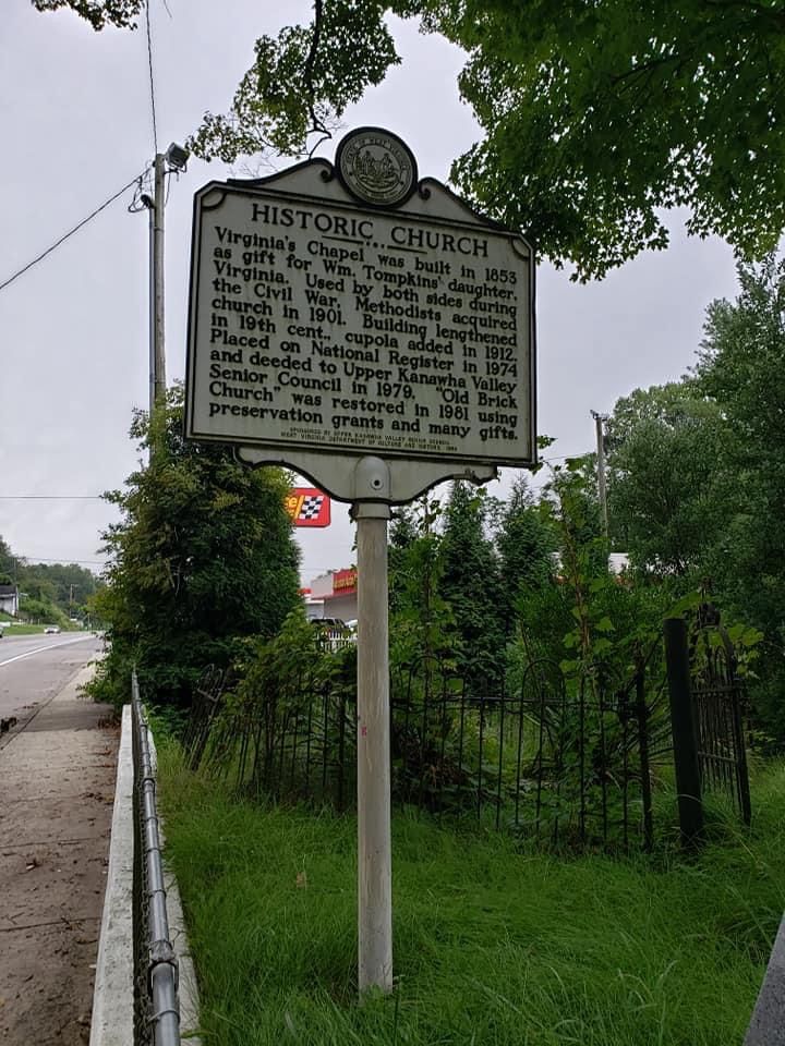
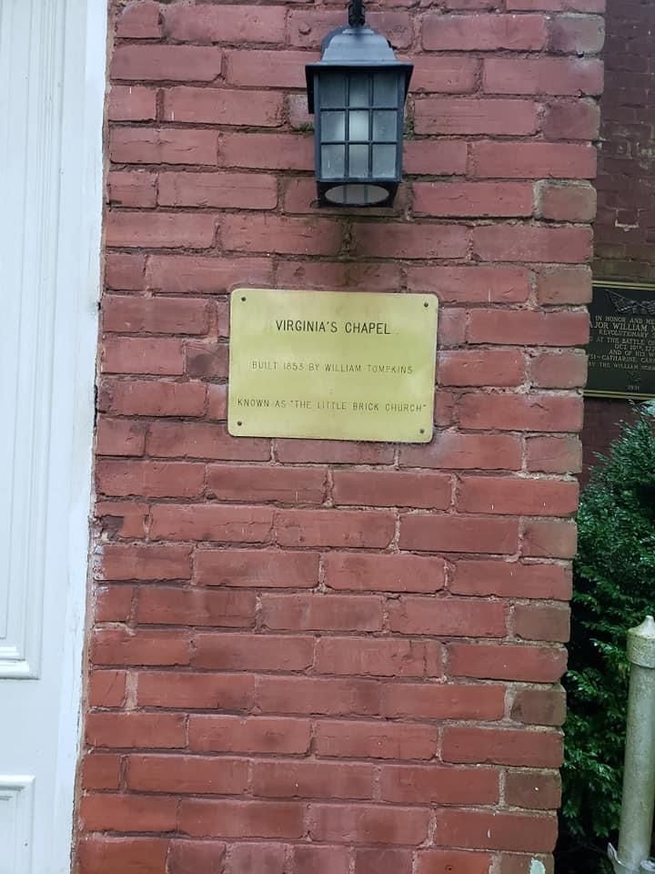
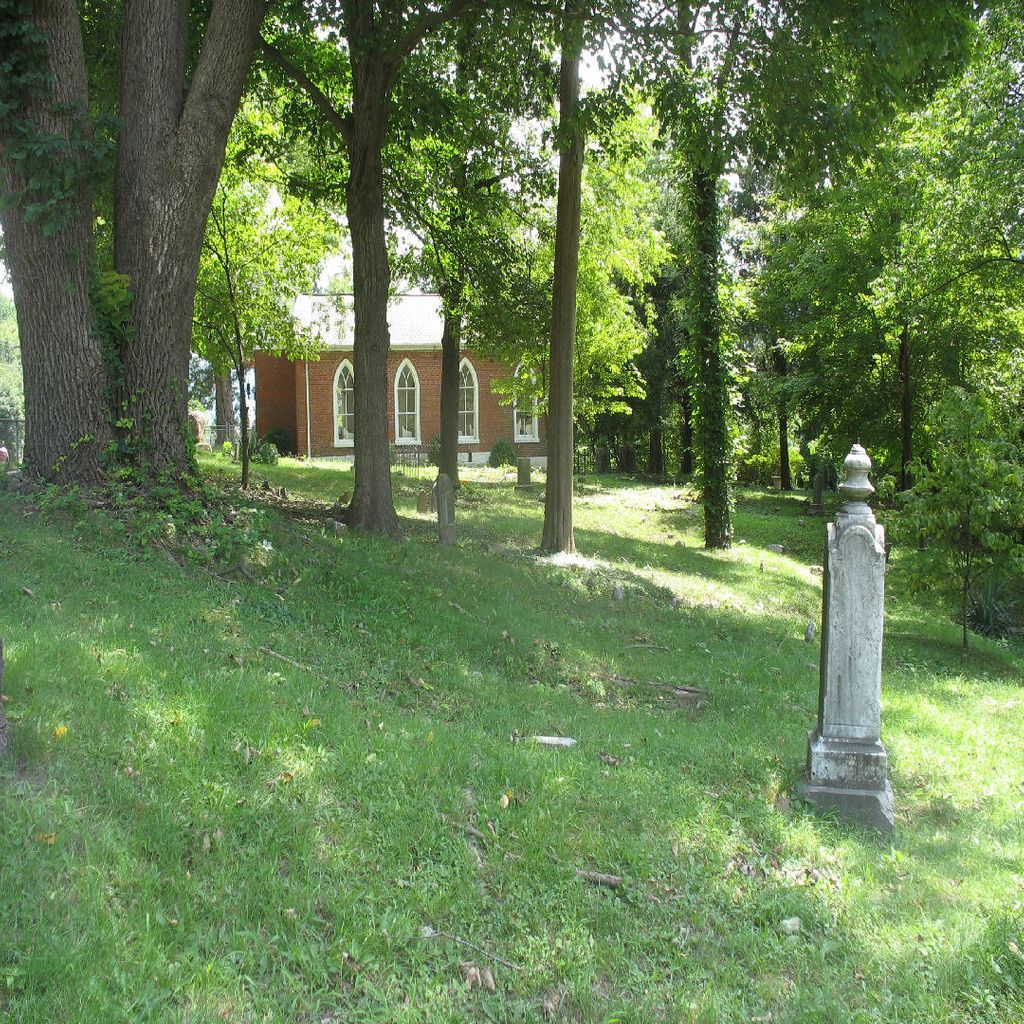
| Description | : | The Little Brick Church, also known as Virginia's Chapel and William Tompkins Church, is a small, brick historic church built in 1853 on a stone foundation. William’s daughter, Virginia, asked that the chapel be built rather than she have a graduation trip to Europe, hence the name. The land where the church sits along US Route 60 in Cedar Grove, Kanawha County, West Virginia was originally settled in 1773/4; it was the first permanent settlement in the Kanawha Valley. In 1774, 79 years before the church was built, Colonel Andrew Lewis marched members of the Virginia militia past the site where... Read More |
frequently asked questions (FAQ):
-
Where is Virginia's Chapel Cemetery?
Virginia's Chapel Cemetery is located at Cedar Grove, Kanawha County ,West Virginia ,USA.
-
Virginia's Chapel Cemetery cemetery's updated grave count on graveviews.com?
4 memorials
-
Where are the coordinates of the Virginia's Chapel Cemetery?
Latitude: 38.2176700
Longitude: -81.4259900
Nearby Cemetories:
1. Woodland Cemetery
Cedar Grove, Kanawha County, USA
Coordinate: 38.2182999, -81.4253006
2. Ward Cemetery
Cedar Grove, Kanawha County, USA
Coordinate: 38.2338982, -81.4175034
3. Mount Lewis Cemetery
Cedar Grove, Kanawha County, USA
Coordinate: 38.2344017, -81.4124985
4. Crown Hill Cemetery
Crown Hill, Kanawha County, USA
Coordinate: 38.1991700, -81.4134500
5. Coalburg Cemetery
Coalburg, Kanawha County, USA
Coordinate: 38.2122640, -81.4539250
6. Clark Cemetery
Dry Branch, Kanawha County, USA
Coordinate: 38.1850320, -81.4567380
7. Hensley Family Cemetery
Dry Branch, Kanawha County, USA
Coordinate: 38.1850014, -81.4574966
8. Dry Branch Cemetery
Dry Branch, Kanawha County, USA
Coordinate: 38.1814003, -81.4666977
9. Ronda Cemetery
Cabin Creek, Kanawha County, USA
Coordinate: 38.1721590, -81.4491930
10. Parsons Cemetery
Alum Creek, Kanawha County, USA
Coordinate: 38.1660400, -81.4540700
11. Gatewood Cemetery
Chelyan, Kanawha County, USA
Coordinate: 38.1941450, -81.4942650
12. Dickinson Cemetery (Defunct)
Kanawha County, USA
Coordinate: 38.2039300, -81.5018000
13. Slaughters Creek Cemetery
Chelyan, Kanawha County, USA
Coordinate: 38.1896590, -81.4987280
14. Witcher Cemetery
Belle, Kanawha County, USA
Coordinate: 38.2282982, -81.5093994
15. Simmons Creek Community Cemetery
Belle, Kanawha County, USA
Coordinate: 38.2556200, -81.5214700
16. Nelson Cemetery
Chesapeake, Kanawha County, USA
Coordinate: 38.2263700, -81.5431700
17. Belcher-White-Clay Cemetery
Blount, Kanawha County, USA
Coordinate: 38.3102250, -81.4264090
18. Garten Cemetery
Blount, Kanawha County, USA
Coordinate: 38.3138000, -81.4294400
19. Stewart Family Cemetery
Coal Fork, Kanawha County, USA
Coordinate: 38.3069813, -81.4976488
20. Landers-Elswick Cemetery
Cinco, Kanawha County, USA
Coordinate: 38.3311880, -81.4595910
21. Blakeley Cemetery
Blakeley, Kanawha County, USA
Coordinate: 38.2922770, -81.3050610
22. Spruce Cemetery
Cinco, Kanawha County, USA
Coordinate: 38.3365120, -81.4684240
23. Blount Cemetery
Coal Fork, Kanawha County, USA
Coordinate: 38.3078100, -81.5354040
24. Mount Hope Cemetery
Dawes, Kanawha County, USA
Coordinate: 38.1077995, -81.5186005