| Memorials | : | 9 |
| Location | : | Vane Asaka, Trollhättans kommun, Sweden |
| Phone | : | +46(521)265850 |
| Website | : | www.svenskakyrkan.se/tunhem/vane-asaka-kyrka |
| Coordinate | : | 58.2457880, 12.4180760 |
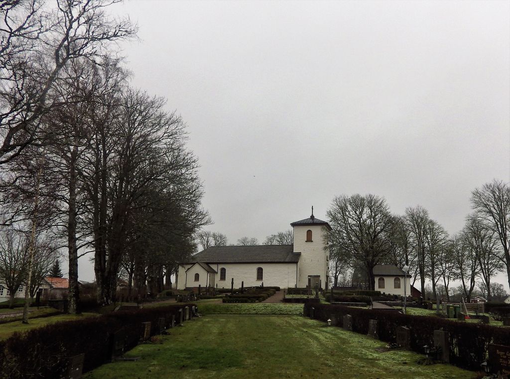
| Description | : | Väne Åsaka church. The oldest parts of the west side of the church probably date from the 12th century. There are no descriptions of the church's building history during the Middle Ages. In 1836 the church got a tower. Previously, the bells were hung in a pole. The church has undergone several restorations. At one of these, in 1750, the church was provided with ceiling paintings, which were removed in 1898. The church got its current appearance during the restoration, which was carried out in 1935. Among the fixtures is the medieval baptismal font, possibly from the 13th century, the pulpit... Read More |
frequently asked questions (FAQ):
-
Where is Väne Åsaka kyrkogård?
Väne Åsaka kyrkogård is located at Vänebyvägen 46 Vane Asaka, Trollhättans kommun ,Västra Götalands län , 461 94Sweden.
-
Väne Åsaka kyrkogård cemetery's updated grave count on graveviews.com?
1 memorials
-
Where are the coordinates of the Väne Åsaka kyrkogård?
Latitude: 58.2457880
Longitude: 12.4180760
Nearby Cemetories:
1. Gärdhems Kyrka
Trollhättans kommun, Sweden
Coordinate: 58.2444710, 12.3344010
2. Västra Tunhems kyrkogård
Tunhem, Vänersborgs kommun, Sweden
Coordinate: 58.3102480, 12.4016580
3. Götalundens kyrkogård
Trollhattan, Trollhättans kommun, Sweden
Coordinate: 58.2871900, 12.3035540
4. Stora Mellby kyrka
Stora Mellby, Alingsås kommun, Sweden
Coordinate: 58.1416667, 12.5783396
5. Vänersborgs strandkyrkogård
Vänersborgs kommun, Sweden
Coordinate: 58.3732990, 12.3192070
6. Kapellkyrkogården
Vänersborgs kommun, Sweden
Coordinate: 58.3767697, 12.3194940
7. Tengene kyrkogård
Grästorps kommun, Sweden
Coordinate: 58.3077900, 12.6661620
8. Tengene kyrkogård
Grästorps kommun, Sweden
Coordinate: 58.3077900, 12.6661620
9. Bäreberg Cemetery
Essunga kommun, Sweden
Coordinate: 58.2067226, 12.7205270
10. Vänersnäs Kyrka
Vänersborgs kommun, Sweden
Coordinate: 58.3974770, 12.5659194
11. Hjärtum kyrkogård
Hjartum, Lilla Edets kommun, Sweden
Coordinate: 58.1815580, 12.1101830
12. Hyringa ödekyrkogård
Hyringa, Grästorps kommun, Sweden
Coordinate: 58.2926790, 12.7683480
13. Essunga
Essunga kommun, Sweden
Coordinate: 58.1822346, 12.7838108
14. Vãsterlanda Kyrkogård
Vasterlanda, Lilla Edets kommun, Sweden
Coordinate: 58.0905200, 12.1200500
15. Fåglums Nya Kyrkogård
Essunga kommun, Sweden
Coordinate: 58.1258998, 12.7792135
16. Fåglums gamla kyrkogård
Essunga kommun, Sweden
Coordinate: 58.1223601, 12.7757212
17. Sparlösa Kyrkogård
Sparlosa, Vara kommun, Sweden
Coordinate: 58.3358930, 12.8316680
18. Södra Kedum Kyrkogård
Vara, Vara kommun, Sweden
Coordinate: 58.2396225, 12.8730965
19. Timmerviks kyrkogård
Bralanda, Vänersborgs kommun, Sweden
Coordinate: 58.4853974, 12.3892662
20. Barne-Åsaka
Essunga kommun, Sweden
Coordinate: 58.1418128, 12.8318773
21. Ryda kyrkogård
Ryda, Vara kommun, Sweden
Coordinate: 58.2868140, 12.8839170
22. Sigelhults Cemetery
Uddevalla, Uddevalla kommun, Sweden
Coordinate: 58.3372640, 11.9635530
23. Fullestad kyrka
Vårgårda, Vårgårda kommun, Sweden
Coordinate: 58.0297890, 12.6960560
24. Resteröds kyrkogård
Ljungskile, Uddevalla kommun, Sweden
Coordinate: 58.2333336, 11.9166670

