| Memorials | : | 168 |
| Location | : | Tunhem, Vänersborgs kommun, Sweden |
| Phone | : | +46(521)265850 |
| Website | : | www.svenskakyrkan.se/tunhem |
| Coordinate | : | 58.3102480, 12.4016580 |
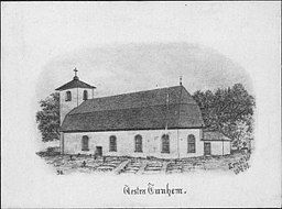
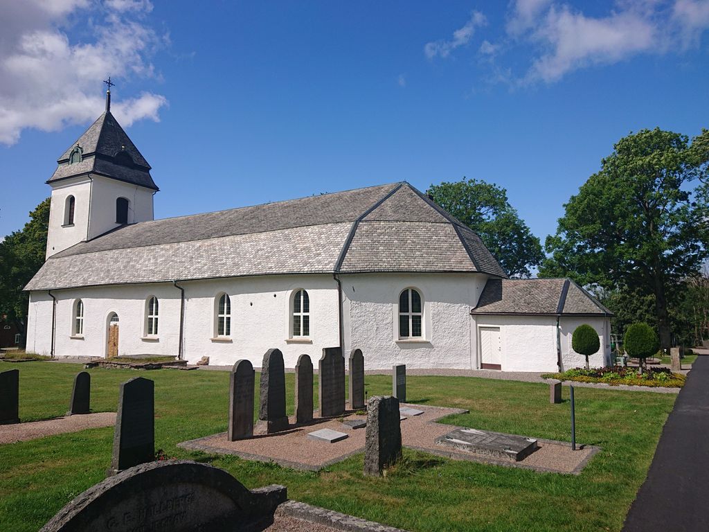
| Description | : | The church and cemetery are located by Hunneberg's precipice slope among oak groves and burial grounds and the cemetery is park-like. The oldest components date from the late 12th century. The building was extended to the west in the 15th century. The current appearance was given to the church during the major rebuilding 1736-1740 when the nave was widened and a three-sided finished chancel was erected. The tower was not built until 1810. The interior is three-nave and two rows of pillars support the roof. A wide cornice is decorated with scenes from biblical history made in 1755 by Johan Wahlin. |
frequently asked questions (FAQ):
-
Where is Västra Tunhems kyrkogård?
Västra Tunhems kyrkogård is located at Prästgården 350 Tunhem, Vänersborgs kommun ,Västra Götalands län , 461 93Sweden.
-
Västra Tunhems kyrkogård cemetery's updated grave count on graveviews.com?
168 memorials
-
Where are the coordinates of the Västra Tunhems kyrkogård?
Latitude: 58.3102480
Longitude: 12.4016580
Nearby Cemetories:
1. Götalundens kyrkogård
Trollhattan, Trollhättans kommun, Sweden
Coordinate: 58.2871900, 12.3035540
2. Väne Åsaka kyrkogård
Vane Asaka, Trollhättans kommun, Sweden
Coordinate: 58.2457880, 12.4180760
3. Gärdhems Kyrka
Trollhättans kommun, Sweden
Coordinate: 58.2444710, 12.3344010
4. Vänersborgs strandkyrkogård
Vänersborgs kommun, Sweden
Coordinate: 58.3732990, 12.3192070
5. Kapellkyrkogården
Vänersborgs kommun, Sweden
Coordinate: 58.3767697, 12.3194940
6. Vänersnäs Kyrka
Vänersborgs kommun, Sweden
Coordinate: 58.3974770, 12.5659194
7. Tengene kyrkogård
Grästorps kommun, Sweden
Coordinate: 58.3077900, 12.6661620
8. Tengene kyrkogård
Grästorps kommun, Sweden
Coordinate: 58.3077900, 12.6661620
9. Timmerviks kyrkogård
Bralanda, Vänersborgs kommun, Sweden
Coordinate: 58.4853974, 12.3892662
10. Stora Mellby kyrka
Stora Mellby, Alingsås kommun, Sweden
Coordinate: 58.1416667, 12.5783396
11. Hyringa ödekyrkogård
Hyringa, Grästorps kommun, Sweden
Coordinate: 58.2926790, 12.7683480
12. Bäreberg Cemetery
Essunga kommun, Sweden
Coordinate: 58.2067226, 12.7205270
13. Hjärtum kyrkogård
Hjartum, Lilla Edets kommun, Sweden
Coordinate: 58.1815580, 12.1101830
14. Sparlösa Kyrkogård
Sparlosa, Vara kommun, Sweden
Coordinate: 58.3358930, 12.8316680
15. Sigelhults Cemetery
Uddevalla, Uddevalla kommun, Sweden
Coordinate: 58.3372640, 11.9635530
16. Essunga
Essunga kommun, Sweden
Coordinate: 58.1822346, 12.7838108
17. Östra kyrkogården
Uddevalla, Uddevalla kommun, Sweden
Coordinate: 58.3474288, 11.9485080
18. Norra kyrkogård
Uddevalla, Uddevalla kommun, Sweden
Coordinate: 58.3527100, 11.9358900
19. Kapelle kyrkogård
Uddevalla, Uddevalla kommun, Sweden
Coordinate: 58.3396867, 11.9274386
20. Ryda kyrkogård
Ryda, Vara kommun, Sweden
Coordinate: 58.2868140, 12.8839170
21. Ramneröds kyrkogård
Uddevalla, Uddevalla kommun, Sweden
Coordinate: 58.3616800, 11.9260400
22. Södra Kedum Kyrkogård
Vara, Vara kommun, Sweden
Coordinate: 58.2396225, 12.8730965
23. Slädene Cemetery
Sparlosa, Vara kommun, Sweden
Coordinate: 58.3731650, 12.8834091
24. Vãsterlanda Kyrkogård
Vasterlanda, Lilla Edets kommun, Sweden
Coordinate: 58.0905200, 12.1200500


