
| Memorials | : | 0 |
| Location | : | Putzbrunn, Landkreis München, Germany |
| Coordinate | : | 48.0702927, 11.7071604 |
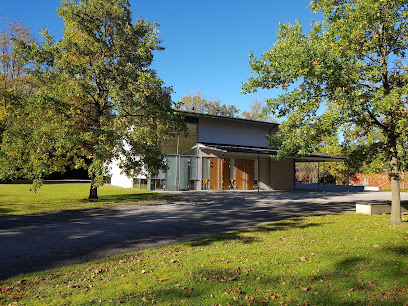
| Description | : | Contact: Tel: 089 46262-320 E-Mail: [email protected] This is the communal cemetery in the village of Putzbrunn. It's only 1.6 acres in size and was established inn 2004. The older (Catholic) cemetery is near the St. Stephen Church in the center of the village. Please note that the graves in Germany are not perpetual. After a certain period of repose (20-30 years) the graves are being leveled and re-used. There is no toxic embalming being done in Germany, so the coffin and the corpse can decompose naturally. If the family of the deceased decides to purchase another period the duration can be extended by another... Read More |
frequently asked questions (FAQ):
-
Where is Waldfriedhof Putzbrunn?
Waldfriedhof Putzbrunn is located at Niedweg 15 Putzbrunn, Landkreis München ,Bavaria (Bayern) , 85640Germany.
-
Waldfriedhof Putzbrunn cemetery's updated grave count on graveviews.com?
0 memorials
-
Where are the coordinates of the Waldfriedhof Putzbrunn?
Latitude: 48.0702927
Longitude: 11.7071604
Nearby Cemetories:
1. Katholischer Friedhof Putzbrunn
Putzbrunn, Landkreis München, Germany
Coordinate: 48.0756733, 11.7162485
2. Friedhof Hohenbrunn
Hohenbrunn, Landkreis München, Germany
Coordinate: 48.0514440, 11.7001600
3. St. Aegidius
Grasbrunn, Landkreis München, Germany
Coordinate: 48.0962000, 11.7262100
4. Waldfriedhof Haar
Haar, Landkreis München, Germany
Coordinate: 48.1023386, 11.7260159
5. Waldfriedhof Neukeferloh
Neukeferloh, Landkreis München, Germany
Coordinate: 48.0880307, 11.7577478
6. Friedhof Ottobrunn
Ottobrunn, Landkreis München, Germany
Coordinate: 48.0611534, 11.6506577
7. Friedhof Neubiberg
Neubiberg, Landkreis München, Germany
Coordinate: 48.0765420, 11.6483910
8. Friedhof Haar
Haar, Landkreis München, Germany
Coordinate: 48.1094825, 11.7243616
9. Friedhof Perlach
Perlach, Stadtkreis München, Germany
Coordinate: 48.0986330, 11.6417190
10. Friedhof Unterhaching
Unterhaching, Landkreis München, Germany
Coordinate: 48.0591670, 11.6275000
11. Pfarrfriedhof St.Leonhard
Höhenkirchen-Siegertsbrunn, Landkreis München, Germany
Coordinate: 48.0179100, 11.7323400
12. Friedhof Vaterstetten
Vaterstetten, Landkreis Ebersberg, Germany
Coordinate: 48.1065700, 11.7749400
13. St. Michael Church Cemetery
Perlach, Stadtkreis München, Germany
Coordinate: 48.1016400, 11.6314100
14. Neuer Südfriedhof
Perlach, Stadtkreis München, Germany
Coordinate: 48.1009100, 11.6239400
15. Friedhof Riem
Riem, Stadtkreis München, Germany
Coordinate: 48.1321000, 11.6800400
16. Friedhof Taufkirchen
Taufkirchen, Landkreis München, Germany
Coordinate: 48.0439911, 11.6171618
17. Friedhof Riem-Neuer Teil
Riem, Stadtkreis München, Germany
Coordinate: 48.1354630, 11.6793450
18. St. Michael in Berg am Laim
Berg am Laim, Stadtkreis München, Germany
Coordinate: 48.1251500, 11.6301800
19. Kirchhof Sankt Maria Ramersdorf
Ramersdorf, Stadtkreis München, Germany
Coordinate: 48.1140950, 11.6150460
20. St. Mina in Berg am Laim
Berg am Laim, Stadtkreis München, Germany
Coordinate: 48.1269200, 11.6295700
21. Friedhof Feldkirchen
Feldkirchen, Landkreis München, Germany
Coordinate: 48.1453530, 11.7367380
22. Gemeindefriedhof Taufkirchen
Taufkirchen, Landkreis München, Germany
Coordinate: 48.0475575, 11.5946541
23. Friedhof am Perlacher Forst
Fasangarten, Stadtkreis München, Germany
Coordinate: 48.0991470, 11.5964970
24. Gemeindefriedhof Zorneding
Zorneding, Landkreis Ebersberg, Germany
Coordinate: 48.0795380, 11.8265320