
| Memorials | : | 0 |
| Location | : | Perlach, Stadtkreis München, Germany |
| Coordinate | : | 48.0986330, 11.6417190 |
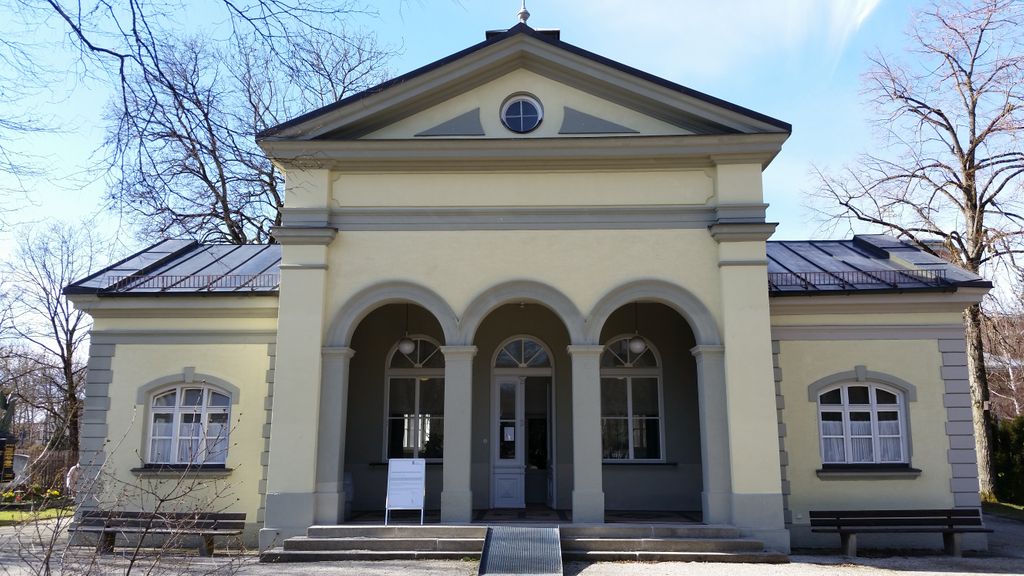
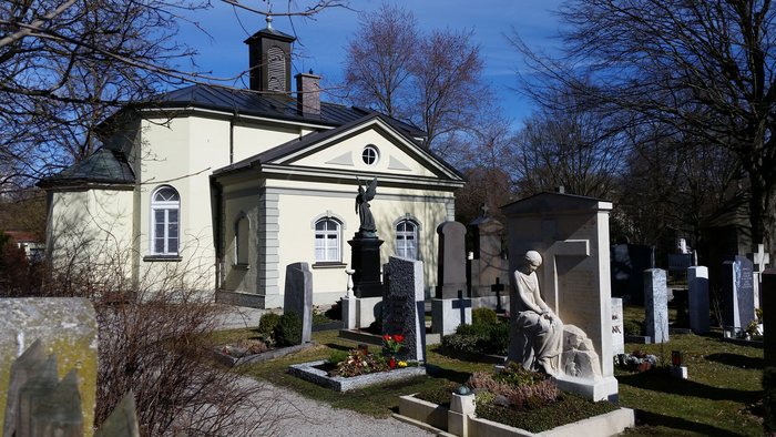
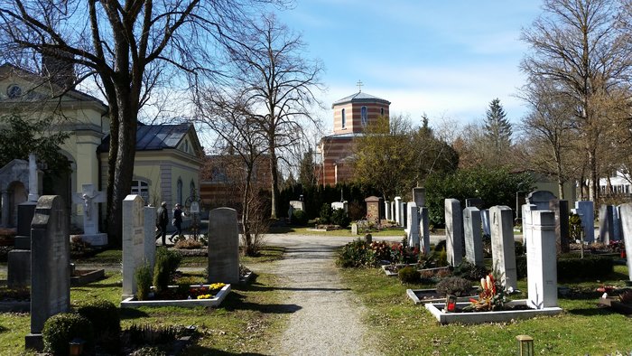
| Description | : | Not to be confused with the Friedhof am Perlacher Forst. This cemetery was opened in 1902 and has a size of only 0.6 acres. Please note that the graves in Germany are not perpetual. After a certain period of repose (20-30 years) the graves are being leveled and re-used. There is no toxic embalming being done in Germany, so the coffin and the corpse have decomposed naturally. If the family of the deceased decides to purchase another period the duration can be extended by another 30 years. War Graves are considered memorials and are kept up by the owner of the... Read More |
frequently asked questions (FAQ):
-
Where is Friedhof Perlach?
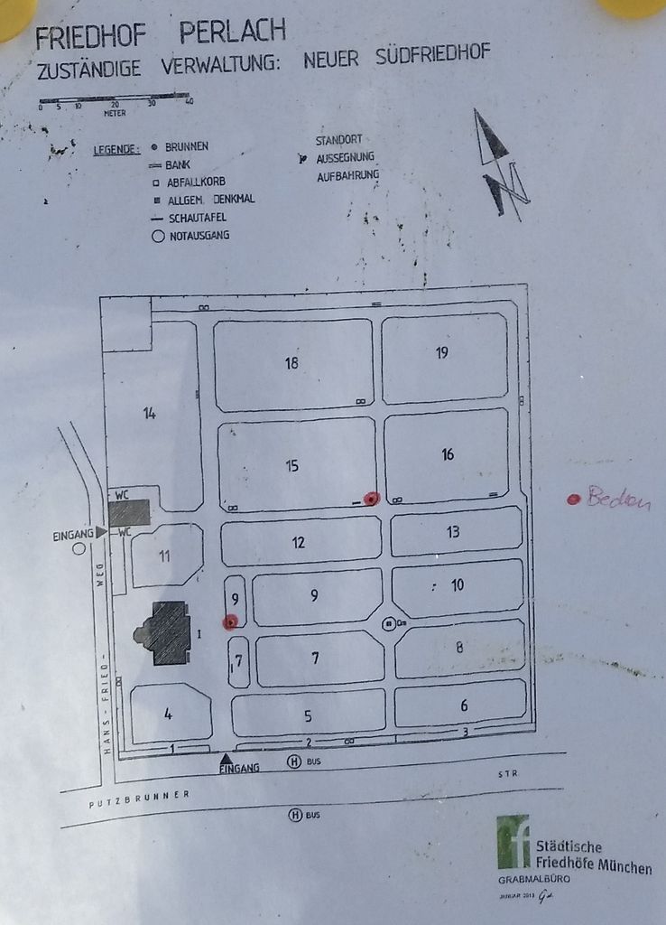
Friedhof Perlach is located at Putzbrunner Strasse 51 Perlach, Stadtkreis München ,Bavaria (Bayern) , 81739Germany.
-
Friedhof Perlach cemetery's updated grave count on graveviews.com?
0 memorials
-
Where are the coordinates of the Friedhof Perlach?
Latitude: 48.0986330
Longitude: 11.6417190
Nearby Cemetories:
1. St. Michael Church Cemetery
Perlach, Stadtkreis München, Germany
Coordinate: 48.1016400, 11.6314100
2. Neuer Südfriedhof
Perlach, Stadtkreis München, Germany
Coordinate: 48.1009100, 11.6239400
3. Friedhof Neubiberg
Neubiberg, Landkreis München, Germany
Coordinate: 48.0765420, 11.6483910
4. Kirchhof Sankt Maria Ramersdorf
Ramersdorf, Stadtkreis München, Germany
Coordinate: 48.1140950, 11.6150460
5. St. Michael in Berg am Laim
Berg am Laim, Stadtkreis München, Germany
Coordinate: 48.1251500, 11.6301800
6. St. Mina in Berg am Laim
Berg am Laim, Stadtkreis München, Germany
Coordinate: 48.1269200, 11.6295700
7. Friedhof am Perlacher Forst
Fasangarten, Stadtkreis München, Germany
Coordinate: 48.0991470, 11.5964970
8. Friedhof Ottobrunn
Ottobrunn, Landkreis München, Germany
Coordinate: 48.0611534, 11.6506577
9. Ostfriedhof München
Giesing, Stadtkreis München, Germany
Coordinate: 48.1177788, 11.5888891
10. Friedhof Unterhaching
Unterhaching, Landkreis München, Germany
Coordinate: 48.0591670, 11.6275000
11. Ostfriedhof Munich
Munich (München), Stadtkreis München, Germany
Coordinate: 48.1201101, 11.5900883
12. Friedhof Riem
Riem, Stadtkreis München, Germany
Coordinate: 48.1321000, 11.6800400
13. Haidhauser Friedhof
Haidhausen, Stadtkreis München, Germany
Coordinate: 48.1340670, 11.6043190
14. Friedhof Riem-Neuer Teil
Riem, Stadtkreis München, Germany
Coordinate: 48.1354630, 11.6793450
15. Waldfriedhof Putzbrunn
Putzbrunn, Landkreis München, Germany
Coordinate: 48.0702927, 11.7071604
16. Friedhof Daglfing
Daglfing, Stadtkreis München, Germany
Coordinate: 48.1524050, 11.6573840
17. Katholischer Friedhof Putzbrunn
Putzbrunn, Landkreis München, Germany
Coordinate: 48.0756733, 11.7162485
18. Bogenhausener Friedhof
Bogenhausen, Stadtkreis München, Germany
Coordinate: 48.1477780, 11.6013890
19. Friedhof Haar
Haar, Landkreis München, Germany
Coordinate: 48.1094825, 11.7243616
20. Waldfriedhof Haar
Haar, Landkreis München, Germany
Coordinate: 48.1023386, 11.7260159
21. St. Aegidius
Grasbrunn, Landkreis München, Germany
Coordinate: 48.0962000, 11.7262100
22. Friedhof Taufkirchen
Taufkirchen, Landkreis München, Germany
Coordinate: 48.0439911, 11.6171618
23. Peterskirche
Altstadt, Stadtkreis München, Germany
Coordinate: 48.1364900, 11.5760200
24. Jakobskirche
Altstadt, Stadtkreis München, Germany
Coordinate: 48.1340860, 11.5720260