
| Memorials | : | 4 |
| Location | : | Fultondale, Jefferson County, USA |
| Phone | : | 205-849-5022 |
| Coordinate | : | 33.6046982, -86.8171997 |
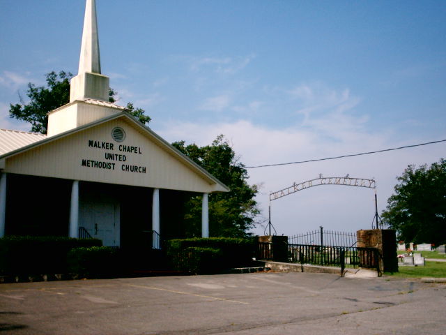
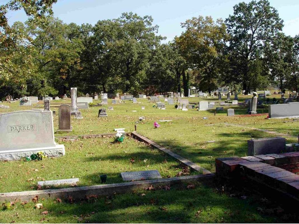
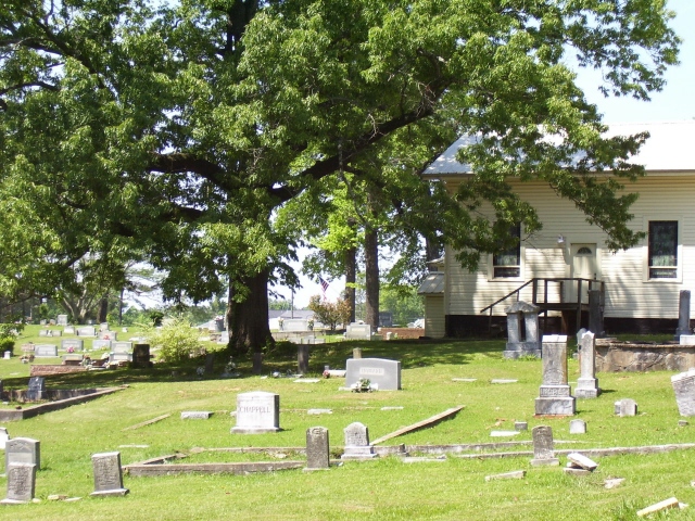
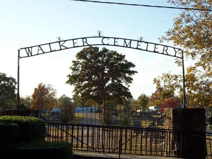
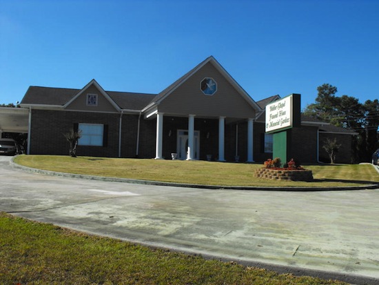
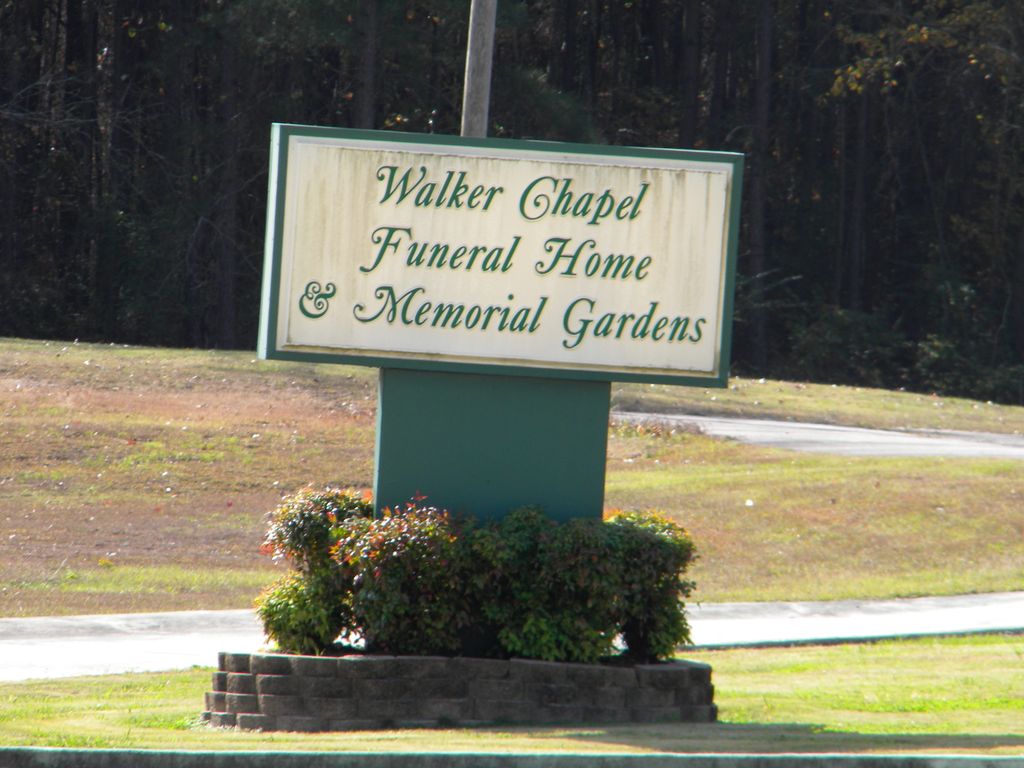
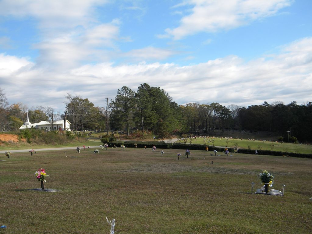
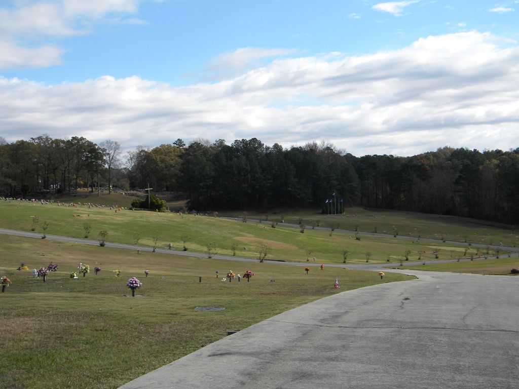
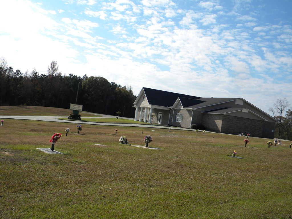
| Description | : | Walker Chapel Memorial Gardens is located on 1200 Ellard Road in Fultondale, Alabama and is easily accessible from Interstate 65 and Hwy 31 and other major roadways in North Jefferson County. Sitting peacefully off Walker Chapel Road and Ellard Road, behind Walker Chapel Cemetery, the memorial gardens offers traditional earth burial, a mausoleum, and a cremation niche columbarium. Walker Chapel Memorial Gardens offers five developed, well maintained gardens that offer peaceful tranquility that is hard to find this day and time, matched with a convenient, accessible location. |
frequently asked questions (FAQ):
-
Where is Walker Chapel Memorial Gardens?
Walker Chapel Memorial Gardens is located at 1200 Ellard Road Fultondale, Jefferson County ,Alabama ,USA.
-
Walker Chapel Memorial Gardens cemetery's updated grave count on graveviews.com?
3 memorials
-
Where are the coordinates of the Walker Chapel Memorial Gardens?
Latitude: 33.6046982
Longitude: -86.8171997
Nearby Cemetories:
1. Cluster Springs Cemetery
Gardendale, Jefferson County, USA
Coordinate: 33.6302986, -86.8323975
2. Coalburg Cemetery
Fultondale, Jefferson County, USA
Coordinate: 33.5971470, -86.8614090
3. Mason Cemetery
Birmingham, Jefferson County, USA
Coordinate: 33.5612810, -86.8224330
4. Hodges Cemetery
Jefferson County, USA
Coordinate: 33.6225014, -86.8743973
5. New Castle Cemetery
New Castle, Jefferson County, USA
Coordinate: 33.6404300, -86.7732400
6. Inglenook Cemetery
Jefferson County, USA
Coordinate: 33.5630989, -86.7778015
7. Pawnee Missionary Baptist Church Cemetery
Birmingham, Jefferson County, USA
Coordinate: 33.6302170, -86.7480170
8. Hillview Baptist Church Cemetery
Forestdale, Jefferson County, USA
Coordinate: 33.5728378, -86.8835297
9. Oakwood Memorial Gardens
Gardendale, Jefferson County, USA
Coordinate: 33.6730150, -86.8158320
10. Moncrief Cemetery
Gardendale, Jefferson County, USA
Coordinate: 33.6730995, -86.8139038
11. Greenwood Cemetery
Birmingham, Jefferson County, USA
Coordinate: 33.5522003, -86.7528000
12. Forest Hill Cemetery
Birmingham, Jefferson County, USA
Coordinate: 33.5485992, -86.7542038
13. Bivens Chapel Cemetery
Brookside, Jefferson County, USA
Coordinate: 33.6203003, -86.9092026
14. Higgins Cemetery
Jefferson County, USA
Coordinate: 33.5881004, -86.7249985
15. Oak Hill Cemetery
Birmingham, Jefferson County, USA
Coordinate: 33.5252991, -86.8167038
16. Zion Memorial Gardens
Birmingham, Jefferson County, USA
Coordinate: 33.5908050, -86.7225660
17. Enon Ridge Cemetery
Birmingham, Jefferson County, USA
Coordinate: 33.5230940, -86.8313210
18. John Belcher Cemetery
Gardendale, Jefferson County, USA
Coordinate: 33.6874100, -86.8176000
19. Knesses Israel Cemetery
Birmingham, Jefferson County, USA
Coordinate: 33.5224991, -86.8311005
20. Wood Cemetery
Birmingham, Jefferson County, USA
Coordinate: 33.5427246, -86.7507935
21. Temple Emanu-El Cemetery
Birmingham, Jefferson County, USA
Coordinate: 33.5214005, -86.8308029
22. Cathedral Church of the Advent Rector's Garden
Birmingham, Jefferson County, USA
Coordinate: 33.5193760, -86.8085310
23. East Lake Cemetery
Birmingham, Jefferson County, USA
Coordinate: 33.5621986, -86.7266998
24. Cathedral of Saint Paul Columbarium
Birmingham, Jefferson County, USA
Coordinate: 33.5179370, -86.8047180