
| Memorials | : | 0 |
| Location | : | Adair County, USA |
| Coordinate | : | 35.9108009, -94.6616974 |
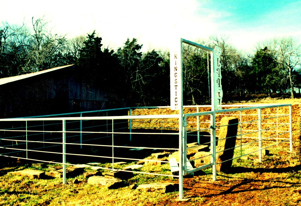
| Description | : | This cemetery is located in the SE4,NW4, SW4 of Section 4, Township 16N, Range 25E. It is located approximately two miles west of Baron in Adair County, Oklahoma. In 1937, Gus Hummingbird surveyed this cemetery through his work with the Works Progress Administration. He recorded the existence of approximately twenty-five graves in this cemetery, five of which contained tombstones. Source: Gus Hummingbird, May 5, 1937. Burial Ground Form, Indian-Pioneer Papers, Western History Collections, University of Oklahoma, Norman, OK. |
frequently asked questions (FAQ):
-
Where is Walkingstick Cemetery?
Walkingstick Cemetery is located at Adair County ,Oklahoma ,USA.
-
Walkingstick Cemetery cemetery's updated grave count on graveviews.com?
0 memorials
-
Where are the coordinates of the Walkingstick Cemetery?
Latitude: 35.9108009
Longitude: -94.6616974
Nearby Cemetories:
1. Knight Cemetery
Baron, Adair County, USA
Coordinate: 35.9107444, -94.6622000
2. Wolf Cemetery
Adair County, USA
Coordinate: 35.9166985, -94.6446991
3. Lincoln England Family Cemetery
Stilwell, Adair County, USA
Coordinate: 35.9274200, -94.6613600
4. Reese Cemetery
Adair County, USA
Coordinate: 35.8861008, -94.6430969
5. England Cemetery
Baron, Adair County, USA
Coordinate: 35.8818000, -94.6668000
6. Youngwolfe Cemetery
Christie, Adair County, USA
Coordinate: 35.9348090, -94.6828410
7. Thornton Cemetery
Addielee, Adair County, USA
Coordinate: 35.9378100, -94.6425280
8. Chewey Cemetery
Christie, Adair County, USA
Coordinate: 35.9285710, -94.6944440
9. Blackwood Cemetery
Stilwell, Adair County, USA
Coordinate: 35.8792000, -94.6481018
10. Terrell Cemetery
Adair County, USA
Coordinate: 35.8972400, -94.6231400
11. Ketcher Cemetery
Stilwell, Adair County, USA
Coordinate: 35.8758011, -94.6544037
12. Whitmire Cemetery
Christie, Adair County, USA
Coordinate: 35.9463889, -94.6641667
13. Easky Cemetery
Baron, Adair County, USA
Coordinate: 35.9018150, -94.6183280
14. Scraper Cemetery
Adair County, USA
Coordinate: 35.9131012, -94.7097015
15. Shell Cemetery
Stilwell, Adair County, USA
Coordinate: 35.8903021, -94.6201321
16. Clyne Cemetery
Baron, Adair County, USA
Coordinate: 35.9139400, -94.6053700
17. Downing Cemetery
Baron, Adair County, USA
Coordinate: 35.9271100, -94.6014100
18. Vaughn Family Cemetery
Sanders, Adair County, USA
Coordinate: 35.9014100, -94.7261800
19. Wilkerson Cemetery
Christie, Adair County, USA
Coordinate: 35.9618750, -94.6887990
20. Mulberry Hollow Cemetery
Adair County, USA
Coordinate: 35.8625000, -94.6995000
21. Tyler Spring Cemetery
Stilwell, Adair County, USA
Coordinate: 35.8460999, -94.6296997
22. Old Green Cemetery
Westville, Adair County, USA
Coordinate: 35.9770000, -94.6260000
23. Spade Mountain Cemetery
Spade Mountain, Adair County, USA
Coordinate: 35.8780000, -94.7420000
24. Corntassel Cemetery
Westville, Adair County, USA
Coordinate: 35.9815250, -94.6213310