
| Memorials | : | 0 |
| Location | : | North Sandwich, Carroll County, USA |
| Coordinate | : | 43.8678460, -71.3950260 |
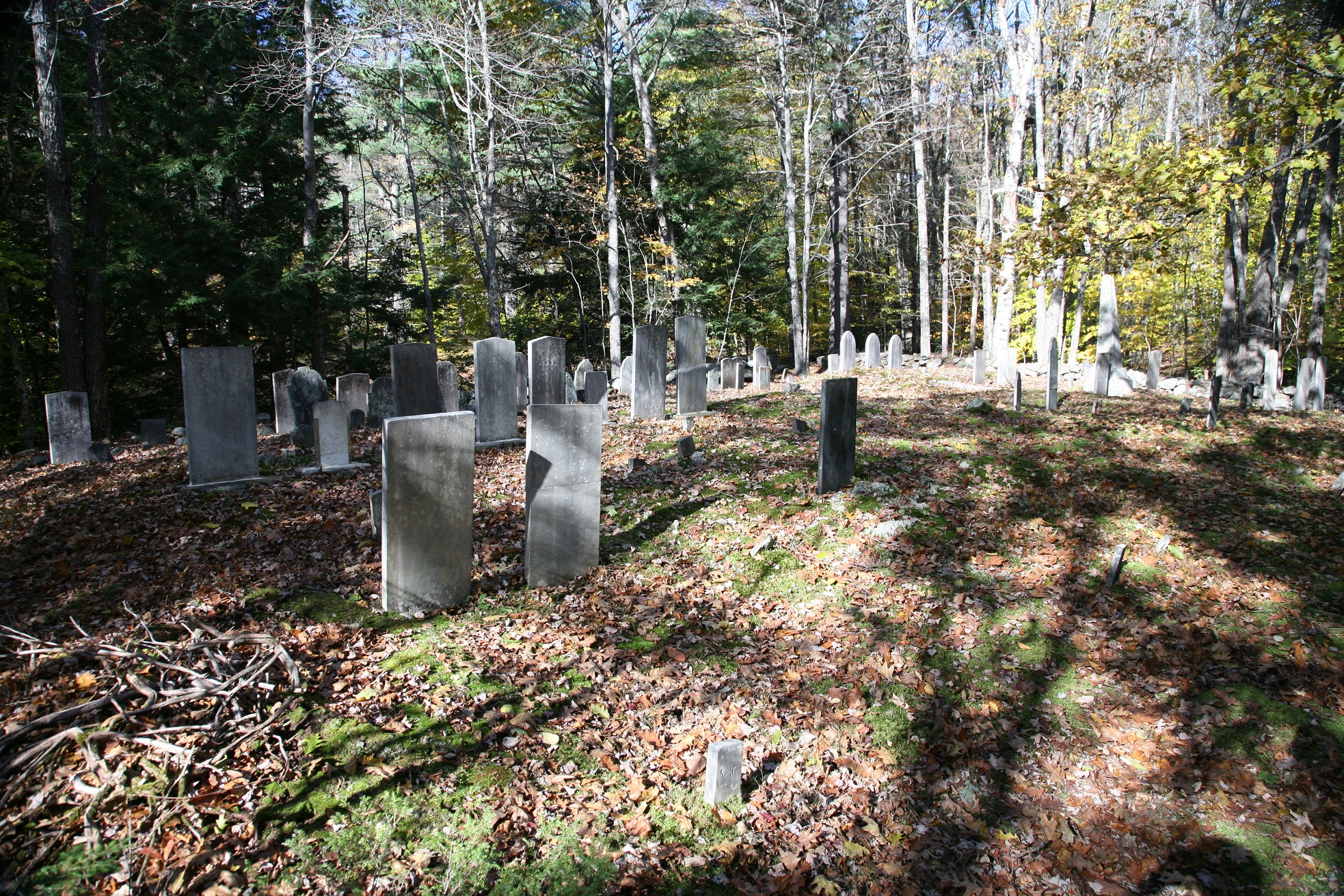
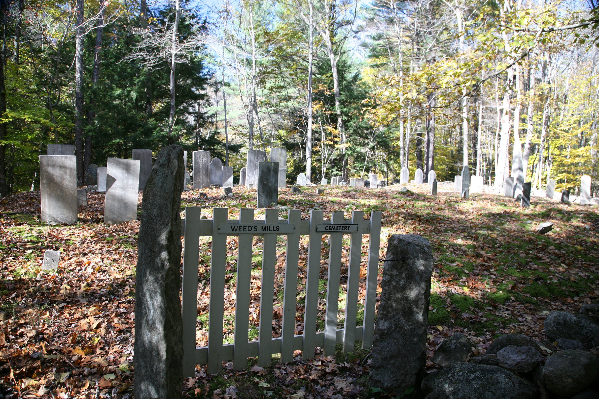
| Description | : | Identified as S05-057, Weed's Mills, by New Hampshire Old Graveyard Association (NHOGA). On the north side of Quaker-Whiteface Road east of the intersection with NH Route 113A in North Sandwich, Carroll County, NH. The cemetery is about 300 feet from the intersection, about 10 feet uphill from the road. Just past it is the entrance to the local tennis court. Pull in the driveway, and park on the left of the driveway. USGS Center Sandwich Quadrangle, E30750, N485979, Zone 19 (43° 52' 5"N, 71° 23' 44"W) Documented by a 1977 Sandwich Historical Society Excursion. See page 25 of their bulletin... Read More |
frequently asked questions (FAQ):
-
Where is Weeds Mills Cemetery?
Weeds Mills Cemetery is located at Quaker-Whiteface Rd, Just off NH Route 113A North Sandwich, Carroll County ,New Hampshire , 03259USA.
-
Weeds Mills Cemetery cemetery's updated grave count on graveviews.com?
0 memorials
-
Where are the coordinates of the Weeds Mills Cemetery?
Latitude: 43.8678460
Longitude: -71.3950260
Nearby Cemetories:
1. Weed Cemetery
North Sandwich, Carroll County, USA
Coordinate: 43.8567140, -71.3907470
2. Whiteface Intervale Cemetery
Sandwich, Carroll County, USA
Coordinate: 43.8911000, -71.3998000
3. North Sandwich Friends Cemetery
North Sandwich, Carroll County, USA
Coordinate: 43.8607300, -71.3636400
4. Morse Cemetery
Center Sandwich, Carroll County, USA
Coordinate: 43.8534300, -71.4241600
5. North Sandwich Cemetery
North Sandwich, Carroll County, USA
Coordinate: 43.8410750, -71.3953610
6. Quinby Cemetery
North Sandwich, Carroll County, USA
Coordinate: 43.8433000, -71.4148000
7. Mason Cemetery
North Sandwich, Carroll County, USA
Coordinate: 43.8542000, -71.4426000
8. Pease Cemetery
Tamworth, Carroll County, USA
Coordinate: 43.8782000, -71.3413000
9. G.G. Smith Cemetery
North Sandwich, Carroll County, USA
Coordinate: 43.8390666, -71.3548476
10. Stevenson Cemetery
Tamworth, Carroll County, USA
Coordinate: 43.8471985, -71.3431015
11. Walden Burial Site at Wonalancet Union Chapel
Wonalancet, Carroll County, USA
Coordinate: 43.9079000, -71.3493000
12. Wonalancet Cemetery
Wonalancet, Carroll County, USA
Coordinate: 43.9077000, -71.3480000
13. Jewell Cemetery
Albany, Carroll County, USA
Coordinate: 43.9137540, -71.3584110
14. Cleveland Family Cemetery
Tamworth, Carroll County, USA
Coordinate: 43.8554370, -71.3204530
15. Meader Cemetery
Tamworth, Carroll County, USA
Coordinate: 43.8387880, -71.3242646
16. Elm Hill Cemetery
Center Sandwich, Carroll County, USA
Coordinate: 43.8158000, -71.4336000
17. Elm Hill Cemetery
Sandwich, Carroll County, USA
Coordinate: 43.8158330, -71.4338890
18. Smith Cemetery
Tamworth, Carroll County, USA
Coordinate: 43.8405670, -71.3189220
19. Vittum Hill Cemetery
Sandwich, Carroll County, USA
Coordinate: 43.8096700, -71.3578100
20. Wallace-Vittum Cemetery
Sandwich, Carroll County, USA
Coordinate: 43.8110897, -71.3536102
21. Baptist Burial Ground
Center Sandwich, Carroll County, USA
Coordinate: 43.8079900, -71.4392600
22. Grove Cemetery
Sandwich, Carroll County, USA
Coordinate: 43.8101100, -71.4445200
23. Beede Cemetery
Sandwich, Carroll County, USA
Coordinate: 43.8013890, -71.4166670
24. Israel Gilman Cemetery
Sandwich Landing, Carroll County, USA
Coordinate: 43.8268727, -71.4757671