
| Memorials | : | 0 |
| Location | : | Wrightsville, Johnson County, USA |
| Coordinate | : | 32.7594160, -82.8962140 |
frequently asked questions (FAQ):
-
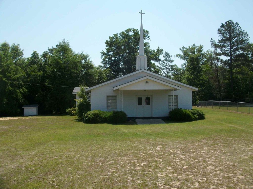
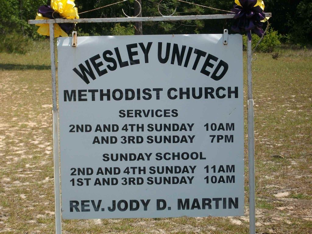
Where is Wesley Chapel United Methodist Church Cemetery?
Wesley Chapel United Methodist Church Cemetery is located at Watermelon Road off Hwy. 57 before entering Washington County Wrightsville, Johnson County ,Georgia ,USA.
-
Wesley Chapel United Methodist Church Cemetery cemetery's updated grave count on graveviews.com?
0 memorials
-
Where are the coordinates of the Wesley Chapel United Methodist Church Cemetery?
Latitude: 32.7594160
Longitude: -82.8962140
Nearby Cemetories:
1. Martin Cemetery
Johnson County, USA
Coordinate: 32.7599983, -82.8867035
2. Waters Cemetery
Johnson County, USA
Coordinate: 32.7574997, -82.8672028
3. Ivey Baptist Church Cemetery
Wrightsville, Johnson County, USA
Coordinate: 32.7430970, -82.8560980
4. Hightower Cemetery
Johnson County, USA
Coordinate: 32.7210999, -82.8843994
5. Moody Cemetery
Johnson County, USA
Coordinate: 32.7207985, -82.9096985
6. John B. Wright Cemetery
Wrightsville, Johnson County, USA
Coordinate: 32.7313340, -82.8595500
7. John B. Wright Cemetery - Slave Section
Johnson County, USA
Coordinate: 32.7313340, -82.8595500
8. Post Cemetery
Laurens County, USA
Coordinate: 32.7106018, -82.9178009
9. Bethel Methodist Church Cemetery
Wrightsville, Johnson County, USA
Coordinate: 32.7582110, -82.8327670
10. Buckeye Baptist Church Cemetery
Laurens County, USA
Coordinate: 32.7129990, -82.8616210
11. Askew House Cemetery
East Dublin, Laurens County, USA
Coordinate: 32.7111390, -82.8640970
12. Daniel Grove Church of God in Christ
Wrightsville, Johnson County, USA
Coordinate: 32.7959840, -82.8406790
13. Plummer Cemetery
Laurens County, USA
Coordinate: 32.6941986, -82.9096985
14. Mount Pleasant AME Church Cemetery
Wrightsville, Johnson County, USA
Coordinate: 32.7561070, -82.8167000
15. Old Dent Cemetery
Wrightsville, Johnson County, USA
Coordinate: 32.7150500, -82.8290500
16. Dent Cemetery
Johnson County, USA
Coordinate: 32.7275009, -82.8189011
17. Burnett Grove AME Church Cemetery
Wrightsville, Johnson County, USA
Coordinate: 32.7992700, -82.8224930
18. New Bethel AME Church Cemetery
Laurens County, USA
Coordinate: 32.6838300, -82.8695100
19. Price-Knight Cemetery
Johnson County, USA
Coordinate: 32.7602220, -82.7970040
20. Walker Cemetery
Wrightsville, Johnson County, USA
Coordinate: 32.7130300, -82.8110400
21. Kellams Cemetery
Laurens County, USA
Coordinate: 32.6727982, -82.8968964
22. Holly Springs Baptist Church Cemetery
Laurens County, USA
Coordinate: 32.6659310, -82.8929070
23. McAfee Family Cemetery
Johnson County, USA
Coordinate: 32.7463270, -82.7838510
24. U. R. Jenkins Cemetery
Wrightsville, Johnson County, USA
Coordinate: 32.7667780, -82.7777660