
| Memorials | : | 0 |
| Location | : | Wrightsville, Johnson County, USA |
| Coordinate | : | 32.7130300, -82.8110400 |
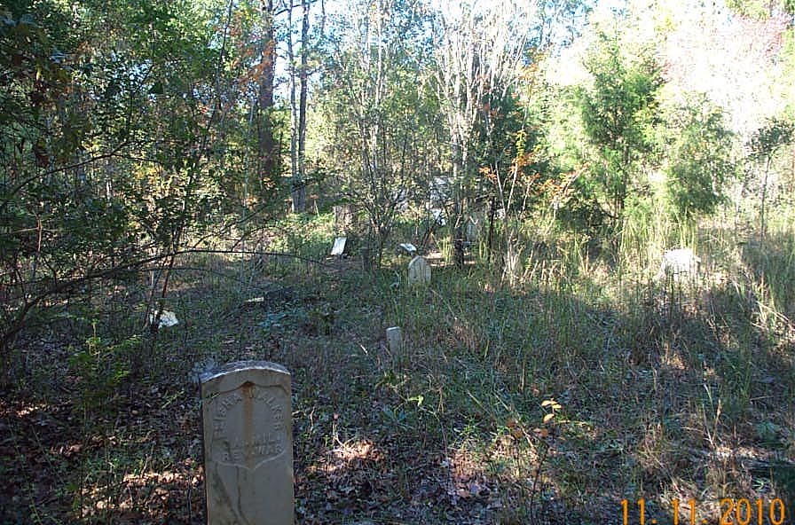
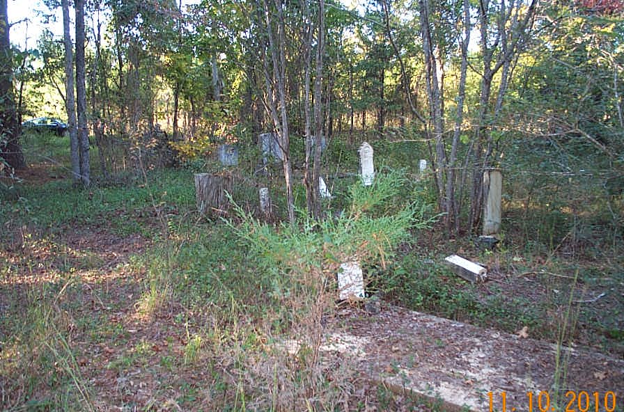
| Description | : | Cemetery survey with burial list and description of location is located at http://files.usgwarchives.org/ga/johnson/ cemeteries/walkerce381cm.txt. Location is south of Paul Underwood Rd. At the T intersection of Jim & Paul Underwood Road, go east on Paul Underwood Road and take first possible right onto a dirt driveway which turns left after passing a white house on the left. Follow the dirt road along the treeline and you come to an intersection at the end of the treeline where the choice is to go straight or left, take the road to the left, go approximately 50 feet and the cemetery will be... Read More |
frequently asked questions (FAQ):
-
Where is Walker Cemetery?
Walker Cemetery is located at Wrightsville, Johnson County ,Georgia ,USA.
-
Walker Cemetery cemetery's updated grave count on graveviews.com?
0 memorials
-
Where are the coordinates of the Walker Cemetery?
Latitude: 32.7130300
Longitude: -82.8110400
Nearby Cemetories:
1. Old Dent Cemetery
Wrightsville, Johnson County, USA
Coordinate: 32.7150500, -82.8290500
2. Dent Cemetery
Johnson County, USA
Coordinate: 32.7275009, -82.8189011
3. Williams Cemetery
Johnson County, USA
Coordinate: 32.7024994, -82.7966995
4. Maddux Cemetery
Wrightsville, Johnson County, USA
Coordinate: 32.7242610, -82.7768500
5. Mitchell Grove Baptist Church Cemetery
Wrightsville, Johnson County, USA
Coordinate: 32.6987990, -82.7770830
6. Pleasant Grove Baptist Church Cemetery
Wrightsville, Johnson County, USA
Coordinate: 32.6900690, -82.7841220
7. McAfee Family Cemetery
Johnson County, USA
Coordinate: 32.7463270, -82.7838510
8. Buckeye Baptist Church Cemetery
Laurens County, USA
Coordinate: 32.7129990, -82.8616210
9. John M. Raines Cemetery
Wrightsville, Johnson County, USA
Coordinate: 32.7416590, -82.7732390
10. Mount Pleasant AME Church Cemetery
Wrightsville, Johnson County, USA
Coordinate: 32.7561070, -82.8167000
11. Askew House Cemetery
East Dublin, Laurens County, USA
Coordinate: 32.7111390, -82.8640970
12. John B. Wright Cemetery
Wrightsville, Johnson County, USA
Coordinate: 32.7313340, -82.8595500
13. John B. Wright Cemetery - Slave Section
Johnson County, USA
Coordinate: 32.7313340, -82.8595500
14. Ivey Baptist Church Cemetery
Wrightsville, Johnson County, USA
Coordinate: 32.7430970, -82.8560980
15. Price-Knight Cemetery
Johnson County, USA
Coordinate: 32.7602220, -82.7970040
16. Bethel Methodist Church Cemetery
Wrightsville, Johnson County, USA
Coordinate: 32.7582110, -82.8327670
17. Price Parker Cemetery
Wrightsville, Johnson County, USA
Coordinate: 32.7486200, -82.7710400
18. New Bethel AME Church Cemetery
Laurens County, USA
Coordinate: 32.6838300, -82.8695100
19. Vickers Hill Baptist Church Cemetery
Wrightsville, Johnson County, USA
Coordinate: 32.7509940, -82.7570824
20. U. R. Jenkins Cemetery
Wrightsville, Johnson County, USA
Coordinate: 32.7667780, -82.7777660
21. Hightower Cemetery
Johnson County, USA
Coordinate: 32.7210999, -82.8843994
22. Waters Cemetery
Johnson County, USA
Coordinate: 32.7574997, -82.8672028
23. Lovett Grove Community Baptist Church Cemetery
Wrightsville, Johnson County, USA
Coordinate: 32.6800750, -82.7399620
24. Galilee Church Cemetery
Wrightsville, Johnson County, USA
Coordinate: 32.7059010, -82.7299100