
| Memorials | : | 0 |
| Location | : | Westerleigh, South Gloucestershire Unitary Authority, England |
| Coordinate | : | 51.5044380, -2.4291520 |
frequently asked questions (FAQ):
-
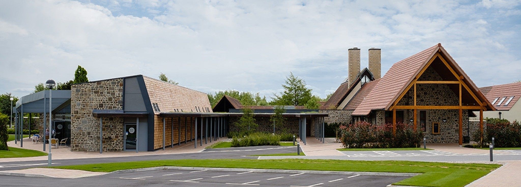
Where is Westerleigh Crematorium?
Westerleigh Crematorium is located at Westerleigh, South Gloucestershire Unitary Authority ,Gloucestershire ,England.
-
Westerleigh Crematorium cemetery's updated grave count on graveviews.com?
0 memorials
-
Where are the coordinates of the Westerleigh Crematorium?
Latitude: 51.5044380
Longitude: -2.4291520
Nearby Cemetories:
1. St Peter's Churchyard & Wapley Burial Ground
Dodington, South Gloucestershire Unitary Authority, England
Coordinate: 51.5157603, -2.4138814
2. St Peter's Churchyard
Wapley, South Gloucestershire Unitary Authority, England
Coordinate: 51.5157000, -2.4137400
3. St Anne's Churchyard
Siston, South Gloucestershire Unitary Authority, England
Coordinate: 51.4752200, -2.4499900
4. St James The Great Churchyard Cemetery
Abson, South Gloucestershire Unitary Authority, England
Coordinate: 51.4716858, -2.4257848
5. St Mary's Churchyard
Yate, South Gloucestershire Unitary Authority, England
Coordinate: 51.5431600, -2.4139020
6. St. James Cemetery
Mangotsfield, South Gloucestershire Unitary Authority, England
Coordinate: 51.4845130, -2.4856679
7. St. John the Baptist Churchyard
Chipping Sodbury, South Gloucestershire Unitary Authority, England
Coordinate: 51.5389590, -2.3944150
8. St Peter's Churchyard
Dyrham, South Gloucestershire Unitary Authority, England
Coordinate: 51.4804500, -2.3735900
9. Mangotsfield Cemetery
Mangotsfield, South Gloucestershire Unitary Authority, England
Coordinate: 51.4905440, -2.4964780
10. St Peter's Churchyard
Frampton Cotterell, South Gloucestershire Unitary Authority, England
Coordinate: 51.5359115, -2.4801320
11. St Mary's Churchyard ( Private )
Dodington, South Gloucestershire Unitary Authority, England
Coordinate: 51.5172820, -2.3588590
12. St James the Less Churchyard
Iron Acton, South Gloucestershire Unitary Authority, England
Coordinate: 51.5490390, -2.4619310
13. Downend Christ Churchyard
Downend, South Gloucestershire Unitary Authority, England
Coordinate: 51.4861501, -2.5075481
14. St. Barnabas Churchyard
Warmley, South Gloucestershire Unitary Authority, England
Coordinate: 51.4570800, -2.4704100
15. St. Barnabas Church of England Churchyard
Bristol, Bristol Unitary Authority, England
Coordinate: 51.4570643, -2.4704304
16. Saint John the Baptist Churchyard
Old Sodbury, South Gloucestershire Unitary Authority, England
Coordinate: 51.5336010, -2.3561470
17. Mayshill Cemetery
South Gloucestershire Unitary Authority, England
Coordinate: 51.5562160, -2.4691663
18. St John the Baptist Churchyard
Frenchay, South Gloucestershire Unitary Authority, England
Coordinate: 51.4947700, -2.5205810
19. St James Churchyard
West Littleton, South Gloucestershire Unitary Authority, England
Coordinate: 51.4780400, -2.3458000
20. St Mary Magdelene Churchyard
Tormarton, South Gloucestershire Unitary Authority, England
Coordinate: 51.5082250, -2.3334930
21. St. Michael the Archangel Churchyard
Winterbourne, South Gloucestershire Unitary Authority, England
Coordinate: 51.5269000, -2.5183600
22. Ebenezer Methodist Chapel
Warmley, South Gloucestershire Unitary Authority, England
Coordinate: 51.4514960, -2.4779637
23. Fishponds Baptist Churchyard
Fishponds, Bristol Unitary Authority, England
Coordinate: 51.4823300, -2.5227200
24. Holy Trinity Churchyard
Kingswood, South Gloucestershire Unitary Authority, England
Coordinate: 51.4619990, -2.5040620